Mon - Off. Rental business and work all day.
Tues - 5 miles track. mile, 8x 400: 5:36, 2:42, 2:36, 2:41, 2:39. No warm-up whatsoever for this workout, so eased into the mile and then cruised the 800s. Tired from a very busy extended weekend of turning rental properties around.
---------------------------------------------------------------------------
January: 330 miles (45,200')
February: 445 miles (58,500')
March: 501.5 (79,600')
April: 430 (66,800')
May: 387.5 (70,700')
June: 297.5 (48,500')
July: 369 (71,100')
Total: 2,760.5 miles (440,400')
Avg: 394.5 miles (62,914')
---------------------------------------------------------------------------
2012 Summits (110):
Horsetooth (7,255') (51 - Aug 5)
Mount Elbert (14,443')
Longs Peak (2) (14,259')
Mount Belford (2) (14,197')
Mount Oxford (14,153')
Missouri Mountain (14,067')
Pacific Peak (13,950')
Emerald Peak (13,904')
Crystal Peak (13,852')
Atlantic Peak (13,841')
Iowa Peak (13,831')
Hagues Peak (2) (13,571')
Ypsilon Mountain (13,514')
Fairchild Mountain (13,502')
Mummy Mountain (13,425')
Pecks Peak (13,277')
Whitney Peak (13,271')
Mount Chiquita (13,069')
Mount Chapin (12,454')
Twin Sisters (11,420')
Mount Baldy (11,068')
Hidden Peak (10,992') (2)
Lookout Mountain (10,626')
Storm Mountain (9,918')
Lily Mountain (9,786')
Crosier Mountain (9,250') (4)
Pilot Hill (8,829')
Mount Ethel (8,471')
8,415' (Leila Peak)
Buckhorn Mountain (8,341')
Round Mountain (8,250') (2)
Spruce Mountain (7,781')
Sullivan Stump (7,778')
7,725'
Green Ridge (7,402')
Green Mountain (7,335')
7,260' (Ziggy Point)
7,178'
7,098' (Poll Mtn range)
Table Mountain (7,074')
Arthurs Rock (6,780') (5)
Palisade Mountain (8,225')
Milner Mountain (6,893')
Alexander Mountain (8,144')
5,773' or 'Aggie Peak'
5,740' (Hwy 34 B4 Narrows) (1)
5,740' (Off Masonville Rd) (2)
Reservoir Ridge (5,735')
Goat Hill (5,604')
Aitxuri (1,551 meters)
Aizkorri (1,528 meters)
Aratz (1,443 meters)
----------------------------------------------------------------------------
Weds - Noon: 7.5 miles (1,800') easy. Horsetooth summit. Southridge/Audra.
PM: 5 miles (1,000') easy. Falls loop.
Thurs - AM: 13 miles (900') easy. Redstone out and back with Alex and Danny.
Noon: 3 miles (600') easy. Bench loop.
PM: 7.5 miles easy with FCTR crew.
Fri - Noon: 3 miles (600') easy. Bench loop.
PM: 10 miles (700') easy. From Brandon's house in Leadville. Late run with Mike and Nick P down to Turquoise Lake campgrounds and then back up into town before returning to Brandon's. Up-tempo pace felt good.
Sat - AM: 16.5 miles (8,300') mountains. Missouri (14,067'), Iowa (13,831'), Emerald (13,904'), Belford (14,197'), Oxford (14,153'), Belford (14,197'), Pecks Peak (13,277').
For those into Colorado 14'ers - or Colorado mountains in general - the triumvirate of Missouri, Oxford and Belford are something of a classic given their tight proximity to one another and ease of route negotiation. Mike suggested we get them done in combination with some surrounding 13'ers, and while that would make our day a long one (with 21 miles of running planned for the evening session), I wasn't about to give up a rare weekend of bachelorhood by sitting around twiddling my thumbs.
With Pedatella on board as well, the three of us set out from the Missouri Gulch trailhead a little before 7:00am, taking the standard route to the summit of Missouri with a mix of running and hiking. Half way up Missouri, it was apparent that Mike and Nick were up for a slightly mellower pace on the morning than I was, meaning my outing was punctuated with some good breaks on the peaks and passes. Missouri came and went quickly, and it was just a quick bop from there to Iowa Peak - not much more than a bump on the ridge running south from Missouri. The extension on to Emerald Peak - a more prominent and 'sexy' summit than Iowa - was a little more consequential to reach in terms of effort output, but still not much more than a steep talus-slope walk up. From Iowa, we assessed our options and decided on a straight-line route across Pine Creek Basin towards Elkhead Pass. As it turned out the scree/talus sidehilling was pretty miserable, and a far superior option would have been to lose some extra elevation and traverse on the grassy flats of the basin. Next time.
From Elkhead Pass, we were back on trail and it was quick going up to Belford. In well under an hour of foot time we were back on Belford - after an Oxford out and back - debating the worthiness of tagging Pecks Peak, which we could essentially descend to by following Belford's northern ridge for a mile or so. We finally managed to convince Pedatella of the glory the extra peak would add to the day and set off to round out the six peak, seven summit morning. Once the grassy bump was negotiated, it was a steep descent back down to the Missouri Gulch trail and then no more than a couple of miles and 2,000 feet down to the trailhead. Total outing time was a casual seven and a quarter hours; moving time was significantly less. A little creek action for the legs and a generous serving of Ultragen recovery nectar and the legs were ready for the evening session.
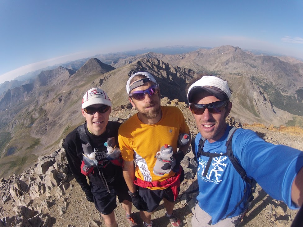 |
| Top Missouri, Iowa (above my head) and Emerald (above Nick P's head) in background. All photos: Mike H. |
 | ||||
| Top Iowa. |
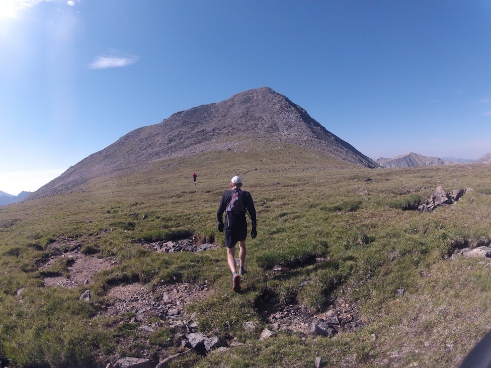 | ||
| Emerald approach. |
 |
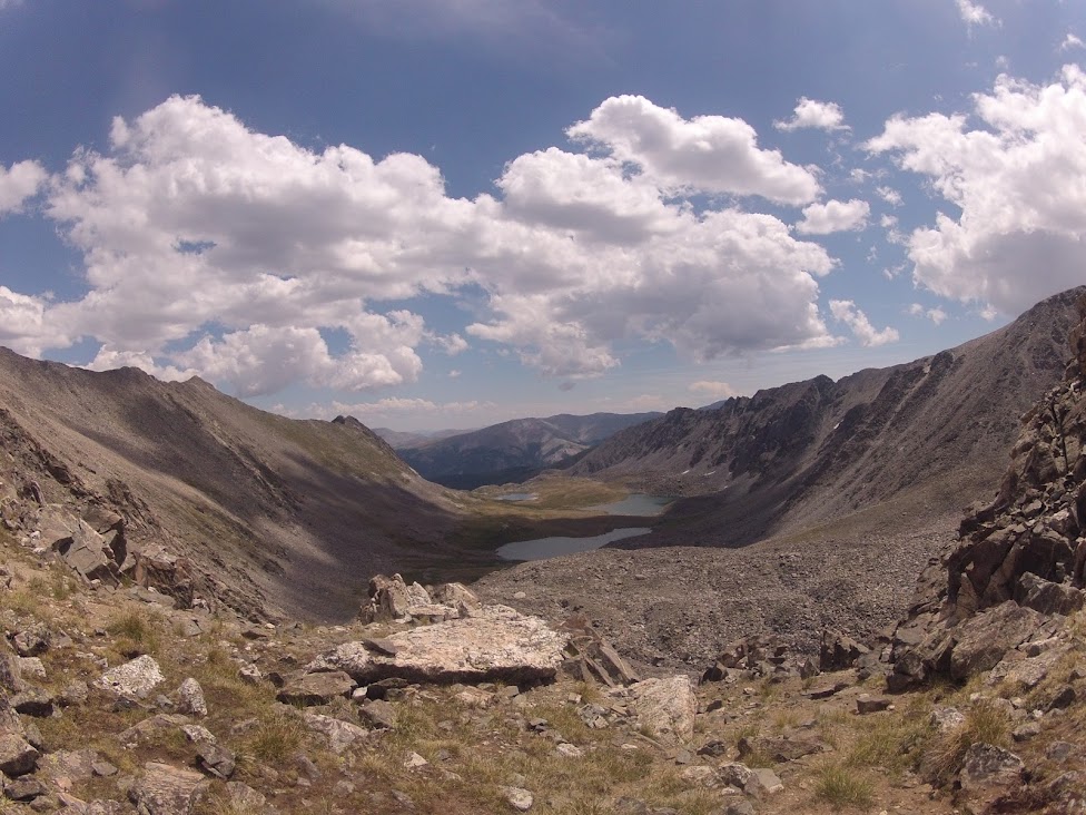
| Iowa, Missouri, Pine Creek Basin, Elkhead Pass, Belford. |
 |
| Top Belford. |
 | ||||
| Top Oxford. |
 |
| Oxford, Belford saddle from Pecks Peak. |
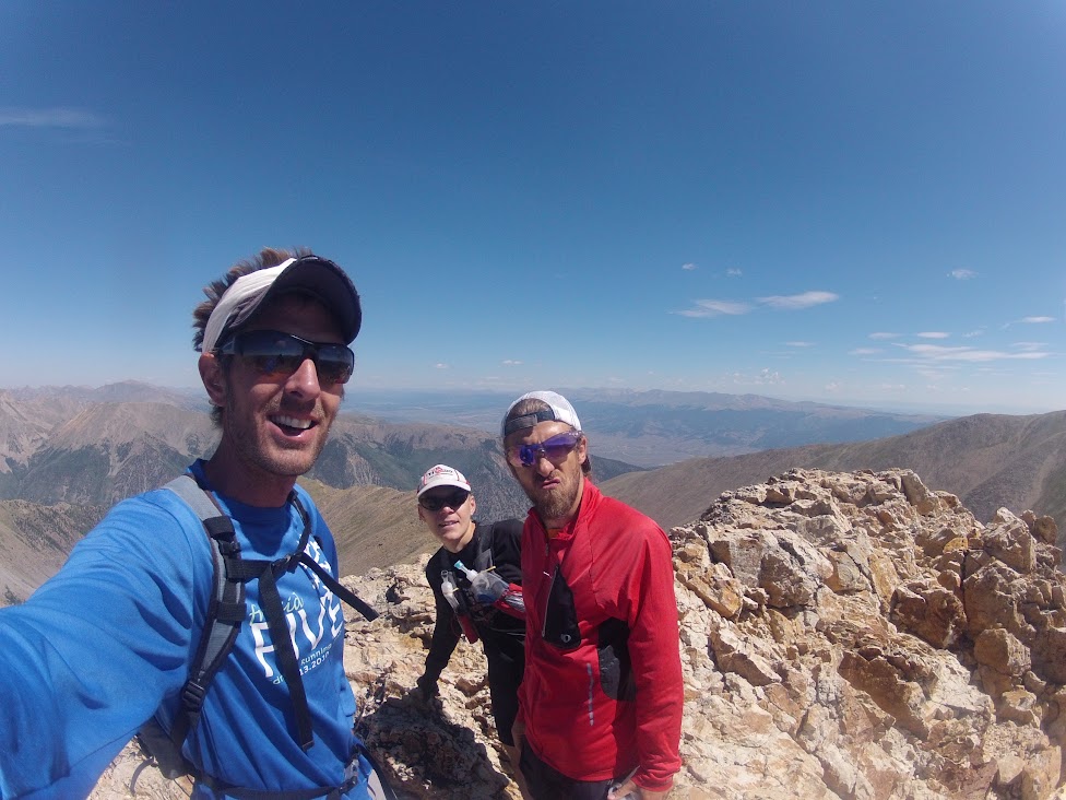
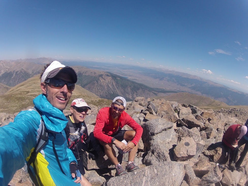
Sun: 8.5 miles (4,300') mountains. Crystal Peak (13,852'), Pacific Peak (13,950'), Atlantic Peak (13,841').
After a late start and much hemming and haa'ing, Mike, Andy Gisler and I finally decided on a little Coast to Coast action in the Mosquito Range. From the Mayflower Gulch trailhead off Hwy 91, this route was a worthy way to wait out Sunday's eastbound I-70 traffic. Given the previous day's exertions, my legs were predictably unenthused at the prospect of additional mileage and vertical, but once off the tedious talus approach to Crystal Peak and with a summit in sight, things starting clicking and I was able to move reasonably efficiently. The views of the ten-mile range from Crystal were most excellent, and worthy alone of the effort. Mike decided he was done for the weekend with the Crystal summit, leaving Andy and me to forge on and knock out Pacific and Atlantic. With my legs on board and engaged, we made short work of the not-insubstantial climb up the Pacific ridge from the Crystal saddle and then it was a pretty straightforward traverse and climb to Atlantic Peak. The standard way off Atlantic to Mayflower Gulch is to descend the west ridge into the Crystal Creek drainage, but a steeper and more direct 1,000'+ scree descent down off the ridge into Mayflower Gulch looked negotiable, so we hit that and were soon on the jeep road on our way back down to the trailhead. Mike was there with beers at the ready to celebrate a fine weekend in the high alpine and the beginning of the Leadville 100 taper.
 |
| East from Crystal, Pacific saddle. Helen and Father Dyer on ridge to left. |
 |
| Top Atlantic with ten-mile behind. |
 |
| Pacific, with Quandry back left. |
Well this turned out to be a much bigger week than I would normally look to push out two weeks from a goal race, but given that I had a free weekend away from parental and spousal duties I wasn't about to give it up. And, wow, all systems appear to be go. All 10 of the weekend's 13,000'+ summits came pretty easy, and while Saturday night's long run was a bit of a slog, it could certainly have been worse given the seven hours of vert and mileage in the morning session.
This was a huge confidence builder of a weekend. Rest and relaxation from here until the Leadville start line.


.png)


Sounds like you had an awesome week. Good luck at Leadville.
ReplyDelete"As it turned out the scree/talus sidehilling was pretty miserable, and a far superior option would have been to lose some extra elevation and traverse on the grassy flats of the basin."
ReplyDeleteNaaah, I love that crap! Just accept that there's going to be some surfing going on and that traverse goes pretty quickly, I think. Way better than dropping all the way down to 12,800' or so in the basin. Sweet that you got some solid high country in this past weekend.
The beard! It shortened!
ReplyDelete