Mon - 7 miles (1,900') easy. Soderberg - Rock - Wathan - Spring Creek - Falls - home long.
Tues - AM: 8 miles of intervals with Jane's group at the cemetery. Workout was: mile, 3x800, mile, 3x800 on 20 second rest between 800s and 3 min before/after miles. Can't seem to get any turnover going at the moment, but it'll come: 5:25, 2:43, 2:44, 2:46, 5:22, 2:46, 2:46, 2:49.
PM: 6.5 miles (1,700') easy. Falls - Spring Creek - Soderberg - Rock - Southridge - Soderberg - home long. Great dusk cruise blowing out some post-work frustrations. Starting to feel like I've found some of that early season hill-cruising fitness. We build from here.
Weds: 8.5 miles (2,100') easy. Falls - Spring Creek - Soderberg - Rock - Horsetooth summit - Audra - Southridge - Soderberg - home long. I love the fact that we're stuck in fall-like weather. I don't think we're going to get a winter.
Thurs - AM: 13.5 miles LT. Met Sarah and Mike early for a 2x4 mile LT session on the Spring Creek bike path with 1.5 mile w-u/c-d and two mile jog between 4 milers. Goal was 5:50 pace heading east (on the subtle drop toward the plains) and 6:00 pace coming back up. Out was a total cruise: 5:58, 5:49, 5:53, 5:52; coming back up was more work than I would have liked (and I think breached the lactate threshold): 6:04, 6:01, 5:56, 5:57. Work to be done. Good job it's only January.
PM: 9 miles (1,800') Towers. Beautiful night out with no wind, so decided to try and push out a second tempo-type effort after easing into things on the lower sections of the hill. Up in 32:25 with some nasty ice up above Westridge.
Fri: 7.5 miles (1,100') easy with Brian E. Falls - Spring Creek - Stout - Towers - Swan Johnson - Shoreline - 38e. A dusting of snow over patches of ice made for some pretty treacherous conditions. Brian took a really bad fall on the Falls trail so we cut things short so he could get home and clean things up and, as it turned out, get stitches to the back of his head. Ouch!
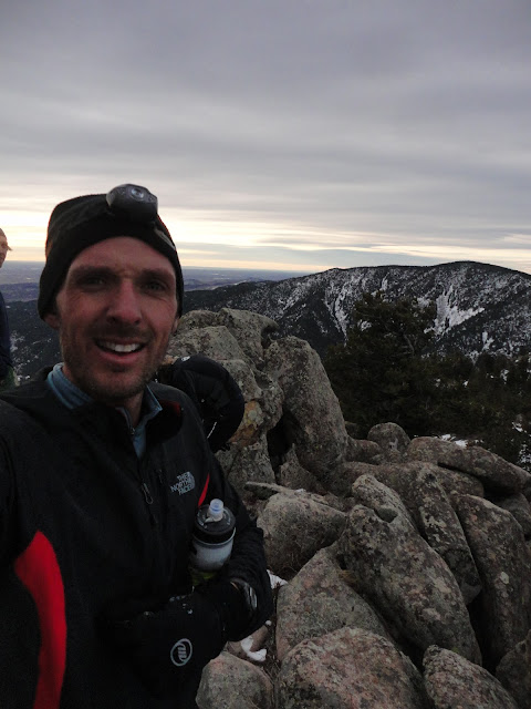
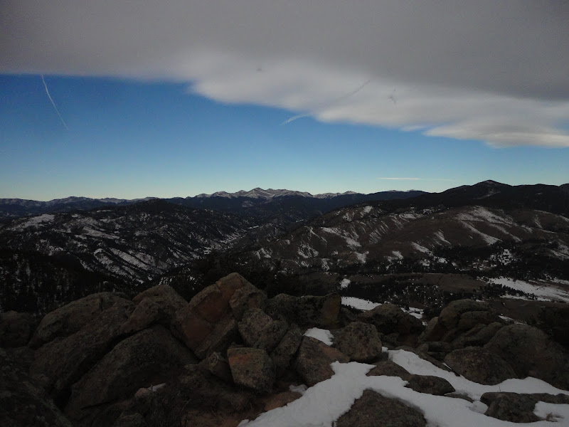
Sat: 10 miles (3,000'). Blue Mountain from Pinewood Reservoir.
Sun: 20.5 miles (1,200') w/5k, 10k double at the Frost Giant in Estes Park. Warmed up with 5.5 on the 5k/10k course, raced 5k, jogged 2, raced 10k, jogged 4.
Total: 90.5 miles (11,900').
A solid week of running without really pushing myself to get out the door. Even though the mileage is a little higher than I had planned for January, it still feels very organic at this stage. I'm definitely a step or two slower than I was last year, but then this time last January I was just about ready to taper for the New Orleans Marathon. Right now I'm just enjoying the mild temperatures, the company of good friends and some new peaks and places in Larimer County.
With all that said, I have been finding the mind wandering to June in the last week or two. The question I keep asking myself is what do I need to do differently to avoid the implosion I suffered over the last 10 miles from Auburn Lake Trails to Placer High? An easier January is, I think, part of the answer, but there will be no shortcuts. There's a lot of hard work ahead and I think I'm just about ready to get started.
On a different note, Pete and I have been blown away by the response to the Quad Rock race here in Fort Collins. The 25 miler is now full (although we do have a waiting list) and there are about 50 spots left in the 50 mile race. We're working hard to make sure we give you the best race experience we can.
Monday, January 30, 2012
Sunday, January 29, 2012
Frost Giant 5k/10k Double
The Frost Giant is a fun bit of wintertime racing up in Estes Park. The morning starts late with an 11:00am kick-off for the 5k, followed by the 10k at noon. The course is a mix of road and heavy cross country, with some good hills and a high point up around 7,800 feet - so not a PR course by any stretch of the imagination.
After a lengthy warm-up and some quality standing around time, we were off to the races. Through the first mile up the hill to MacGregor Ranch we had a lead pack of four, which helped a bit with the blustery headwind. Mark Saunders I knew could win it if he was fit, Rob Kosick looked sharp, and then the guy pulling us all up the hill I didn't recognize.
On the dirt hill to the high point of the course in MacGregor Ranch, I was laboring a bit and lost a few strides on Mark and Rob, with the early leader now considerably off the pace. I was able to bridge back to Mark fairly quickly on the treacherous and clumpy cross country section, but still had a good 10-15 meters to make up on Rob. The headwind running along the Devil's Gulch fence line was fierce so the going was slow despite the downward trajectory of the course.
As we made the turn back onto the road for the last mile or so of the race, Rob, myself and Mark were equally spaced about 20 meters apart. I might have closed a bit on Rob, but never really made much of a dent. Ended up maybe 10 seconds back in 18:22 and 30 seconds back on my time from last year when I was in much better shape getting ready for a February marathon in New Orleans.
And now onto the 10k.
After a bit of jogging and more standing around, I was suitably stiff as the gun went off for round two of a punishing morning. Both Rob and I were slow out of the gate, content to ease into the steep hill that begins the 10k course, letting a couple of guys who were fresh lead the early going. However, after a half mile it was Rob and me off the front again, and this one essentially played out much the same as the 5k.
We ran the road together and then Rob eased into a lead on MacGregor Ranch and proceeded to hold it. The wind was blowing even harder this second time around and I was content to get some harder miles in and not blow a gasket - or an ankle - trying to get back into the race. Rob looked strong enough that I knew it probably would have been futile anyway. I crossed the line a minute or so behind Rob and two minutes back on my time from last year.
Sarah, Slush and I jogged out a further four miles after the race to cap off a full 20 miles on the morning and then it was off to the Estes Park Brewery for beers and burgers with the FoCo gang, Dana and the kids.
Post food, Dana and I took the kids up to Lily Mountain to try and sneak in a summit (it's ranked), but the trail was an ice rink so we aborted half way up, which put me at 2 for 6 on the weekend's attempted summits. Poor.
After a lengthy warm-up and some quality standing around time, we were off to the races. Through the first mile up the hill to MacGregor Ranch we had a lead pack of four, which helped a bit with the blustery headwind. Mark Saunders I knew could win it if he was fit, Rob Kosick looked sharp, and then the guy pulling us all up the hill I didn't recognize.
 |
| Frost Giant 5k Start. All pics: Lane Eskew |
As we made the turn back onto the road for the last mile or so of the race, Rob, myself and Mark were equally spaced about 20 meters apart. I might have closed a bit on Rob, but never really made much of a dent. Ended up maybe 10 seconds back in 18:22 and 30 seconds back on my time from last year when I was in much better shape getting ready for a February marathon in New Orleans.
 | |||
| Rob with a commanding lead coming into the finish. |
 |
After a bit of jogging and more standing around, I was suitably stiff as the gun went off for round two of a punishing morning. Both Rob and I were slow out of the gate, content to ease into the steep hill that begins the 10k course, letting a couple of guys who were fresh lead the early going. However, after a half mile it was Rob and me off the front again, and this one essentially played out much the same as the 5k.
We ran the road together and then Rob eased into a lead on MacGregor Ranch and proceeded to hold it. The wind was blowing even harder this second time around and I was content to get some harder miles in and not blow a gasket - or an ankle - trying to get back into the race. Rob looked strong enough that I knew it probably would have been futile anyway. I crossed the line a minute or so behind Rob and two minutes back on my time from last year.
Sarah, Slush and I jogged out a further four miles after the race to cap off a full 20 miles on the morning and then it was off to the Estes Park Brewery for beers and burgers with the FoCo gang, Dana and the kids.
Post food, Dana and I took the kids up to Lily Mountain to try and sneak in a summit (it's ranked), but the trail was an ice rink so we aborted half way up, which put me at 2 for 6 on the weekend's attempted summits. Poor.
Saturday, January 28, 2012
Green Mountain, Bald Mountain & Blue Mountain
 |
| The unexciting Green Mountain. |
The plan for the morning was to hit five summits, four of them ranked, with the centerpiece being Blue Mountain.
A map would have been a good idea.
The frigid pre-dawn jog to summit 7,335' (Green Mountain) was easy enough. It was 700 feet straight up Green Mountain Road from Pinewood Lake in a little over a mile. Unfortunately there was a big house perched right on the summit. And the lights were on. I quickly ran to what looked like the highest point - maybe 100 feet from the house - turned around and headed back down the way I had come.
Back on Pole Hill Road, I jogged eastward for a few hundred meters and then made a right onto another private road, which forked left (hop gate) for the quick jaunt up to my next peak, Bald Mountain (7,098' - not ranked). This one was home to a communication tower. Hmm. It did have some nice views of Blue Mountain and the Divide from the top though, and I wasn't in danger of scaring the crap out of someone enjoying their first brew of the morning from the comfort of their cozy home. But, yeah, more trespassing.
Despite the excessive trespassing, my mental map of this unfamiliar terrain was so far serving me well. Next, if memory served correct, was a retrace halfway down the service road and a spot of cross country before picking up a jeep track that would trace a line around the northeastern flank of Blue Mountain.
 | ||||
| Coming down off 7,098'. Longs/Meeker and Indian Peaks with west flank of Blue Mtn in the foreground | . |
After what seemed like more cross country than I had remembered planning on, there was still no sign of my forest road, but I had a decent view of what I thought might be the northerly and highest point of Blue Mountain's three tops. Nonetheless, I kept forging on around the side of the mountain because I remember thinking it should have been a good mile and a half before the planned cut to the top. And then I found an old jeep track. I followed that and ran too far, eventually cutting steeply up the hill once I came to yet another gate with an intimidating KEEP OUT sign.
I gained a slight plateau at 7,500 feet, cut across some pretty nasty terrain with plenty of thigh-deep snow drifts before seeing what looked like a summit hill across a gully which dropped a few hundred feet before its steep rise to the top. It seemed totally wrong, but I headed that way anyway. The grunt up was filled with a ton of deadfall, multiple mega posthole punch-throughs, and mental certainty that I was barking up the wrong tree ... er ... mountain.
 |
| Blue Mountain from Bald (with another communication tower foreground). True summit: nearest; middle summit: behind; my eventual summit: not in view. |
 |
| The Continental Divide from top of Blue Mountain. |
That was confirmed once I was on top and had the lie of the land. Although my Highgear was reading right at the 7,888' I wanted for the Blue Mountain summit, I was clearly on the southernmost summit, which I would later find out was 14 feet lower than the northern summit (FAIL). The wind had really picked up and I was in danger of a late return home, so I decided not to bother picking my way across the ridge for the true summit, and instead cut a sketchily steep line down the cactus and mountain mahogany infested southwestern slope of Blue.
 |
| Cold and pissed off on top of Blue Mountain. |
I decided not to bother with point 6930' or 7383', both of which would have required blatant bouts of trespassing with little to no cover. Rather, I put my tail between my legs and ran back to Pinewood Lake on the private ranch road that skirts Blue Mountain's westerly flank - jumping four gates along the way.
 |
| Couldn't be bothered with 6,930' |
I learned two things today:
- Bring the bloody map.
- This Larimer County peak-bagging project might just be a bit more trouble than it's worth with all the trespassing that it will evidently require.
Tuesday, January 24, 2012
Week Ending Jan 22
Mon - 3 miles (600') easy. Bench loop, home long. Snowy.
Tues - AM: 7.5 miles intervals. Met Jane's group on a very cold morning. With the ground covered in snow and ice and the thermometer reading 5 degrees, this one was just about stretching the legs and busting the holiday rust. Workout was cemetery 2x800, 2xmile, 2x800. Splits: 3:00, 2:49, 5:34, 5:33, 2:49, 2:46. 15 min w-u/c-d on either side.
PM: 7 miles (1,900') easy. Soderberg - Rock - Wathan - Spring Creek - Falls - home long. Felt super smooth aerobically, but sore in the usual places physically. Inch of snow over top of some good stretches of ice, interspersed with dirt and packed snow. Perfect conditions for old school Yaktrax, which people love to hate, but I quite like. In these conditions they are way better than a spiked traction device which are just annoying in mixed conditions.
Weds: 7 miles (1,900') easy. Soderberg - Rock - Wathan - Spring Creek - Falls - home long. Most of the snow from two days ago is essentially gone with the slightly warmer temps. Legs were heavy, but heart and lungs good.
Thurs - AM: 11 miles (1,500') hill tempo. HTH5MO&B. Felt like I went ten rounds with Tyson out there this morning. The wind was swirling like crazy and was highly unpredictable. Rounding the last east-side dam, a massive gust picked up a bunch of gravel and raked us like we'd just been shot in the face by Dick Cheney. That one stopped me and Scott in our tracks and had us whimpering and assuming the crouching position. I think that's the worst I've seen it up there on the ridge. But at least it wasn't too cold. Not surprisingly, performance coming back suffered, despite a pretty hard effort. 39:26 out, 31:26 back (7:00, 6:19, 6:28, 6:17, 5:19). One mile c-d.
PM: 7.5 miles easy with the FCTR crowd at Pineridge.
Fri: 7 miles (1,900') easy. Soderberg - Rock - Wathan - Spring Creek - Falls - home long. Tired of this wind, but as long as the mild temps stick around, I'll take it I guess.
Sat: 3 miles (1,600') hike. Alexander Mtn with Ryan.
Sun: 23.5 miles (3,500') long. Milner Mtn (6,881'), Bobcat Ridge, point 7,124' with Mike H.
Total: 76.5 miles (11,300')
A friend of mine pointed me in the direction of a website called Lists of John the other day. It's an invaluable resource for those into the fine art of peakbaggery, and while I'd visited it before I'd never really perused it fully. Aforementioned friend offered up a link to the 255 ranked peaks in Larimer County (where I reside), the simple act of which finds me getting a little obsessed.
Many of these 'peaks' are peaks in name only. To be ranked, a peak has to have a minimum of 300 feet of climb (or prominence) on any route from a higher peak (or sea level), a rule that means such elegant summits as Arthurs Rock and Comanche Peak are not ranked, but some random hillside above Horsetooth Reservoir is.
This all means that I find myself plotting to hike or run up totally unworthy hillsides simply to check off another ranked Larimer peak. By extension, however, this new-found obsession has also given me a much keener eye for the skyline around me. I see a peak that previously had been just another rise in the endless swell of rises that surround us here in Colorado and I want to know if it's named, what its prominence is and how I'm going to get up it.
I think I've become more familiar with the geography and topography of Larimer County in the last two weeks than I have in the last five years. And that's a good thing. I find myself plotting new routes and getting excited about totally random 8,000 foot peaks.
Anyway, enough of my peakbaggery babble.
What else? Well, we've recently secured a sponsorship from the fine folks at Cornerstone Mortgage Company (my own personal lender and all-around supporter of the Fort Collins running community) for the Quad Rock 50 in May, which now means that we're able to offer up a modest prize purse for the 50 mile race, in addition to some nice product prizes for age group winners (Pearl Izumi shoes for sure in the 50 and hopefully in the 25 too). We're also working on some really neat ideas for finishers' awards and hope to have an announcement on that soon.
I'm also excited about a new flavor of EFS Liquid Shot that Robert over at First Endurance has been working on. I sampled the Kona Mocha, as it will be called, on Sunday during my long run and really enjoyed it. Like all EFS Liquid Shot, the non-viscous nature of the gel means that it goes down easy, but best of all I really think they nailed the flavoring. The blend between coffee and chocolate doesn't leave that cloyingly sweet taste in your mouth; it just tastes good. I think this one is going to be popular. The planned launch date is March, I believe, so I'm really hoping that we'll have some to distribute at the Quad Rock in May.
And now my Larimer peak completion list (seven non-ranked, so 231 ranked boys to go!):
# of Larimer County peaks completed: 31
| Name | Elevation | Prominence | Counties | Quadrangle |
| Hagues Peak | 13,560' | 2,420' | Larimer | Trail Ridge |
| Ypsilon Mountain | 13,514' | 1,116' | Larimer | Trail Ridge |
| Fairchild Mountain | 13,502' | 922' | Larimer | Trail Ridge |
| Mummy Mountain | 13,425' | 485' | Larimer | Estes Park |
| McHenrys Peak | 13,327' | 907' | Grand & Larimer | McHenrys Peak |
| Taylor Peak | 13,153' | 413' | Grand & Larimer | McHenrys Peak |
| Chiquita, Mount | 13,069' | 283' | Larimer | Trail Ridge |
| Hallett Peak | 12,713' | 733' | Grand & Larimer | McHenrys Peak |
| Comanche Peak | 12,709' | 209' | Larimer | Comanche Peak |
| Dunraven, Mount | 12,571' | 231' | Larimer | Estes Park |
| Otis Peak | 12,486' | 426' | Larimer | McHenrys Peak |
| Chapin, Mount | 12,454' | 434' | Larimer | Trail Ridge |
| Flattop Mountain | 12,324' | 24' | Grand & Larimer | McHenrys Peak |
| Stormy Peaks | 12,148' | 488' | Larimer | Pingree Park |
| Dickinson, Mount | 11,831' | 171' | Larimer | Estes Park |
| Twin Sisters Peak East | 11,428' | 2,298' | Larimer | Longs Peak |
| Twin Sisters Peak West | 11,413' | 73' | Larimer | Longs Peak |
| Twin Sisters Mountain | 11,384' | 364' | Larimer | Longs Peak |
| Signal Mountain | 11,262' | 802' | Larimer | Pingree Park |
| Lookout Mountain | 10,626' | 406' | Larimer | Crystal Mountain |
| West White Pine Mountain | 10,305' | 1,445' | Larimer | Crystal Mountain |
| Deer Mountain | 10,013' | 1,073' | Larimer | Estes Park |
| Crosier Mountain | 9,250' | 1,270' | Larimer | Glen Haven |
| Sheep Mountain | 8,450' | 1,108' | Larimer | Drake |
| Palisade Mountain | 8,264' | 1,084' | Larimer | Drake |
| McConnel, Mount | 8,020' | 520' | Larimer | Big Narrows |
| Greyrock Mountain | 7,613' | 753' | Larimer | Poudre Park |
| Horsetooth Mountain | 7,255' | 595' | Larimer | Horsetooth Reservoir |
| Alexander Mountain | 7,105' | 605' | Larimer | Drake |
| Arthurs Rock | 6,780' | 80' | Larimer | Horsetooth Reservoir |
| Milner Mountain | 6,881' | 1,119' | Larimer | Masonville |
Monday, January 23, 2012
Milner Mountain

Milner Mountain
Milner Mountain (6,881') is a big lump of a mountain with a good rise to the summit and a long southern ridge running for miles down to Loveland. I actually live on the northeastern flank of Milner, but have never taken the time to hoof it to the top, primarily because access requires trespassing over private property; summit included. I was told recently that the summit acreage was up for sale, so figured I'd go take a look to see if I was interested.
There's no great way to get up there from my house, but the route Mike and I chose for this very windy morning was to run the mile to the southern end of my road and then hoof to the summit saddle by way of a small drainage. Halfway up the drainage, we changed tack and decided to cut a line straight up the hillside and into the trees, which provided convenient cover for our trespassing ways, in addition to an expedited climb.
Approaching the Milner summit block
Mike with the camera looking south.
Once on top, it was a toss up as to which rock outcropping was higher, so we tagged both and then headed south to a sub summit, home to a communication tower where we were able to pick up a convenient private service road that headed all the way down to the valley between Milner and Green Ridge (Bobcat Ridge). From there we ran out to the Bobcat Ridge trailhead, completed the 11-mile outer loop with a quick summit detour of an unranked, but sightly peak (7,124') above Mahoney Park on the way.
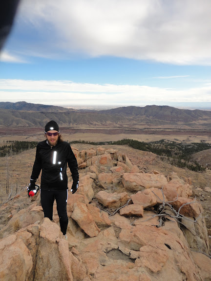
Coming off peak 7,214', we found a decent game trail down through a gully, which hooked back into the DR trail and the traditional Bobcat loop. We finished off our figure eight route by hitting Buckhorn/38e roads for the 5 mile climb back up to my house. All told, we were about 23-24 miles on the morning, with two fun and unusual summits, a fierce lashing on Bobcat Ridge from the strong northwesterly wind, and some quality time-on-feet base building.
Saturday, January 21, 2012
Alexander Mountain

Alexander Mountain (right), the gateway to the Big Thompson Narrows.
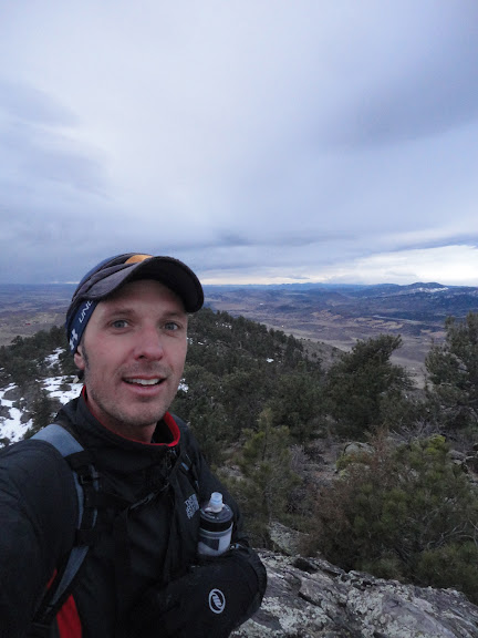
Despite it's somewhat diminutive stature, Alexander Mountain (7,105') is a good challenge, with rewarding and unique views of some very familiar terrain from its summit.
If you've ever driven up Hwy 34 through the Narrows of the Big Thompson, then you've undoubtedly seen Alexander, but maybe never known it as such. Alexander Mountain is the first named mountain in the Big Thompson Canyon, but plays little brother to it's better-known neighbors. Both Round Mountain and Palisade Mountain can be seen from the top of Alexander, but neither of them offer the unique views of the Narrows and hogback foothills that their humble sibling does.
As you approach the mouth of the canyon, Alexander Mountain is easily recognizable from its sheer south face. The Big Thompson itself begins its journey from the peaks of Rocky Mountain National Park - viewable to the west from Alexander's summit.

Left to right: Stone, Meeker, Longs, Round.

The entry to the gully, right off the Big Thompson.

The southeast ridge of Alexander.
Soon after entering the gully, there is a large boulder plugging up the boxed-in route, which requires some class III maneuvering to get around. Once past the chockstone, it's time to fight with the rough brush that inhabits the dry creek bed.Tiring of that game, Ryan and I cut a line to the western ridge of the gully and enjoyed some fun class III/IV climbing all the way to the top of a small point from where the best views on Alexander are available. The actual summit is a short hike north on the summit ridge in a forested area of little note.

Chockstone.

Brush, brush and more brush early on.

Out of the weeds...

...and on to some solid rock.

Anticlimactic summit.
After making the requisite summit tag, Ryan and I returned to the slightly lower point that we had gained from the ridge and enjoyed the awesome views for a while. 100 miles to the south, Pikes Peak was visible, with close-ups of Carter Lake, Longs Peak, Mount Meeker, and Round and Stone Mountains in the foreground. Off to the east, there were great views of the foothill hogbacks, including Devil's Backbone, the Bluesky Valley, Eden Valley Reservoir, Horsetooth and Milner Mountain. To the west were good views of the nicely painted Mummies and other RMNP peaks. But perhaps most impressive of all was the view down into the Big Thompson Narrows - a quite unique vantage point to be sure.
Eden Valley Reservoir

Horsetooth (left) & Milner Mountain (right)

Big Thompson Narrows, with hogbacks beyond.
Coming down, we forewent the rocky down-climbing, deciding instead to wage war against the mountain mahogany and other nasty creek brush.With 20-30 minutes on top, we were up and down in about 2.5 hours. Total climb is in the 1,600 foot range and distance is probably no more than 3 miles. This one comes highly recommended.
Sunday, January 15, 2012
Fortnight Ending Jan 15
Mon - 3.5 miles easy. Two university loops.
Tues - 3.5 miles easy. Two university loops.
Weds - 0 miles. London to Denver by way of manic JFK.
Thurs - Noon: 4.5 miles (900') easy. Falls loop. Insanely warm out.
PM - 6 miles easy on the bike paths with the FCTR crowd. Despite the Jan 6 date and dark of night, we had sports bras and bare midriffs aplenty tonight. Two weeks in the UK and I return home to mid-summer in January.
Fri - PM: 2.5 miles (500') easy with Dylan and Yassine on the Bandera course.
Sat - 62 miles (4,500'). Bandera 100k.
Sun - 0 miles
Total: 82 miles (5,900')
Mon - 0 miles
Tues - 0 miles
Weds - 0 miles
Thurs - AM: 10.5 miles (1,500'). HTH5MO&B with Pete, Celeste, Ziggy (who has big doggy goals for 2012), Slush, Mike, and a very late Sarah. Windy and cold. Out in a sore 45 mins, back in an even sorer ~34.5 mins. Downhills were quite painful on the quads. Took things very easy.
PM: 7 miles (1,700'). First Towers session of the year. Good turnout on what was a pretty nice evening for mid January. Track was dangerously icy in places. Up in an easy 38 mins.
Fri - 5 miles (1,100') easy. Falls long.
Sat - 22 miles (1,800') easy. Horsetooth circumnavigation with Sarah, Alex and Pete. Beautiful morning. Still quite sore in the quads, but just glad to be out.
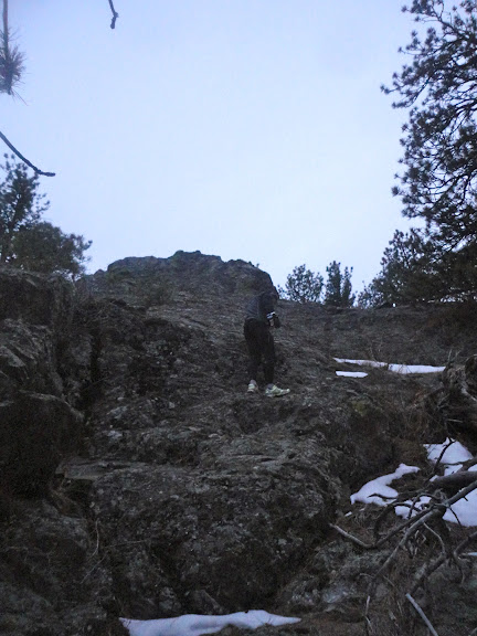
Sun - AM: 3.5 miles (2,500'). Palisade Mtn (8,264') with Mike and Elijah. Been wanting to get on Palisade Mtn, a prominent and jagged Front Range peak, for quite some time. Palisade is essentially on the opposite side of the Big Thompson from Round Mountain and is visible from many vantage points in Fort Collins and Loveland. From the canyon floor, there are multiple drainages and ridges to choose from in getting up. We ascended a few drainage ribs too far to the east, making our morning a little longer than it would otherwise have been, but we were still up and down in a reasonable 2.5 hours. All bushwhacking, probably a little more class III than necessary, and a ton of cactus. Back home for breakfast and then up Horsetooth with friends and family.
Possibly the largest summit-register canister in the Rockies. All pics: Mike H
Mike with Round Mtn. behind

Total: 52.5 miles (10,100')
Bit of this, bit of that and a few days off after Bandera. January will be a very relaxed, run-when-I-want kind of month. There is so little snow around right now, I think I'll take the opportunity to explore locally a bit and get up a few of the lesser visited NoCo Front Range peaks. Palisade was a good start today. Also on the list are Alexander, Storm, Christ, Milner, Goat, Spruce, Buckhorn, and Ethel. Other suggestions welcome.
Registrations for the Quad Rock 50 (aka FoCo 50) are going strong. We're about half full right now, with just 40 spots left in the 25 miler. Pete and I are working hard to make sure that we put on a top-notch event, and we couldn't be happier to be teaming up with some really great local companies, including Pearl Izumi which has just signed on as the shoe and apparel sponsor. This means top-quality, gender-cut race T-shirts for all participants, shoes for age group winners and tons of other great giveaways.
In addition to Pearl, we're working with First Endurance as the fuel sponsor. All participants will receive a 5oz EFS gel flask with their entry and we'll be doing jug refills at the aid stations. If you haven't tried EFS before and want to test it out before the race, we've set up a 20% discount for runners. Visit the race website, nose around a bit and you'll find the coupon code. We're also working with Smith Optics (which means more awesome prizes and giveaways) and Colorado Physical Therapy Specialists (which means free massages and PT after your run). Other relationships are in the works, all of which means more cool stuff for you.
Rick just hosted his first annual VerticALE Beer Mile in North Carolina. I hear there might be one occurring on the Incline soon too. It's sweeping the nation, folks.
Tues - 3.5 miles easy. Two university loops.
Weds - 0 miles. London to Denver by way of manic JFK.
Thurs - Noon: 4.5 miles (900') easy. Falls loop. Insanely warm out.
PM - 6 miles easy on the bike paths with the FCTR crowd. Despite the Jan 6 date and dark of night, we had sports bras and bare midriffs aplenty tonight. Two weeks in the UK and I return home to mid-summer in January.
Fri - PM: 2.5 miles (500') easy with Dylan and Yassine on the Bandera course.
Sat - 62 miles (4,500'). Bandera 100k.
Sun - 0 miles
Total: 82 miles (5,900')
Mon - 0 miles
Tues - 0 miles
Weds - 0 miles
Thurs - AM: 10.5 miles (1,500'). HTH5MO&B with Pete, Celeste, Ziggy (who has big doggy goals for 2012), Slush, Mike, and a very late Sarah. Windy and cold. Out in a sore 45 mins, back in an even sorer ~34.5 mins. Downhills were quite painful on the quads. Took things very easy.
PM: 7 miles (1,700'). First Towers session of the year. Good turnout on what was a pretty nice evening for mid January. Track was dangerously icy in places. Up in an easy 38 mins.
Fri - 5 miles (1,100') easy. Falls long.
Sat - 22 miles (1,800') easy. Horsetooth circumnavigation with Sarah, Alex and Pete. Beautiful morning. Still quite sore in the quads, but just glad to be out.
Sun - AM: 3.5 miles (2,500'). Palisade Mtn (8,264') with Mike and Elijah. Been wanting to get on Palisade Mtn, a prominent and jagged Front Range peak, for quite some time. Palisade is essentially on the opposite side of the Big Thompson from Round Mountain and is visible from many vantage points in Fort Collins and Loveland. From the canyon floor, there are multiple drainages and ridges to choose from in getting up. We ascended a few drainage ribs too far to the east, making our morning a little longer than it would otherwise have been, but we were still up and down in a reasonable 2.5 hours. All bushwhacking, probably a little more class III than necessary, and a ton of cactus. Back home for breakfast and then up Horsetooth with friends and family.
Possibly the largest summit-register canister in the Rockies. All pics: Mike H
Mike with Round Mtn. behind
West up the Big Thompson toward RMNP
PM: 4.5 miles (1,500'). Horsetooth summit with Dana, Alistair, Stella C, Brian, Sandis, Stella W, Rob and Madison.
On H'tooth summit with Great Plains to the east behind.

Looking southwest. Pikes is faintly visible 100 miles south.

Halfway up with my zonked-out baby.

Looking southwest. Pikes is faintly visible 100 miles south.

Halfway up with my zonked-out baby.
Total: 52.5 miles (10,100')
Bit of this, bit of that and a few days off after Bandera. January will be a very relaxed, run-when-I-want kind of month. There is so little snow around right now, I think I'll take the opportunity to explore locally a bit and get up a few of the lesser visited NoCo Front Range peaks. Palisade was a good start today. Also on the list are Alexander, Storm, Christ, Milner, Goat, Spruce, Buckhorn, and Ethel. Other suggestions welcome.
Registrations for the Quad Rock 50 (aka FoCo 50) are going strong. We're about half full right now, with just 40 spots left in the 25 miler. Pete and I are working hard to make sure that we put on a top-notch event, and we couldn't be happier to be teaming up with some really great local companies, including Pearl Izumi which has just signed on as the shoe and apparel sponsor. This means top-quality, gender-cut race T-shirts for all participants, shoes for age group winners and tons of other great giveaways.
In addition to Pearl, we're working with First Endurance as the fuel sponsor. All participants will receive a 5oz EFS gel flask with their entry and we'll be doing jug refills at the aid stations. If you haven't tried EFS before and want to test it out before the race, we've set up a 20% discount for runners. Visit the race website, nose around a bit and you'll find the coupon code. We're also working with Smith Optics (which means more awesome prizes and giveaways) and Colorado Physical Therapy Specialists (which means free massages and PT after your run). Other relationships are in the works, all of which means more cool stuff for you.
Rick just hosted his first annual VerticALE Beer Mile in North Carolina. I hear there might be one occurring on the Incline soon too. It's sweeping the nation, folks.
Monday, January 9, 2012
Bandera 2012
Sitting on the plane from Denver to San Antonio, just two days after getting off a plane from London to Denver, I was wondering what on earth I had been thinking in signing up to run the Bandera 100km race out in Hill Country Texas. This would be my second jet-lagged, ultra-distance run in less than three weeks, and I had a crappy gravelly throat to boot.
Nonetheless, signed up and on my way I was, so it was time to think about how I might be able to limit the pain and suffering, while still putting forth a decent effort. Not much was coming to mind, and the thought of 62 miles over rock-littered trail was really quite nauseating.
My mood perked up a bit when I met Dylan and Yassine at the airport, but it was frustrating to be hanging out barely able to talk. Ah, bugger. Maybe things would feel a little better in the morning. I'd only had 4 hours sleep on average the last three nights, so I was almost guaranteed a solid kip. After some pasta and a quick beer courtesy of our very gracious hosts (Mr Wilen and Mr Albert, you are owed) at the formidable hunting cabin at which we were staying, it was time to get the ole' head down for a serious ZED fest.
I could talk in the morning. That was good. But the thought of 62 miles at race pace still sounded terrible, almost like a death sentence hanging over my head. What in God's name was I doing here? I was about to get spanked by course and competition and I knew it.
Stiff upper lip.
Bandera was once again serving as the 100km national trail championship, but probably of more relevance to those in the USAT&F field were the 74 Montrail Ultra Cup points up for grabs, the cheese (a Dylan'ism for cold, hard cash), and the two Western States berths. Or, more euphemistically, the chance to run against competition.
Bandera is run on a repeated 50km route. It offers a limited amount of climbing, but nonetheless is probably harder than Miwok with its 10,000' plus of climbing.
This course is quite capable of bringing you to your knees. The chief culprits are the rocks that litter the opening and closing thirds of the course. On fresh legs and feet, it’s all fun and games. You go out charging up the 200-300 foot mini climbs high-stepping the limestone rock ledges, before descending the marble-, tennis ball- and softball-sized rocks on the backside descents. This is repeated a number of times before you open up the stride and build a head of steam running some of the less technical sections of the course. The middle miles take you over a mixture of open, fast grassland, more gnarl on the crossroad loop, buffed singletrack, a short sharp bop up and down Lucky’s Hill. And then it all ends where you started with punishing rocks and two more climbs, the final one involving a section of ridge running that can seem endless on tired legs.
The conditions for this, the tenth running of Bandera, were unseasonably hot with not a cloud to be seen all day. Between the rocks and the sun, there was some pretty significant carnage, among which I would most definitely include myself.
Dylan and I had discussed our desire to keep things somewhat conservative on the first loop in hopes of mounting a charge on the second go around. From the gun, Timmy Olson and Dave James were immediately off to the races with myself and a pack of guys sitting back in reasonably close pursuit. By the time we hit the first aid station six miles in, Dylan and I were running together in third and fourth with Dave and Timmy a minute or so ahead and a still sizable pack a similar distance behind.
Things would essentially remain this way for the first half of the first lap. However, a few sneaky glances behind on some of the open sections revealed a patiently waiting Dave Mackey, while the gap on Timmy and Dave James appeared to be closing ahead.
By the halfway mark of the first 50k at the Crossroads aid station, Justin Ricks had managed to tag onto Dylan and me and we ran that middle loop together at what seemed like a slightly up-tempo version of what we had previously been pushing out. Not long after leaving Crossroads for the second time, at mile 22, Dylan and I were once again running solo in third and fourth with Justin having fallen off the pace. Dave and Timmy seemed to have rebuilt their lead a bit.
I was hanging on by a thread and I knew it, but I wanted to keep Dylan moving well at least until we finished the first loop. I desperately wanted him to pick up a WS spot.
Working our way up Boyle’s Bump, the final climb of the loop, Mackey suddenly made an appearance and was quickly ahead of us looking strong and in command. Seeing him moving the way he was, I figured he was on his way to bridging the gap to Dave and Timmy and maybe contending for the win. Dylan and I meanwhile had seemed to be dropping the pace ever so slightly. Figuring that Dave and Timmy were gone, it was up to Dylan to pick up Dave James - who I was assuming had a 50-50 chance of finishing - if he wanted that Squaw start.
Dylan was much quicker than me through the turnaround and I knew he was gone for the day. I now had to find the grit to get on with things and stop entertaining the swelling urge to throw in the towel. And so off I jogged back out for another 31 miles of unadulterated torture. I think I saw five guys coming at me on the half mile it took to clear the start/finish out and back, and I assumed that each and every one of them would swallow me up before I was finished. Top ten was starting to look like a good result.
Joe Uhan was the first to emerge, six miles later, just as I was leaving the first aid station. I mumbled some form of unconvincing encouragement and jogged out. Somehow I managed to hold Joe off for five more miles - or I should say, Joe didn't pass me until the next aid station as I certainly wasn't trying to hold position. I wanted to quit there as well, but that would have been embarrassing with a Queen and a Lord in attendance.
I wasn't eating, I felt bloated on fluids and I wanted to puke. Oh, and like everyone else I was cramping like it was secretly in fashion. I literally ate handfuls of E-Caps, but got nothing in return, just more cramps. My system was absorbing nothing. I was on for a death march of epic proportions, and was firmly set on pulling out at Crossroads, the next aid station. But there were Mike and Albert who had so kindly put me up for the weekend, and there was a smiling Darcy telling me that I had nothing more than a lunchtime run to go (14 miles). Good grief Charlie Brown.
Off into the sotol infested jungle I went to receive further lacerations to the legs and increased levels of dehydration under the burning sun. I passed Dave James on the top of some hill and cursed him silently for having the courage to drop out when there really is no point in continued forward movement.
Back to Darcy and more encouragement. She had ice. Sweet baby Jesus, she had ice. Nine more miles. Was I still in fifth? How on earth was I still in fifth? Okay what was the next section again? Oh yeah, moderately rolling, not very technical singletrack, a sharp climb and then half a mile on doubletrack to the last aid station. Get me on that climb - all I want to do is walk and feel sorry for myself.
Olga, sweet Olga. There she was waiting at the last aid station. How did I get there? 55 minutes to the finish if I walked every step of upward facing trail and ran the rest, she told me. That's less than an hour. Should I puke this bloat out of my stomach and start afresh or should I stubbornly keep drinking coke and downing salt caps in the vain hope that my stomach might actually absorb something and stop the horrendous leg cramps. I chose the latter. It continued to be a highly ineffective strategy.
Two more climbs, an endless traverse and then just like that I was done. I sat down and proceeded to feel worse and then worse some more. I was dehydrated, with a touch of sunstroke and some major nausea. Easily the worst I have ever felt post race.
I finally did puke, put I didn't get the window down in time. Sorry multinational rental car agency.
So enough of my self pity. I'm fine.
Congrats to Joe Uhan on running a really gutsy race and claiming that Western States spot. Congrats to Timmy for destroying the field, and to Dave for hanging tough yet again. Dylan, you'll get yours in Sonoma.
I wish I could have been a little more sociable after the race. Or that I had puked sooner. I was like a new man after getting all that junk out of my system. I went on to consume three beers and half a pizza that night, which for as bad as I was feeling for the first two hours post-race is quite a miracle.
Thanks to Joe P for putting on a great event, encouraging fast and slow alike, and gathering together a formidable crew of volunteers. He's got nine more events (he likes to remind people of that). Go check one of them out. You'll be glad you did.
The depressing truth
1st lap: 3:57
2nd lap: 4:57
Thursday, January 5, 2012
Week Ending Jan 1
Mon - 6 miles. Saltwood Boxing Day Run with 3 mile w-u.
Tues - 10 miles easy. Blean Woods black loop.
Fri - 4 miles easy with my brother Matt and nephew William in the leafy Kentish countryside around Horsmonden.


Sat - 9 miles. Whitstable Parkrun 5k with 6 mile run to Jim's house from Canters on the Crab and Winkle.
---------------------------------------------------
January: 440.5 miles (45,850')
February: 304.5 miles (39,200')
March: 469.5 miles (67,100')
April: 427 (62,000')
May: 509.5 (92,500')
June: 323 (54,900')
July: 303.5 (79,700)
August: 297.5 (70,000')
September: 202 (37,500')
October: 373.5 (68,150')
November 377.5 (67,400)
December 236 (45,000')
Total: 4,264 miles (729,400')
Avg: 355 miles (60,783')
---------------------------------------------------
Sun - 5.5 miles easy. Three university loops in Canterbury.
Total: 50.5 miles
Closed the year out with my second-lowest mileage month of the year. However, 4,264 miles on the year is most respectable and an increase of 164 miles on last year. In addition to the linear mileage, I was able to rack 140 miles in the third dimension for an average over the year of 170 feet gained (and lost) per mile run. Two years back to back at over 4,000 miles is good consistency, but I'm on the Nordic 4-year plan. The peak comes in 2013 and then I retire.
Given the relatively low December mileage, it would be reasonable to assume that I'll be nice and rested for Bandera this weekend, but unfortunately I don't feel particularly fresh, especially after a long and stressful flight back from the UK yesterday. But you never know, sometimes you run your best races when you least expect them. As always when I'm toeing a start line, I'll be there to compete, not just go through the motions, so you never know.
Sixty degrees on my lunch run today with clear blue skies. Man I love Colorado.
Tues - 10 miles easy. Blean Woods black loop.
Weds - 6.5 miles easy. Blean Woods red and green loop.
Thurs - 9.5 miles easy at Bedgebury with Matt in the mud and rain
Fri - 4 miles easy with my brother Matt and nephew William in the leafy Kentish countryside around Horsmonden.


Sat - 9 miles. Whitstable Parkrun 5k with 6 mile run to Jim's house from Canters on the Crab and Winkle.
---------------------------------------------------
January: 440.5 miles (45,850')
February: 304.5 miles (39,200')
March: 469.5 miles (67,100')
April: 427 (62,000')
May: 509.5 (92,500')
June: 323 (54,900')
July: 303.5 (79,700)
August: 297.5 (70,000')
September: 202 (37,500')
October: 373.5 (68,150')
November 377.5 (67,400)
December 236 (45,000')
Total: 4,264 miles (729,400')
Avg: 355 miles (60,783')
---------------------------------------------------
Sun - 5.5 miles easy. Three university loops in Canterbury.
Total: 50.5 miles
Closed the year out with my second-lowest mileage month of the year. However, 4,264 miles on the year is most respectable and an increase of 164 miles on last year. In addition to the linear mileage, I was able to rack 140 miles in the third dimension for an average over the year of 170 feet gained (and lost) per mile run. Two years back to back at over 4,000 miles is good consistency, but I'm on the Nordic 4-year plan. The peak comes in 2013 and then I retire.
Given the relatively low December mileage, it would be reasonable to assume that I'll be nice and rested for Bandera this weekend, but unfortunately I don't feel particularly fresh, especially after a long and stressful flight back from the UK yesterday. But you never know, sometimes you run your best races when you least expect them. As always when I'm toeing a start line, I'll be there to compete, not just go through the motions, so you never know.
Sixty degrees on my lunch run today with clear blue skies. Man I love Colorado.
Sunday, January 1, 2012
Whitstable Park Run
The Parkrun was a new one on me up until this recent trip to the UK. My good friend Jim has been a regular at the Whitstable Parkrun for quite some time now, and he suggested I come down and join him at 9:00 am on New Year's Eve for the run/race that happens every Saturday in the same location year round, and at many other locations around the nation at the same time.
The concept is very simple: a free 5k race open to all, and conducted with the help of regular attendees who take turns volunteering and racing. A slick and simple bar code timing method ensures accurate and timely results which are maintained and uploaded onto a website that put to shame many a paid-for road race. Photos are also uploaded, and geez, I even got a free chocolate bar at the end. You can expect about the same level of service from the New York Marathon in 2012...for $255. I guess all events have their place, but it's great to see grassroots events like this encouraging people to get out and run, because ... well ... running's fun and it's good for you.
The Whitstable run is conducted on the Tankerton Slopes right on the seafront, almost guaranteeing that runners will encounter a significant headwind for more than half the race. The course is a mix of pavement promenade and short-cut grass on a single loop run twice.


Matt and me going coastal at the Parkrun.
William completes lap 1. Running is fun!
For the last event of the year, there were just over 100 assembled. I'd run the six miles from Canterbury to attend, while my brother Matt had driven down from West Kent with William, his middle child, to meet Jim and I on the seafront. A few short words and we were off charging down the promenade.
A 3:10 first kilometer (15:50 pace) almost ensured that the second half of my race was going to be a bust, but I was out chasing heels thinking I could sneak an out-of-shape 5k PR (given that I haven't run one at sea level in donkey's years). However, as soon as we turned around shortly after the 1km mark and began forging our way back up towards the start/finish area on the grass above the promenade into a steady headwind, I gave up on the idea of a PR and just ran for effort.
Three guys had gotten out ahead of me; one came back on the grass, but the other two grew their leads to 20-30 seconds by the time it was all said and done. The second and third kilometers averaged a rather pathetic 7:08, the fourth an equally pathetic 3:30, and then the final km on the second lap a miserable 3:45 for an incredibly lackluster 17:33. I'll put this one down to season excesses, numb feet, and a surprisingly tough course (as 5ks go) with a naughty headwind.
Matt and Jim had equally (self-described) poor performances, so it was great to see the youngest member of our party, 8-year-old William, showing us all how it was supposed to be done with an impressive 24:00 run and 35th place finish overall (out of 105).

Finishing up the last race of the year.
Jim describes that look as 'focused'
William showing his onlooking dad and uncle how it is supposed to be done.
Subscribe to:
Posts (Atom)


.png)

