Tues - AM: 7.5 miles intervals. Met Jane's group on a very cold morning. With the ground covered in snow and ice and the thermometer reading 5 degrees, this one was just about stretching the legs and busting the holiday rust. Workout was cemetery 2x800, 2xmile, 2x800. Splits: 3:00, 2:49, 5:34, 5:33, 2:49, 2:46. 15 min w-u/c-d on either side.
PM: 7 miles (1,900') easy. Soderberg - Rock - Wathan - Spring Creek - Falls - home long. Felt super smooth aerobically, but sore in the usual places physically. Inch of snow over top of some good stretches of ice, interspersed with dirt and packed snow. Perfect conditions for old school Yaktrax, which people love to hate, but I quite like. In these conditions they are way better than a spiked traction device which are just annoying in mixed conditions.
Weds: 7 miles (1,900') easy. Soderberg - Rock - Wathan - Spring Creek - Falls - home long. Most of the snow from two days ago is essentially gone with the slightly warmer temps. Legs were heavy, but heart and lungs good.
Thurs - AM: 11 miles (1,500') hill tempo. HTH5MO&B. Felt like I went ten rounds with Tyson out there this morning. The wind was swirling like crazy and was highly unpredictable. Rounding the last east-side dam, a massive gust picked up a bunch of gravel and raked us like we'd just been shot in the face by Dick Cheney. That one stopped me and Scott in our tracks and had us whimpering and assuming the crouching position. I think that's the worst I've seen it up there on the ridge. But at least it wasn't too cold. Not surprisingly, performance coming back suffered, despite a pretty hard effort. 39:26 out, 31:26 back (7:00, 6:19, 6:28, 6:17, 5:19). One mile c-d.
PM: 7.5 miles easy with the FCTR crowd at Pineridge.
Fri: 7 miles (1,900') easy. Soderberg - Rock - Wathan - Spring Creek - Falls - home long. Tired of this wind, but as long as the mild temps stick around, I'll take it I guess.
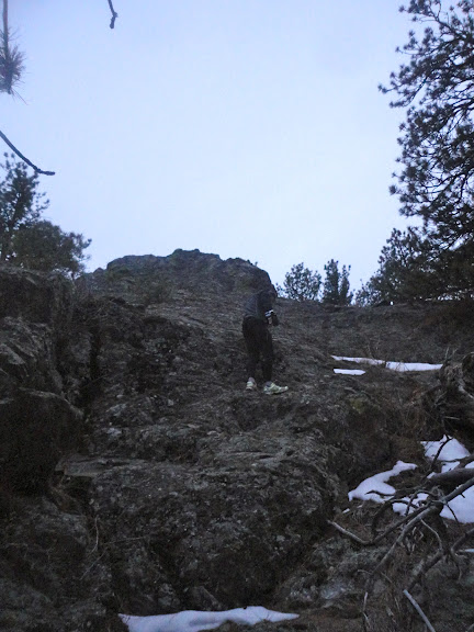
Sat: 3 miles (1,600') hike. Alexander Mtn with Ryan.
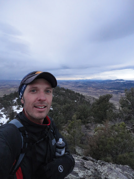
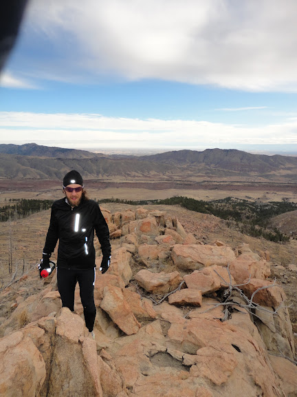
Sun: 23.5 miles (3,500') long. Milner Mtn (6,881'), Bobcat Ridge, point 7,124' with Mike H.
Total: 76.5 miles (11,300')
A friend of mine pointed me in the direction of a website called Lists of John the other day. It's an invaluable resource for those into the fine art of peakbaggery, and while I'd visited it before I'd never really perused it fully. Aforementioned friend offered up a link to the 255 ranked peaks in Larimer County (where I reside), the simple act of which finds me getting a little obsessed.
Many of these 'peaks' are peaks in name only. To be ranked, a peak has to have a minimum of 300 feet of climb (or prominence) on any route from a higher peak (or sea level), a rule that means such elegant summits as Arthurs Rock and Comanche Peak are not ranked, but some random hillside above Horsetooth Reservoir is.
This all means that I find myself plotting to hike or run up totally unworthy hillsides simply to check off another ranked Larimer peak. By extension, however, this new-found obsession has also given me a much keener eye for the skyline around me. I see a peak that previously had been just another rise in the endless swell of rises that surround us here in Colorado and I want to know if it's named, what its prominence is and how I'm going to get up it.
I think I've become more familiar with the geography and topography of Larimer County in the last two weeks than I have in the last five years. And that's a good thing. I find myself plotting new routes and getting excited about totally random 8,000 foot peaks.
Anyway, enough of my peakbaggery babble.
What else? Well, we've recently secured a sponsorship from the fine folks at Cornerstone Mortgage Company (my own personal lender and all-around supporter of the Fort Collins running community) for the Quad Rock 50 in May, which now means that we're able to offer up a modest prize purse for the 50 mile race, in addition to some nice product prizes for age group winners (Pearl Izumi shoes for sure in the 50 and hopefully in the 25 too). We're also working on some really neat ideas for finishers' awards and hope to have an announcement on that soon.
I'm also excited about a new flavor of EFS Liquid Shot that Robert over at First Endurance has been working on. I sampled the Kona Mocha, as it will be called, on Sunday during my long run and really enjoyed it. Like all EFS Liquid Shot, the non-viscous nature of the gel means that it goes down easy, but best of all I really think they nailed the flavoring. The blend between coffee and chocolate doesn't leave that cloyingly sweet taste in your mouth; it just tastes good. I think this one is going to be popular. The planned launch date is March, I believe, so I'm really hoping that we'll have some to distribute at the Quad Rock in May.
And now my Larimer peak completion list (seven non-ranked, so 231 ranked boys to go!):
# of Larimer County peaks completed: 31
| Name | Elevation | Prominence | Counties | Quadrangle |
| Hagues Peak | 13,560' | 2,420' | Larimer | Trail Ridge |
| Ypsilon Mountain | 13,514' | 1,116' | Larimer | Trail Ridge |
| Fairchild Mountain | 13,502' | 922' | Larimer | Trail Ridge |
| Mummy Mountain | 13,425' | 485' | Larimer | Estes Park |
| McHenrys Peak | 13,327' | 907' | Grand & Larimer | McHenrys Peak |
| Taylor Peak | 13,153' | 413' | Grand & Larimer | McHenrys Peak |
| Chiquita, Mount | 13,069' | 283' | Larimer | Trail Ridge |
| Hallett Peak | 12,713' | 733' | Grand & Larimer | McHenrys Peak |
| Comanche Peak | 12,709' | 209' | Larimer | Comanche Peak |
| Dunraven, Mount | 12,571' | 231' | Larimer | Estes Park |
| Otis Peak | 12,486' | 426' | Larimer | McHenrys Peak |
| Chapin, Mount | 12,454' | 434' | Larimer | Trail Ridge |
| Flattop Mountain | 12,324' | 24' | Grand & Larimer | McHenrys Peak |
| Stormy Peaks | 12,148' | 488' | Larimer | Pingree Park |
| Dickinson, Mount | 11,831' | 171' | Larimer | Estes Park |
| Twin Sisters Peak East | 11,428' | 2,298' | Larimer | Longs Peak |
| Twin Sisters Peak West | 11,413' | 73' | Larimer | Longs Peak |
| Twin Sisters Mountain | 11,384' | 364' | Larimer | Longs Peak |
| Signal Mountain | 11,262' | 802' | Larimer | Pingree Park |
| Lookout Mountain | 10,626' | 406' | Larimer | Crystal Mountain |
| West White Pine Mountain | 10,305' | 1,445' | Larimer | Crystal Mountain |
| Deer Mountain | 10,013' | 1,073' | Larimer | Estes Park |
| Crosier Mountain | 9,250' | 1,270' | Larimer | Glen Haven |
| Sheep Mountain | 8,450' | 1,108' | Larimer | Drake |
| Palisade Mountain | 8,264' | 1,084' | Larimer | Drake |
| McConnel, Mount | 8,020' | 520' | Larimer | Big Narrows |
| Greyrock Mountain | 7,613' | 753' | Larimer | Poudre Park |
| Horsetooth Mountain | 7,255' | 595' | Larimer | Horsetooth Reservoir |
| Alexander Mountain | 7,105' | 605' | Larimer | Drake |
| Arthurs Rock | 6,780' | 80' | Larimer | Horsetooth Reservoir |
| Milner Mountain | 6,881' | 1,119' | Larimer | Masonville |


.png)

