Mon - 18 miles (6,500') peaks. Sprague, Stones w/Joe in the park.
Tues - 6.5 miles (1,600') easy. Horsetooth north summit via north notch w/Wesir and Burch.
Weds - 6.5 miles (1,700') easy. Horsetooth south summit.
Thus - 8 miles (1,800') steady. Towers in 32:37. Felt like I was working at a 30-min effort. Conditions weren't the best, with some snow up high, but not that bad. My fitness is apparently not that great right now.
Fri - 6.5 miles (1,600') easy. Horsetooth north summit in the snow w/Wesir. Up in the dark via Southridge/Audra, down in the mist via the Rock trail.
Sat - Off. Not quite sure where the day went, but a running window never quite materialized.
Sun - 4.5 miles (1,900') peakbaggery. Unnamed, but ranked, peak 6,674'. This one has been sitting there bugging me since a failed attempt months back. The first time I tried this, I parked up across from the Cherry Store at the west end of the Big Thompson Narrows with a view to ascending via Dickson Gulch. Unfortunately, this route requires the use of an aggressively signed private road (Stagecoach?) and the passing of several houses in the early going, and I didn't want to deal with that hassle, so turned around and came home. I have since scouted a couple of alternative routes, dismissing the route from the east which would require trespassing on the Horsetooth Canal Road, and opting instead for a steep scramble up from the canyon floor of the Big Thompson Narrows on NF land. The other option that looks viable is to come in on Bear Track Rd from Pole Hill Rd to the south, but I have no idea what the status of that road is. It is marked on maps as a county road, but I have learned in recent months that that doesn't necessarily make it a public road.
Anyway, I parked the car at a pull-off in the first major bend of the east side of the narrows - just before the Roosevelt NF sign. From that pull-off, there were flags indicating a route up the south side of the canyon. This had me confused at first, but then I remembered that there had been a small fire up there this summer and figured it was flagging for the fire-fighting effort. Sure enough, after a steep, scrambly climb following the flagging, I was in the small burn area (maybe 20 acres) on the northeastern shoulder of the first summit of the 6,674' ridgeline. The actual highpoint is on the southern end of the ridgeline, with four or five points along the way. I hit three of the four summits on the ridge before finally getting up on 6,674. The going was decent, as bushwhacking goes, but not great: plenty of downed trees, typical scrub and lots of pointy, prickly stuff. The views from 6,674' were good, with a great line of sight to the southeastern ridge of Round Mtn, including the Stone Mtn rock outcropping. Other views included Palisade and Alexander in all their glory to the east, in addition to some high snow-capped peaks to the north. On the return trip, I skirted the ridgeline to the north and west, and ended up having to traverse east a half mile on some sketchy terrain high above the narrows in order to be able to descend back into the canyon at a point where the road was on the correct side of the river (a bend west of the NF sign). Would have been much better off retracing my steps. Glad to finally have this one ticked off the list.
Total: 50 miles (15,100')
Finding it hard right now to motivate for hard quality sessions. The plan for the off-season was to drop the mileage and focus on quality. I have succeeded in dropping the mileage, but not so much with the quality part. Back on track (badda, bing) this week, one hopes.
Monday, October 29, 2012
Friday, October 26, 2012
Week Ending October 21
Mon - Off
Tues - 8.5 miles track. 3(4x400) - 200 jog between intervals, 600 between sets: (78, 75, 74, 73) (74, 75, 75, 75) (75, 74, 76, 75). Met Mike at the track and then followed him around it 12 times. Goal was 75s, but as usual I felt like I was working harder for them than I would have liked.
Weds - 6 miles (1,600') easy. Horsetooth south summit up a ramp on the southwest side
Thurs - 6.5 miles (1,600') easy. Horsetooth south summit w/Wesir. Took a look at the west side of the rock, which has a surprisingly big face. Apparently there is a bolted 5.11 line in there somewhere; we didn't see that, but we did see a couple of good looking cracks and other potential routes. We tooled around a bit looking for an easy free-climb route, but ended up backtracking a couple of times before we found a way up onto the southwest ridge. Got a little nervy on the one exposed crux move.
Fri - 6.5 miles (1,700') easy. Horsetooth north summit. Standard route.
Sat - 13.5 miles (3,500') peakbaggery. Pole Hill (8,683'), Sugarloaf Mtn (8,980'), 9,075', Panorama Peak (9,284'). Met Nikolai and Wesir early at the Hwy 34 gas station, then jetted up Rattlesnake Hill (18E) for a fun little loop in the Pole Hill area, west of Pinewood Reservoir. After a couple of wrong turns trying to find the pull-off for the National Forest (just before the gate where Pole Hill Rd turns private), we parked up in the dark and followed a fence line north for a while, and then again west at the perimeter of the private property before charting a generally northwest course on an old forest road (marked 320 on the topo map). The summit of Pole Hill, which sits in open forest, was pretty unremarkable, but does offer awesome views. From Pole Hill we could see unranked Sugarloaf Mtn across a small gulley to the west. We headed for the saddle between the two and then hoofed it up to the large rock outcrop that forms the true summit of Sugarloaf (different from the GPS coordinates for a lower outcrop listed on List of John). Some fun scrambling to get on top and awesome views of the Estes skyline, before continuing our westerly trajectory in search of ranked, but unnamed, peak 9,075'. This was very straightforward. The summit had a register, so we signed in and then picked up the jeep trail just below the summit, which would take us south down to the Pole Hill valley. We crossed Pole Hill Rd and continued across a meadow in the direction of the northern ridge of Panorama Peak. The original plan was to pick up the 4x4 tracks that lead all the way up to Panorama Peak, but we ended up bushwhacking the whole thing on a more direct line. The summit of Panorama Peak has a private lookout tower (the land is leased from the NF), and if one were to scale it, the views - I am sure - would be absolutely stunning, perhaps the best of any lower summit east of Estes. The actual summit itself, though, is treed in. After a decent repose on the summit, we charted a northeasterly course through reasonably open forest before picking up Pole Hill road for the 3-4 mile run back to the car. This route comes highly recommended - the bushwhacking is very light (as bushwhacking goes), most of the route is on public land, and the views are mind-blowingly good.
Sun - AM: 3 miles (1,400') hiking. Mt. Olympus (8,808') with Alistair and Stella. Mum wanted us out of the house, so we drove up to Estes for a quick summit of Olympus. Mount Olympus is one of the more iconic lower peaks that ring the Estes Valley. It sits right on the east side of town, just south and west of Hwy 34 and the Big Thompson Canyon. Given its location and rocky summit, the views - I knew - would be huge. I just needed to keep Alistair motivated enough to complete the steep, off-trail ascent. From the pull-off by the National Forest sign, we charted a steep, slabby southerly course up a gulley before plateauing on the western shoulder of the mountain at about 8,000'. The summit grunt to the east was easily viewed from here, and it was all I could do to convince Alistair that it would be worth it. Eventually, we got our heads down and went for it. Nearing the top, there is some fun scrambling and I let Alistair pick the line through the rocks. We ended up on a sub-summit, so descended and hit the true summit a quarter mile to the east. The views from the top were as big and sensational as predicted, with the Continental Divide, Mummies, Dunraven/Buckhorn area, Panorama Peak, Pole Hill, etc all clearly visible. We hung out for a good long while, enjoying a picnic and more scrambling. On the way down, we picked up a series of cairns, which guided us on a more direct northerly route down the mountain. Alistair had a ton of fun running from cairn to cairn and then erecting cairns where he saw fit. Ultimately, we funneled into a drainage that led us directly down to the Big T and our pull-off. Awesome peak.
PM: 6.5 miles (1,600') easy. Horsetooth south summit w/Joe U.
Total: 50.5 miles (11,400')
Four Horsetooth summits and five new Larimer summits made for a fun week. The goal of getting fit for the T-Day four miler is kind of slipping, but that's okay.
Tues - 8.5 miles track. 3(4x400) - 200 jog between intervals, 600 between sets: (78, 75, 74, 73) (74, 75, 75, 75) (75, 74, 76, 75). Met Mike at the track and then followed him around it 12 times. Goal was 75s, but as usual I felt like I was working harder for them than I would have liked.
Weds - 6 miles (1,600') easy. Horsetooth south summit up a ramp on the southwest side
Thurs - 6.5 miles (1,600') easy. Horsetooth south summit w/Wesir. Took a look at the west side of the rock, which has a surprisingly big face. Apparently there is a bolted 5.11 line in there somewhere; we didn't see that, but we did see a couple of good looking cracks and other potential routes. We tooled around a bit looking for an easy free-climb route, but ended up backtracking a couple of times before we found a way up onto the southwest ridge. Got a little nervy on the one exposed crux move.
Fri - 6.5 miles (1,700') easy. Horsetooth north summit. Standard route.
Sat - 13.5 miles (3,500') peakbaggery. Pole Hill (8,683'), Sugarloaf Mtn (8,980'), 9,075', Panorama Peak (9,284'). Met Nikolai and Wesir early at the Hwy 34 gas station, then jetted up Rattlesnake Hill (18E) for a fun little loop in the Pole Hill area, west of Pinewood Reservoir. After a couple of wrong turns trying to find the pull-off for the National Forest (just before the gate where Pole Hill Rd turns private), we parked up in the dark and followed a fence line north for a while, and then again west at the perimeter of the private property before charting a generally northwest course on an old forest road (marked 320 on the topo map). The summit of Pole Hill, which sits in open forest, was pretty unremarkable, but does offer awesome views. From Pole Hill we could see unranked Sugarloaf Mtn across a small gulley to the west. We headed for the saddle between the two and then hoofed it up to the large rock outcrop that forms the true summit of Sugarloaf (different from the GPS coordinates for a lower outcrop listed on List of John). Some fun scrambling to get on top and awesome views of the Estes skyline, before continuing our westerly trajectory in search of ranked, but unnamed, peak 9,075'. This was very straightforward. The summit had a register, so we signed in and then picked up the jeep trail just below the summit, which would take us south down to the Pole Hill valley. We crossed Pole Hill Rd and continued across a meadow in the direction of the northern ridge of Panorama Peak. The original plan was to pick up the 4x4 tracks that lead all the way up to Panorama Peak, but we ended up bushwhacking the whole thing on a more direct line. The summit of Panorama Peak has a private lookout tower (the land is leased from the NF), and if one were to scale it, the views - I am sure - would be absolutely stunning, perhaps the best of any lower summit east of Estes. The actual summit itself, though, is treed in. After a decent repose on the summit, we charted a northeasterly course through reasonably open forest before picking up Pole Hill road for the 3-4 mile run back to the car. This route comes highly recommended - the bushwhacking is very light (as bushwhacking goes), most of the route is on public land, and the views are mind-blowingly good.
Sun - AM: 3 miles (1,400') hiking. Mt. Olympus (8,808') with Alistair and Stella. Mum wanted us out of the house, so we drove up to Estes for a quick summit of Olympus. Mount Olympus is one of the more iconic lower peaks that ring the Estes Valley. It sits right on the east side of town, just south and west of Hwy 34 and the Big Thompson Canyon. Given its location and rocky summit, the views - I knew - would be huge. I just needed to keep Alistair motivated enough to complete the steep, off-trail ascent. From the pull-off by the National Forest sign, we charted a steep, slabby southerly course up a gulley before plateauing on the western shoulder of the mountain at about 8,000'. The summit grunt to the east was easily viewed from here, and it was all I could do to convince Alistair that it would be worth it. Eventually, we got our heads down and went for it. Nearing the top, there is some fun scrambling and I let Alistair pick the line through the rocks. We ended up on a sub-summit, so descended and hit the true summit a quarter mile to the east. The views from the top were as big and sensational as predicted, with the Continental Divide, Mummies, Dunraven/Buckhorn area, Panorama Peak, Pole Hill, etc all clearly visible. We hung out for a good long while, enjoying a picnic and more scrambling. On the way down, we picked up a series of cairns, which guided us on a more direct northerly route down the mountain. Alistair had a ton of fun running from cairn to cairn and then erecting cairns where he saw fit. Ultimately, we funneled into a drainage that led us directly down to the Big T and our pull-off. Awesome peak.
 |
| Stella, Alistair on Olympus summit. |
 |
| Lake Estes, RMNP fire, Continental Divide. |
Total: 50.5 miles (11,400')
Four Horsetooth summits and five new Larimer summits made for a fun week. The goal of getting fit for the T-Day four miler is kind of slipping, but that's okay.
Wednesday, October 24, 2012
Sprague Mtn, Stones Peak and A Heavy Dose of Sch'wackin'
Olive Oil Joe was in town from Oregon this past weekend for a PT conference/junket. I was in charge of the junket details and came up with a plan to go grab a couple of the more remote and committing summits on my never-ending list of Larimer County ranked peaks - these would be numbers 63 & 64.
We warmed up late Sunday afternoon with a lap on Horsetooth followed by some nourishment at 415 (a restaurant) and beers in a can from Pateros Creek (Quad Rock beer sponsor). The wake-up call for Monday was 5:15. We arrived at Rocky Mountain National Park's Bear Creek trailhead (perhaps the biggest in the world) at around 6:45 and after some fannying around we were on our way up the hill headed for Flattop (12,324'). In the spirit of the off-season, I set a nice casual pace up the mountain which had us topping out on the summit boulder approximately 75 minutes into the outing.
True to form, the winds were blowing hard on the uber-exposed high alpine of Flattop, which meant a potentially miserable traverse of the Bighorn Flats en route to Sprague Pass. A quick look at a quivering Joe confirmed that it was indeed cold. Time to get moving. We followed the Tonahutu Trail for a ways across the gently descending high alpine flats, before choosing a more direct off-trail route across intermittent snowfields, talus and tundra, charting a course in the general direction of Sprague Pass. The blustery winds forced a heat-making pace, so we made reasonably quick work of the 12,000 foot Flats.
From Sprague Pass, we had a bird's eye view down into Forest Canyon where a 1,000 acre blaze was burning hard thanks to the strong winds. A quick map consultation suggested that we were in the vicinity of where we thought we were, meaning a relatively easy, if steep, hoof up to the summit of Sprague Mountain (12,713').
From the top of Sprague we found some shelter (and sunshine) on the ridge overlooking Sprague Glacier and a nice little gaggle of high alpine lakes, all of which feed into Spruce Creek and the Big Thompson River. Refueled and a touch warmer, we forged on across the connecting ridge to Stones Peak (12,922'), losing five or six hundred feet in the process before regaining it all (plus change) for the steep chossy ascent of the aptly named summit. Coming up from the southwest, we were nicely sheltered from the worst of the wind, making the summit push a whole lot more pleasant than it otherwise would have been. Once on the summit the winds were blowing hard again, and looking across to the now much closer smoke plume it looked like the fire was really getting stoked up. But we were still one drainage removed, with the wind blowing in our favor - so no imminent danger with regards to our chosen descent route.
Hidden River had not been my original game plan with regards to a descent route, but Joe liked the look of it and I'm easily persuaded. We'd have to drop a not-insubstantial 3,000 feet to gain the valley floor and we really had no beta on what kind of terrain to expect, so we took a roll of the dice and hoped for the best. We ended up getting the full mixed bag.
The gently sloping tundra above the headwaters of Hidden River were just fine, but once we got into the drainage proper things got a little spicier. In the upper reaches of the canyon, we were forced to the right by icy, cliffed-off slabs, before having to negotiate what would be the crux section of the morning.
We were faced with a snowy, icy shoot at a not-insubstantial angle with a couple of turns that if overshot would have resulted in a pretty unpleasant ending. To not take that path would have meant a long haul back up the valley and a likely retracing of our outbound steps across the windy Bighorn Flats. Not an appealing option. After throwing a couple of large rocks at the snow to assess its depth, we both agreed that we were comfortable with the route and got to work with the butt-scooting. Thankfully, there was adequate snow and a limited enough amount of ice to make this a totally controllable descent, and before we knew it we were both down the shoot, inspecting the next set of options for getting past the iced-out band of slabs that we were trying to negotiate down to a rocky pooling plateau.
Once down, we were in amongst some significant boulders, which ranged in size from small to three-bed house. We had to choose our lines a little more carefully with rocks that size, a fact that continued to keep our rate of descent painfully slow.
With about 2,000 feet of the descent negotiated, we were over the final plateau looking into Spruce Canyon. Like Forest Canyon, its neighbor to the north and east, Spruce Canyon is a heavily forested mess of a place with steep canyon walls and endless deadfall. Negotiating a line is challenging to say the least. Nonetheless, the descent in was simple enough as, well, we just needed to descend alongside the creek. The plan from the valley floor was to contour around the lower reaches of Castle Rock until we hit Spruce Lake.
We contoured and then we contoured some more. An hour or two later and doubts started creeping in. We were moving at maybe half a mile per hour and seemingly getting nowhere, but we were both calm despite the tedious nature of the terrain. With that said, there was a significant degree of uncertainty as to where exactly on the map we were. I thought we were below the lake, Joe thought we were above it. Landmarks were tough to come by through the thicket, so when we finally came upon a creek we were able to get a bearing. The likelihood was that it was Spruce Creek, which meant that Spruce Lake was either above us or below us. We chose not to follow it - and instead continued contouring. We were 'bending the map' and ignoring the reality on the ground.
A half hour later, and the canopy opened up enough to give us a view of the confluence of the Big Thompson and Spruce Creek valleys. Immediately we knew that we'd overshot Spruce Lake by a considerable margin. However, if we kept contouring it looked like we'd eventually end up in Fern Creek Canyon, and thus happen across the Fern Lake trail. And so we kept on sch'wackin' until finally, after more than two hours of negotiating unrelenting deadfall, we caught a glimpse of the Fern Lake trail a steep hundred feet below us.
And then, all of a sudden, we were running. We had a direct line of sight up the Big Thompson Canyon and it was clear that the fire had burned a large swath of timber. The wind was moving the smoke in our direction and for the first time all day we were breathing and smelling the smoke that we'd been looking at for most of the morning.
An hour later and we were back at Bear Lake's football-field sized parking lot. It had been an eventful nine hours, but we both stayed calm, even in the depths of the forest when it seemed like we might be stuck there for some time. A fun day in the park indeed, but once again I am reminded that shortcutting through the forest is typically a really bad idea.
We warmed up late Sunday afternoon with a lap on Horsetooth followed by some nourishment at 415 (a restaurant) and beers in a can from Pateros Creek (Quad Rock beer sponsor). The wake-up call for Monday was 5:15. We arrived at Rocky Mountain National Park's Bear Creek trailhead (perhaps the biggest in the world) at around 6:45 and after some fannying around we were on our way up the hill headed for Flattop (12,324'). In the spirit of the off-season, I set a nice casual pace up the mountain which had us topping out on the summit boulder approximately 75 minutes into the outing.
 |
| Two-thirds of the way up, a few hundred feet below treeline, with Maccas Notch in view behind Joe on The Divide. |
 |
| Olive Oil Joe, the summit boulder, Hallet Peak and Longs. |
From Sprague Pass, we had a bird's eye view down into Forest Canyon where a 1,000 acre blaze was burning hard thanks to the strong winds. A quick map consultation suggested that we were in the vicinity of where we thought we were, meaning a relatively easy, if steep, hoof up to the summit of Sprague Mountain (12,713').
 | ||
| Joe fiddling at Sprague Pass. |
 |
| A moment of shelter behind a ridge fin. Not a bad spot to take in some calories. |
 |
| A fire burning in the lower reaches of Forest Canyon above the Big Thompson River. View from Stones Peak |
 |
| A view back to Sprague Mountain and the glacier-fed high alpine lakes. |
 |
| The wind helped Joe add a bit of bulk. |
 |
| The Hidden River drainage, you say! Hmmm. Rocking the new PI M2s - best PI shoe ever - available spring 2013. |
The gently sloping tundra above the headwaters of Hidden River were just fine, but once we got into the drainage proper things got a little spicier. In the upper reaches of the canyon, we were forced to the right by icy, cliffed-off slabs, before having to negotiate what would be the crux section of the morning.
We were faced with a snowy, icy shoot at a not-insubstantial angle with a couple of turns that if overshot would have resulted in a pretty unpleasant ending. To not take that path would have meant a long haul back up the valley and a likely retracing of our outbound steps across the windy Bighorn Flats. Not an appealing option. After throwing a couple of large rocks at the snow to assess its depth, we both agreed that we were comfortable with the route and got to work with the butt-scooting. Thankfully, there was adequate snow and a limited enough amount of ice to make this a totally controllable descent, and before we knew it we were both down the shoot, inspecting the next set of options for getting past the iced-out band of slabs that we were trying to negotiate down to a rocky pooling plateau.
Once down, we were in amongst some significant boulders, which ranged in size from small to three-bed house. We had to choose our lines a little more carefully with rocks that size, a fact that continued to keep our rate of descent painfully slow.
 |
| If the map comes out too often, the chances are I'll lead you in the wrong direction. High above the Hidden River drainage, a few hundred feet below Stones Peak with Longs off in the distance. |
 |
| Joe after negotiating the snowy crux of our route. |
 | |
| A scenic moment of reprieve on a tricky 3,000 foot descent. |
 |
| Winter isn't even close to being in full effect up high, but there are signs that it's coming. |
 | ||
| The beginning of the real trudge fest. |
We contoured and then we contoured some more. An hour or two later and doubts started creeping in. We were moving at maybe half a mile per hour and seemingly getting nowhere, but we were both calm despite the tedious nature of the terrain. With that said, there was a significant degree of uncertainty as to where exactly on the map we were. I thought we were below the lake, Joe thought we were above it. Landmarks were tough to come by through the thicket, so when we finally came upon a creek we were able to get a bearing. The likelihood was that it was Spruce Creek, which meant that Spruce Lake was either above us or below us. We chose not to follow it - and instead continued contouring. We were 'bending the map' and ignoring the reality on the ground.
 |
| The aptly named Castle Rock |
And then, all of a sudden, we were running. We had a direct line of sight up the Big Thompson Canyon and it was clear that the fire had burned a large swath of timber. The wind was moving the smoke in our direction and for the first time all day we were breathing and smelling the smoke that we'd been looking at for most of the morning.
An hour later and we were back at Bear Lake's football-field sized parking lot. It had been an eventful nine hours, but we both stayed calm, even in the depths of the forest when it seemed like we might be stuck there for some time. A fun day in the park indeed, but once again I am reminded that shortcutting through the forest is typically a really bad idea.
Monday, October 15, 2012
Week Ending October 14
Mon - 6.5 miles (1,700') easy. Horsetooth south summit. Scouted around for the route that I had intended to take Alistair up on Sunday. I now have that properly dialed so he should be good next time we venture up there.
Tues - 9.5 miles track. Switched the Tuesday workout to the morning now that Tuesday Night Track is over for the season. Warmed up in the dark with Mike and Sarah before beginning one of my more pathetic track workouts in recent memory. Drill was 4x400 (w/200 jog between reps), 600 jog, 2xmile (w/400 jog between), 800 jog, 2x800 (w/400). So this was 4 miles of work with the mile repeats targeted at my desired T-Day 4 mile pace (5:20), and 400s and 800s a little quicker. The result was: 74, 74, 73, 73, 5:27, 5:33, 2:41, 2:39. So, yeah, I could barely hold 5:20 pace on the 800s and the miles were just a disaster. If I had to offer an excuse, I'd say that I'm still in recovery mode from UROC (10 days prior), but I prefer Mike's excuse that the air was exceptionally thick that morning. If I had a coach, then I'm sure I wouldn't have been at the track - I certainly would have advised anyone I was coaching to stay away so soon after a long race, especially considering the 'off season' factor - but I don't have a coach and hence do stupid things based on desire rather than method. Ah well.
Weds - 6.5 miles (1,600') easy. Early AM Horsetooth south summit with Mike and Wesir. Went up the crack just south of Slush's Slit, taking the S-Curve variation to the right rather than the more vertical direct route. Good to see Mike getting back on the horse. Nice crisp morning.
Thurs - AM: 10 miles (1,400') easy. Bluesky/Indian Summer out and back mostly with Mike, but also some company from Celeste and Sarah. Tripped, fell and lost my shades in the dark on the way out; found them on the way back; never wore them. Gorgeous morning.
PM: 7 miles (1,700') steady. Towers in 33:17. Easy through to Herrington (19:20), then picked it up a bit through the second half. Lights for the return trip.
Fri - 6 miles (1,600') easy. Horsetooth north summit via standard trail.
Sat - AM: 10.5 miles (1,300') race. Up in the Happy Jack area of Laramie County (WY) for the Silent Trails 10 miler, one of my favorite races of the year. Predictably enough, the weather was miserable, but nonetheless it was significantly better than last year's white-out conditions. Ended up running a few ticks slower than two years ago (in perfect conditions) and five to six minutes quicker than last year. Jason Delaney broke his own course record, running a fast 1:06 low, beating me by a good five minutes. Frustratingly, I ran 10-40 seconds behind Horsecow for much of the race but just couldn't reel him in. That won't happen Dec 6.
PM: 2.5 miles (800') peakbaggery. Mike and I decided that we'd pick off a couple of the northerly Larimer County peaks on our way back from the race. The original plan was to do Table Mountain and Red Mountain, but our attempts to drive up close to Table were stymied by more than one gate. I was under the impression that county roads were public access, but that apparently isn't the case as the county road approach to Table Mountain was aggressively gated and signed. We hoofed a ridge to the east of the gate, following a fence line, to get a view of Table but the distance to the summit was too great for the available time that I had on hand, so we backtracked to the car. On a whim, we tried another road to the south off Hwy 287, but came up against two more gates. Tail between legs, we headed further south for Red Mountain, which we had beta on and knew to be a short up and down. Indeed it was a short and relatively easy summit, even if we did manage to get a bit turned around on the return trip - running three-quarters of a mile the wrong way on the access road, before turning around and retracing. Upon our return, we discovered that a nasty note had been left under the windshield wiper of my car stating in no uncertain terms that we were not welcome back. For the record, we breached no fences and ignored no signs in gaining the summit, but evidently we were on private property. Ho hum.
Sun - AM: 1.5 miles setting up the T&H course. Record turnout for the first race of the season, but everything went about as well as I could have hoped for, despite 90 individual start times and 60 new runners to establish handicaps for.
PM: 4 miles (2,600') scrambling. Headed down to Boulder with Wesir and the family for a spot of scrambling on the famed Boulder flatirons. Met up with Andy Gindler at NCAR and then headed up Skunk Canyon to do two of the four 1,000 foot ribs on the north side of the canyon. After a moderate bushwhack to the base of Angel's Way (5.3), we donned rock shoes and headed up. It's been a year or two since I last put on a pair of rock shoes, and quite frankly I haven't missed them. The scrambling up this first route was sustained but quite straightforward with a couple of moves here and there to keep things interesting. From the top, we switched out shoes and then shot back down the canyon to the base of Stairway to Heaven (5.2), a similar but probably easier climb - mostly in class 3/4 territory. There are features absolutely everywhere on these slabs, so there are really only a couple of spots where you have to stop and think. Descent off the rock was overgrown with cacti, a couple of which made their presence known by puncturing my shoes and feet. Back to NCAR and then out to a brewpub for beers and burgers at a joint that was overrun with bikers (the human-powered variety).
Total: 64 miles (12,700')
A fun week with some running, racing, summits and climbing.
Monday, October 8, 2012
Week Ending October 7
Mon - Off. Legs still destroyed from the 40 miles of pavement at UROC.
Tues - 3 miles track. End of season relays for the Tuesday Night Track group. I only showed up for this because it was the last session of the season. I jogged out a painful mile to warm up and then ground my teeth for an 800 - 800 - 400 - 200 - 100 relay session with tons of rest between each one. For the open 800 I was just about able to hang with Sarah. The 800 and 400 after that were just painful, but the sprints felt okay. I had the anchor leg for the 200 and ended up receiving the baton in second just five meters back from Ruth - a former D1 (Baylor) 400 meter runner - and of course felt compelled to at least try and compete. Was able to keep the gap at 5 meters for the first 150, then totally pooped out when it became clear that I wasn't going to bridge the gap. The final 100 meter leg felt pretty good compared to everything else (in fact the shorter the distance, the better things felt in general).
Weds - Off
Thurs - 6.5 miles (1,600') easy. Horsetooth south summit via Slush's Slit with Burch, Wesir and Marks. Good to get some miles in with Burch after his return from boot camp. Dude has put on a bunch of upper body poundage.
Fri - 6.5 miles (1,600') easy. Horsetooth north summit.
Sat - 4 miles (1,000') hiking. Kruger Rock (9,355'). Took a quick trip up to Estes after Alistair's XC meet in Longmont. Hiked up with the family on a beautifully crisp fall morning. Everything south of Longs was obscured by clouds, but north from there the views were sensational. Fun little hike.
Sun - 4.5 miles (1,500') hiking. Horsetooth north summit with Alistair and Stella later in the day after manning the Towers aid station for the Bluesky Marathon in the morning. Alistair called off any talk of breaking an hour for the ascent early in the hike, so we just enjoyed the afternoon and goofed off on the way up. Alistair said he wanted a south summit, so we tried one of the easier routes up there, but he got a bit freaked out half way up so we backtracked and did the north summit instead. Started getting cold once the sun ducked behind the Divide, so we hot footed it down with Stella screaming in my ear much of the way.
Total: 24.5 miles (5,700')
I love the off season: Go out when you feel like it, otherwise stay home and feel good about it. More of the same over the next few months with lots of bushwhacking up obscure peaks added to the mix.
Wednesday, October 3, 2012
UROC 2012
The first thing that pops into my head when I think of Virgina - a state I had previously never visited - is power hungry, talk-out-of-both-sides-of-their-mouths politicians; or at least that was the case. Now I've had a chance to visit, it turns out that they have some pretty awesome forests and mountains too. The Ultra Race of Champions (or UROC) offers beautiful vistas of the densely forested Blue Ridge Mountains, which while lower than their Rocky Mountain nephews are certainly no less intimidating from a vertical-relief standpoint. There's some good climbing to be done out east, people.
The journey out to Charlottesville was punctuated by thunderstorms, late flights and two hours of sitting in a stationary plane waiting to take off for a 20-minute commuter flight. Nonetheless, I finally arrived at Wintergreen Resort - nestled high in the Blue Ridge Mountains - at 2:30 a.m on Friday morning with a motley crew of travel companions (Ellie Greenwood, Scott Jaime and Jorge Maravilla) and the most wonderful chauffeur ever, Ms. Rosemary.
Friday brought rains, but you'd never have known the next day. Things apparently drain a whole lot better in the Blue Ridge Mountains than they do on the Front Range, so I decided to stick with the Kissaki 2.0, my go-to Pearl Izumi light weight road shoe. The field in the men's event was a strong one, packed with fast ultrarunners and faster marathoners. Given the number of road miles we'd have to cover, I wasn't much liking my chances, but I had to keep reminding myself that it was still 62 miles and that with patience anything was possible.
From the gun, there was a quick section of road before we hit a 2,000 foot drop on a pretty rocky, loose and somewhat slippery section of double track trail. We descended en masse through the thick canopy, barely able to make out our next footfalls in the early morning light. The pace felt unnecessarily hot, but that was to be expected given the pack dynamics, the overabundance of testosterone, and the early hour. The climb back out created some gaps, and by the time we topped out back in the Wintergreen Resort, I was running with David Riddle and a fast-looking Ethiopian guy. We continued to hammer any and all descents and I was starting to shake my head at my stupidity, but of course continued to run with it.
No more than eight miles into the race, our Ethiopian companion decided that he'd had enough and caught a lift from a passing car. That left me and Dave chasing Dave Mackey and (we thought) Sage Canaday and Max King. Turns out that Sage and Max took a wrong turn somewhere on the road and that in fact Riddle and I were running in second and third. After the 10-mile, king of the hill aid station there was a rip-roaring descent out of the sprawling Wintergreen Resort towards the Blue Ridge Parkway. I decided then that it was time to let David go, and I watched him quickly gap me as I slotted into a pace that I figured would be a little less destructive on my quads - although my legs were already telling me that it might have been an idea to consider that option a little earlier.
What followed was a long and somewhat tedious section of road running. Yes the views were outstanding, but there was no getting away from the fact that we were pounding some serious road mileage. I could see the two Daves in the lead up ahead as we progressed along the Parkway, and I picked up my pace to hang with Jordan McDougal and David LePorho as they caught up to me. Not long thereafter, Max and Sage bridged the gap, and I upped the pace one more time, before deciding that the wise move here was to find my own rhythm and forget about the rest of the field.
I came into the mile 20 aid station a few ticks behind Jordan and David, while Sage and Max were just making their way out. I got out before Daivd and just after Jordan. Thirty seconds later, I went by Jordan who was off the side of the trail losing his stomach. Bummer for him, but he assured me it was standard-operating procedure.
Rather than energize me, the trail actually zapped me a bit. After a half marathon of road running, I was having a hard time transitioning back to technical trail. My legs were tired and they really didn't want to be dealing with any kind of lateral motion. David went by me quickly, and a couple of miles further down the trail, Jorge did the same. And then we were back on the Parkway for another eight miles of pounding. Sharman went by me here, and while I wasn't totally falling apart, I could tell that the guys in front of me were hungry and moving well. They were present in the race, whereas I was trying my hardest to take my mind to a different place. I spent a lot of time thinking about my kids and the off season.
Finally, I got to the aid station for the four mile out and back section on the Dragon's Back trail. I had begun to settle in and I at least knew now that I would complete the race, if not set it on fire. I had come to terms with the fact that my only chance of getting into the top five would be by plugging along in my one gear in hopes that some of the guys in front of me blew up. The gaps were definitely still small enough and with 30 miles still left to run, anything was possible. I would need to catch three guys if I wanted to make the top five.
Max was the first guy coming back on the trail and he was looking focused and moving really well. After seeing Sage a little worse for wear and a good four minutes back on Max, I was pretty certain Max would win. Riddle looked a bit out of it in third and Mackey didn't look a whole lot better. Le Porho and Jorge both looked impressive, while Ian seemed steady as ever. Sixth was starting to look like my best possible place.
Mercifully, the trail section was super runnable and passed by very quickly. My legs were sore, I was feeling sluggish, but my stomach was in fine fettle which meant I had great energy. I knew that if nothing else, I was at least going to run every step of the course. Now at mile 40, we were down to nothing more than a long training run - equivalent in terrain and relief to a lap of Horsetooth Reservoir back home.
And back along the road I ran. Nobody behind and nobody ahead. At the mile 48 aid station, I learned that Riddle had dropped and that Mackey was struggling, just a couple of minutes up on me, but that the rest of the field was a good 15-20 minutes up. If ever there was a racing no-man's-land, this was it. I was in seventh, likely to pick up sixth, but with very little chance of getting into the paying top five spots.
And so it was. I plugged away, covered the miles, all the while getting repeated updates that Mackey was looking terrible just two minutes ahead. I think I caught sight of Dave once on the Parkway, but it wasn't until the last two-mile climb that I was finally able to lock on. As I caught up to Dave, I considered suggesting that we finish together, but he was moving too slow and I desperately wanted to be done.
It was a great feeling to cross the finish line, as that particular finish line marks the end of my ultrarunning season. Right now, I'm looking forward to chopping my training mileage significantly, bumping up the quality in preparation for some fun on the roads, while also tagging a whole bunch of really random and obscure peaks in Larimer County with family and friends.
The UROC event is a unique one, and quite unlike any other I have run. The course itself was a little road heavy to be considered a true hybrid, in my opinion. My best guess is that we ran 40 miles of road and 20 miles of true trail, a ratio that obviously favors the faster turnover guys. Next year, the race migrates to Colorado, where I would guess the mix will be flipped on its head. In addition, there will be the altitude variable - something that typically works in my favor. I like my chances a little better there.
It was great to have the opportunity to run out east. I know it is a frustration for many ultrarunners based east of the Rockies that their courses get less love than those in the west, so I tip my hat to Fran and Gil for organizing this event and promoting such a stunning location. They really put on a first-class event; from the course marking, to the aid stations and to all the other little details that go into putting on event like this. My guess is that with the new Colorado location and buy-in from the host towns (Frisco, Breck, Vail), the UROC concept will go from strength to strength in the coming years.
The journey out to Charlottesville was punctuated by thunderstorms, late flights and two hours of sitting in a stationary plane waiting to take off for a 20-minute commuter flight. Nonetheless, I finally arrived at Wintergreen Resort - nestled high in the Blue Ridge Mountains - at 2:30 a.m on Friday morning with a motley crew of travel companions (Ellie Greenwood, Scott Jaime and Jorge Maravilla) and the most wonderful chauffeur ever, Ms. Rosemary.
Friday brought rains, but you'd never have known the next day. Things apparently drain a whole lot better in the Blue Ridge Mountains than they do on the Front Range, so I decided to stick with the Kissaki 2.0, my go-to Pearl Izumi light weight road shoe. The field in the men's event was a strong one, packed with fast ultrarunners and faster marathoners. Given the number of road miles we'd have to cover, I wasn't much liking my chances, but I had to keep reminding myself that it was still 62 miles and that with patience anything was possible.
From the gun, there was a quick section of road before we hit a 2,000 foot drop on a pretty rocky, loose and somewhat slippery section of double track trail. We descended en masse through the thick canopy, barely able to make out our next footfalls in the early morning light. The pace felt unnecessarily hot, but that was to be expected given the pack dynamics, the overabundance of testosterone, and the early hour. The climb back out created some gaps, and by the time we topped out back in the Wintergreen Resort, I was running with David Riddle and a fast-looking Ethiopian guy. We continued to hammer any and all descents and I was starting to shake my head at my stupidity, but of course continued to run with it.
No more than eight miles into the race, our Ethiopian companion decided that he'd had enough and caught a lift from a passing car. That left me and Dave chasing Dave Mackey and (we thought) Sage Canaday and Max King. Turns out that Sage and Max took a wrong turn somewhere on the road and that in fact Riddle and I were running in second and third. After the 10-mile, king of the hill aid station there was a rip-roaring descent out of the sprawling Wintergreen Resort towards the Blue Ridge Parkway. I decided then that it was time to let David go, and I watched him quickly gap me as I slotted into a pace that I figured would be a little less destructive on my quads - although my legs were already telling me that it might have been an idea to consider that option a little earlier.
What followed was a long and somewhat tedious section of road running. Yes the views were outstanding, but there was no getting away from the fact that we were pounding some serious road mileage. I could see the two Daves in the lead up ahead as we progressed along the Parkway, and I picked up my pace to hang with Jordan McDougal and David LePorho as they caught up to me. Not long thereafter, Max and Sage bridged the gap, and I upped the pace one more time, before deciding that the wise move here was to find my own rhythm and forget about the rest of the field.
I came into the mile 20 aid station a few ticks behind Jordan and David, while Sage and Max were just making their way out. I got out before Daivd and just after Jordan. Thirty seconds later, I went by Jordan who was off the side of the trail losing his stomach. Bummer for him, but he assured me it was standard-operating procedure.
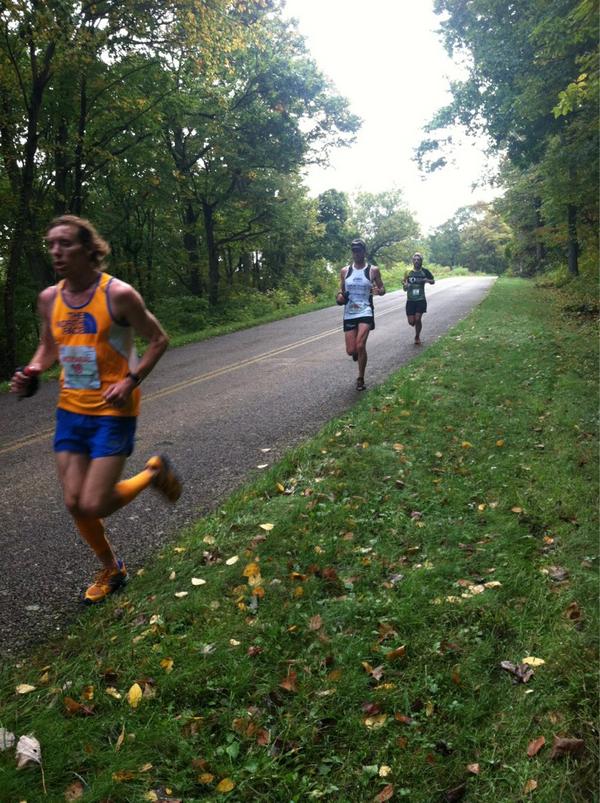 |
| Jordan, David and myself coming into the 20 mile aid. All photos: IRunFar Media. |
Finally, I got to the aid station for the four mile out and back section on the Dragon's Back trail. I had begun to settle in and I at least knew now that I would complete the race, if not set it on fire. I had come to terms with the fact that my only chance of getting into the top five would be by plugging along in my one gear in hopes that some of the guys in front of me blew up. The gaps were definitely still small enough and with 30 miles still left to run, anything was possible. I would need to catch three guys if I wanted to make the top five.
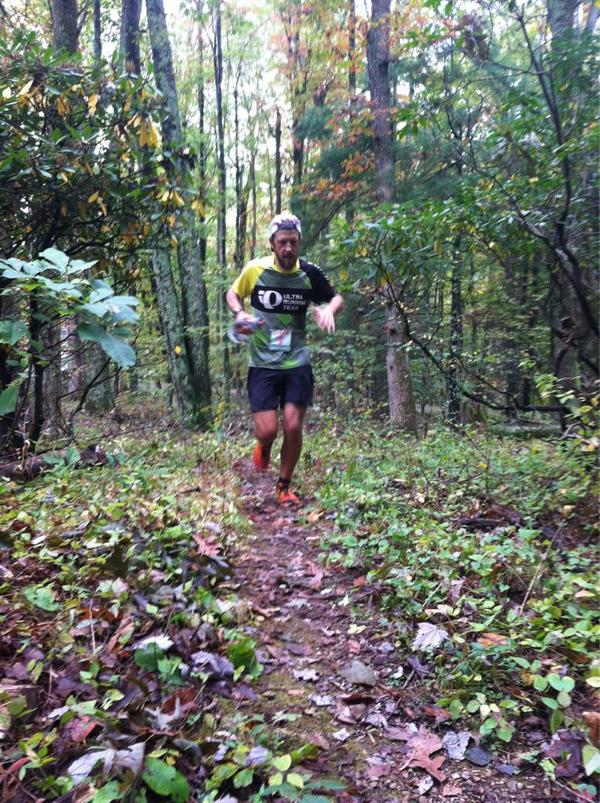 |
| Hitting Dragons Back outbound. |
Mercifully, the trail section was super runnable and passed by very quickly. My legs were sore, I was feeling sluggish, but my stomach was in fine fettle which meant I had great energy. I knew that if nothing else, I was at least going to run every step of the course. Now at mile 40, we were down to nothing more than a long training run - equivalent in terrain and relief to a lap of Horsetooth Reservoir back home.
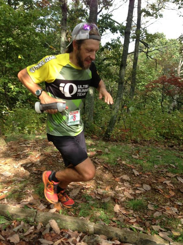 |
| Popping back out 8 miles later. |
And so it was. I plugged away, covered the miles, all the while getting repeated updates that Mackey was looking terrible just two minutes ahead. I think I caught sight of Dave once on the Parkway, but it wasn't until the last two-mile climb that I was finally able to lock on. As I caught up to Dave, I considered suggesting that we finish together, but he was moving too slow and I desperately wanted to be done.
It was a great feeling to cross the finish line, as that particular finish line marks the end of my ultrarunning season. Right now, I'm looking forward to chopping my training mileage significantly, bumping up the quality in preparation for some fun on the roads, while also tagging a whole bunch of really random and obscure peaks in Larimer County with family and friends.
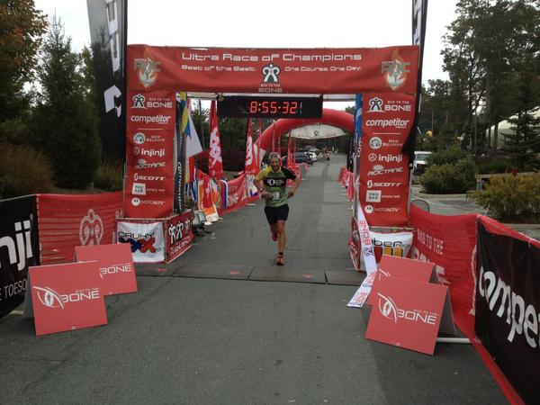 |
| Time for a break. |
It was great to have the opportunity to run out east. I know it is a frustration for many ultrarunners based east of the Rockies that their courses get less love than those in the west, so I tip my hat to Fran and Gil for organizing this event and promoting such a stunning location. They really put on a first-class event; from the course marking, to the aid stations and to all the other little details that go into putting on event like this. My guess is that with the new Colorado location and buy-in from the host towns (Frisco, Breck, Vail), the UROC concept will go from strength to strength in the coming years.
Tuesday, October 2, 2012
Fortnight Ending September 30
Week Ending September 23
Mon - 4 miles easy on the bike paths pushing Stella while Alistair was at X-C practice.
Tues - 7 miles track. Workout: 800 open, then 2 x broken mile (3x300 hard w/100 float, 400 hard), broken 1,200 (800, 100 float, 300), 400 jog between miles/1,200. A 2:36 warm-up 800, then miles were both 5:26, followed by 2:39, 56 for broken 1,200. One mile up, 2 mile down. Lazy again.
Weds - 4 miles easy on the bike paths pushing Stella while Alistair was at X-C practice.
Thurs - AM: 10 miles w/5 @ tempo (1,400'). Back to Centennial for the HTH5MO@B, this time with Eric, Mike and Slush. Five out easy in 44 mins, then 30:43 back (7:22, 6:11, 6:33, 5:40, 4:57). Three minutes or so faster than last week, after setting the effort early by pushing the north dam hill a little harder. Could have pushed middle miles a little better, but decided to keep this at a true tempo effort. Overall, the effort to pace ratio felt much better than last week, which was slow and slogworthy at what felt like too hard of an effort for the actual pace.
PM: 7.5 miles super easy with the FCTR crew at Pineridge.
Fri - Noon: 6.5 miles (1,700') easy. Horsetooth south summit via Slush's Slit.
Sat - AM: 11 miles (1,300') easy to Devil's Backbone from home via Bluesky Trail w/Slush. Stopped along the way to check out the high point of the Bone, which is ranked a 5.1 climb. The line I looked at on the south side of the rock, which seemed the most logical, was IMO significantly tougher than 5.1 - especially as a down climb. I will need to come back when I have more time to scope other options as I bailed at the committing crux, not liking at all like the looks of down climbing there.
PM: 4.5 miles peakbagging (1,100'). Picked up a couple of Larimer ranked peaks down by Carter Lake with a quick two-hour window. 6,227' on the southeast corner of Carter Lake was easy enough. Just followed the trail from the campground north, then cut west up the first gulley and headed in a northwesterly direction for the summit through sparse trees and scrub. A few houses/properties to work around, but easily done. The summit is basically a cliff band with four or five candidates for the high point. Tagged them all to make sure. 6,300' was more of a pain in the arse. The logical way to summit this prominent hogback would be via the steeper west slope, but there is zero cover and a bunch of properties, so I decided to come up the northeast ridge, which looked to have some good cover thanks to a rock band which I figured I'd follow. The scrub was pretty thick, but negotiable thanks to heavy game traffic. Encountered a property that I couldn't see from below when scoping the original line, which was avoidable by dropping a little lower on the ridge below the rock band, and then it was a straightforward hoof to the summit. Nice views of the lake from there. Coming back down, I ended up heading due east to avoid the one property, but ended up having to skirt an even bigger property and then bushwahck pretty heavily after getting barked at by a very large dog in order to get to a spot where I could cross the aqueduct and connect with roads to get back to my car. Every time I do one of these dodgy peaks, I find myself questioning my sanity, but hey, just 199 ranked Larimer County peaks left to get.
Sunday: 4.5 miles hiking (1,500'). Horsetooth summit with Alistair and Stella. I goaded Alistair into setting a time standard for Horsetooth (up and down). The goal was to go under an hour for the climb and under an hour again for the descent. Alistair stayed focused the whole way, just missing out on his ascent goal by two minutes. We took a 25 minute picnic break on the summit before descending in 54 minutes. Pretty sure Alistair could run the whole descent, but because I had Stella on my back he had to wait for me and my fast hike pace, plus we stopped to check out a rattlesnake for a few minutes and also play in other random spots along the way. Next time we'll do it solo to set a real standard. Alistair's seventh Horsetooth summit of the year. My 70th, I think.
Total: 59 miles (7,000')
Week Ending September 30
Mon - 4 miles jogging stroller on bike paths while Alistair was at X-C practice.
Tues - 6 miles track workout: 3x800, lap jog, 400, 1,600, 2x400 in: 2:37, 2:32, 2:35, :71, 5:14, :74, :70. Relay style, 2:30 static rest between 800s, then lap jog, 400, then 3:00 static rest, mile, lap jog, 70 rest between 400s. This was a promising workout given that I really want to start focusing on speed over quantity through the off season. The mile was about 5-10 seconds faster than I have been doing them this summer at the track, with just a bit more focus and effort - 4s and 8s were also a bit faster. This is the kind of effort I need to start putting in if I am going to improve road times this winter/spring. Can't wait.
Weds - 5 miles (1,500') easy with Al_Wesir to Horsetooth middle summit. Super easy jog to the base of the rock, waited around forever for Brian to make it up, and then we hit the middle rock chimney. Rocks were wet from the night before so we had to be a little cautious, but otherwise it was pretty straightforward getting up. Brian ended up giving me a leg down on the crux chockstone coming down as I was faffing around too much. Beautiful fall morning.
Thurs - Off
Fri - Off
Sat - 62 miles (11,000') race. UROC 100k.
Sun - Off
Total: 77 miles (12,500')
Well that'll just about do it for the season. I kind of felt like I was going through the motions a bit out in Virginia on Saturday, and definitely feel like I'm ready to take a break from destroying myself over uber-long distances. I'm now really looking forward to cutting my mileage, running some shorter distance trail and road races, bagging a whole bunch of obscure Larimer County peaks and engaging in the local off-season running festivities.
Local Running Festivities
First up is Slush's Runners Without Borders, which this year will feature MAGIC TOKENS. Yes, you read that right people, MAGIC TOKENS. All details will be posted over at his joint, with preliminary instructions here. Last year, the event was a ton of fun and raised over $4,000 for Doctors Without Borders. This year Scott says we're going to top both the fun factor and donation totals, so come on out SUNDAY, OCTOBER 28th (8:00 am - 4:00 pm) and join the fun, or go to Scott's website and register your support for the work of Doctors Without Borders with a donation, or - better yet - do both!

Second up is the third annual Chubby Cheeks fatass race ... er ... run. The date has been set for December 8 with starts at 7:00, 8:00 and 9:00. Route options are the same (32 miles with gobs of climbing, 25 miles with bags of climbing, 20 miles with a hill or two, whatever miles and climbing) as are all details really. Back to my place between 2:00 & 3:00 for beers, food and good times.
 Third up is the Tortoise and Hare handicapped race series, which begins with a 4k at Rolland Moore park next Sunday at 8:00 a.m. I'll be RD'ing the series again this year, so hope to see some of you out there. The T&H series is a super low key set of seven races with runners setting off at staggered starts according to handicaps based on previous races. Everyone has an equal chance of winning, regardless of ability, and we have cash prizes at the end of the series. Better yet, Fort Collins Running Club members run free and even get post-race bagel spreads at Rocky Mountain Bagel Works. You read that right, a $20 membership gets you seven free races, seven free breakfasts, and a chance to win up to $100. Better yet, if you plan on running the Horsetooth Half next spring, then your membership gets you a $20 discount. Best running deal in town right there.
 Fourth up is the Race That Will Not Be Mentioned, which takes place Thursday, Dec 6th at 6:00 p.m.

Fifth up is the second annual Quad Rock 25 & 50 mile races. We have set the date for May 11, 2013. The course was not impacted by the High Park fire so it will be the same great route for the same great price. We are in preliminary discussions with sponsors and vendors, but the event focus will be much the same as last year: great course, impeccable marking, great awards, great food, great music, and tons of fun for everyone. Registration will open in December.

That's all I got.
---------------------------------------------------------------------------
January: 330 miles (45,200')
February: 445 miles (58,500')
March: 501.5 (79,600')
April: 430 (66,800')
May: 387.5 (70,700')
June: 297.5 (48,500')
July: 369 (71,100')
August: 330.5 (67,100')
September: 344 (65,000')
Total: 3,435 miles (572,500')
Avg: 382 miles (63,611')
---------------------------------------------------------------------------
2012 Summits (149):
.......................................
Horsetooth (7,255') (67)
.......................................
Mount Elbert (14,443')
Longs Peak (2) (14,259')
Mount Belford (2) (14,197')
Mount Oxford (14,153')
Missouri Mountain (14,067')
Pacific Peak (13,950')
Emerald Peak (13,904')
Crystal Peak (13,852')
Atlantic Peak (13,841')
Iowa Peak (13,831')
Hagues Peak (2) (13,571')
Ypsilon Mountain (13,514')
Fairchild Mountain (13,502')
Mummy Mountain (13,425')
McHenrys Peak (13,327')
Pecks Peak (13,277')
Whitney Peak (13,271')
Powell Peak (13,208')
Taylor Peak (13,153')
Mount Chiquita (13,069')
West Mount Sheridan (12,952')
East Desolation Peak (12,949')
Julian (12,928')
West Desolation Peak (12,918')
Mount Ida (12,880')
Point 12,820' (Chorier Point)
Chief Cheley (12,804')
Cracktop (12,766')
Terra Tomah (12,718')
Hallet Peak (12,713')
Otis Peak (12,486')
Mount Chapin (12,454')
Flattop Mtn (12,324')
Marmot Point W(12,005')
Marmot Point E (11,909')
Twin Sisters (11,420')
Mount Baldy (11,068')
Estes Cone (11,006')
Hidden Peak (10,992') (2)
Lookout Mountain (10,626')
Storm Mountain (9,918')
Lily Mountain (9,786')
Crosier Mountain (9,250') (4)
Pilot Hill (8,829')
Mount Ethel (8,471')
8,415' (Leila Peak)
Triangle Mountain (8,415')
Buckhorn Mountain (8,341')
8,310'
Round Mountain (8,250') (4)
Palisade Mountain (8,225')
8,194' (Giant Boulder Point)
Alexander Mountain (8,144')
Spruce Mountain (7,781')
Sullivan Stump (7,778')
7,725'
7,567'
7,470'
Green Ridge (7,402')
Green Mountain (7,335')
7,260' (Ziggy Point)
7,178'
7,098' (Poll Mtn range)
Table Mountain (7,074')
Arthurs Rock (6,780') (5)
Milner Mountain (6,893')
6,300'
6,227'
5,773' or 'Aggie Peak'
5,740' (Hwy 34 B4 Narrows) (1)
5,740' (Off Masonville Rd) (2)
Reservoir Ridge (5,735')
Goat Hill (5,604')
Aitxuri (1,551 meters)
Aizkorri (1,528 meters)
Aratz (1,443 meters)
----------------------------------------------------------------------------
Mon - 4 miles easy on the bike paths pushing Stella while Alistair was at X-C practice.
Tues - 7 miles track. Workout: 800 open, then 2 x broken mile (3x300 hard w/100 float, 400 hard), broken 1,200 (800, 100 float, 300), 400 jog between miles/1,200. A 2:36 warm-up 800, then miles were both 5:26, followed by 2:39, 56 for broken 1,200. One mile up, 2 mile down. Lazy again.
Weds - 4 miles easy on the bike paths pushing Stella while Alistair was at X-C practice.
Thurs - AM: 10 miles w/5 @ tempo (1,400'). Back to Centennial for the HTH5MO@B, this time with Eric, Mike and Slush. Five out easy in 44 mins, then 30:43 back (7:22, 6:11, 6:33, 5:40, 4:57). Three minutes or so faster than last week, after setting the effort early by pushing the north dam hill a little harder. Could have pushed middle miles a little better, but decided to keep this at a true tempo effort. Overall, the effort to pace ratio felt much better than last week, which was slow and slogworthy at what felt like too hard of an effort for the actual pace.
PM: 7.5 miles super easy with the FCTR crew at Pineridge.
Fri - Noon: 6.5 miles (1,700') easy. Horsetooth south summit via Slush's Slit.
Sat - AM: 11 miles (1,300') easy to Devil's Backbone from home via Bluesky Trail w/Slush. Stopped along the way to check out the high point of the Bone, which is ranked a 5.1 climb. The line I looked at on the south side of the rock, which seemed the most logical, was IMO significantly tougher than 5.1 - especially as a down climb. I will need to come back when I have more time to scope other options as I bailed at the committing crux, not liking at all like the looks of down climbing there.
PM: 4.5 miles peakbagging (1,100'). Picked up a couple of Larimer ranked peaks down by Carter Lake with a quick two-hour window. 6,227' on the southeast corner of Carter Lake was easy enough. Just followed the trail from the campground north, then cut west up the first gulley and headed in a northwesterly direction for the summit through sparse trees and scrub. A few houses/properties to work around, but easily done. The summit is basically a cliff band with four or five candidates for the high point. Tagged them all to make sure. 6,300' was more of a pain in the arse. The logical way to summit this prominent hogback would be via the steeper west slope, but there is zero cover and a bunch of properties, so I decided to come up the northeast ridge, which looked to have some good cover thanks to a rock band which I figured I'd follow. The scrub was pretty thick, but negotiable thanks to heavy game traffic. Encountered a property that I couldn't see from below when scoping the original line, which was avoidable by dropping a little lower on the ridge below the rock band, and then it was a straightforward hoof to the summit. Nice views of the lake from there. Coming back down, I ended up heading due east to avoid the one property, but ended up having to skirt an even bigger property and then bushwahck pretty heavily after getting barked at by a very large dog in order to get to a spot where I could cross the aqueduct and connect with roads to get back to my car. Every time I do one of these dodgy peaks, I find myself questioning my sanity, but hey, just 199 ranked Larimer County peaks left to get.
Sunday: 4.5 miles hiking (1,500'). Horsetooth summit with Alistair and Stella. I goaded Alistair into setting a time standard for Horsetooth (up and down). The goal was to go under an hour for the climb and under an hour again for the descent. Alistair stayed focused the whole way, just missing out on his ascent goal by two minutes. We took a 25 minute picnic break on the summit before descending in 54 minutes. Pretty sure Alistair could run the whole descent, but because I had Stella on my back he had to wait for me and my fast hike pace, plus we stopped to check out a rattlesnake for a few minutes and also play in other random spots along the way. Next time we'll do it solo to set a real standard. Alistair's seventh Horsetooth summit of the year. My 70th, I think.
Check out the rattler halfway through the vid.
Total: 59 miles (7,000')
Week Ending September 30
Mon - 4 miles jogging stroller on bike paths while Alistair was at X-C practice.
Tues - 6 miles track workout: 3x800, lap jog, 400, 1,600, 2x400 in: 2:37, 2:32, 2:35, :71, 5:14, :74, :70. Relay style, 2:30 static rest between 800s, then lap jog, 400, then 3:00 static rest, mile, lap jog, 70 rest between 400s. This was a promising workout given that I really want to start focusing on speed over quantity through the off season. The mile was about 5-10 seconds faster than I have been doing them this summer at the track, with just a bit more focus and effort - 4s and 8s were also a bit faster. This is the kind of effort I need to start putting in if I am going to improve road times this winter/spring. Can't wait.
Weds - 5 miles (1,500') easy with Al_Wesir to Horsetooth middle summit. Super easy jog to the base of the rock, waited around forever for Brian to make it up, and then we hit the middle rock chimney. Rocks were wet from the night before so we had to be a little cautious, but otherwise it was pretty straightforward getting up. Brian ended up giving me a leg down on the crux chockstone coming down as I was faffing around too much. Beautiful fall morning.
Thurs - Off
Fri - Off
Sat - 62 miles (11,000') race. UROC 100k.
Sun - Off
Total: 77 miles (12,500')
Well that'll just about do it for the season. I kind of felt like I was going through the motions a bit out in Virginia on Saturday, and definitely feel like I'm ready to take a break from destroying myself over uber-long distances. I'm now really looking forward to cutting my mileage, running some shorter distance trail and road races, bagging a whole bunch of obscure Larimer County peaks and engaging in the local off-season running festivities.
Local Running Festivities
First up is Slush's Runners Without Borders, which this year will feature MAGIC TOKENS. Yes, you read that right people, MAGIC TOKENS. All details will be posted over at his joint, with preliminary instructions here. Last year, the event was a ton of fun and raised over $4,000 for Doctors Without Borders. This year Scott says we're going to top both the fun factor and donation totals, so come on out SUNDAY, OCTOBER 28th (8:00 am - 4:00 pm) and join the fun, or go to Scott's website and register your support for the work of Doctors Without Borders with a donation, or - better yet - do both!
Second up is the third annual Chubby Cheeks fatass race ... er ... run. The date has been set for December 8 with starts at 7:00, 8:00 and 9:00. Route options are the same (32 miles with gobs of climbing, 25 miles with bags of climbing, 20 miles with a hill or two, whatever miles and climbing) as are all details really. Back to my place between 2:00 & 3:00 for beers, food and good times.
Fifth up is the second annual Quad Rock 25 & 50 mile races. We have set the date for May 11, 2013. The course was not impacted by the High Park fire so it will be the same great route for the same great price. We are in preliminary discussions with sponsors and vendors, but the event focus will be much the same as last year: great course, impeccable marking, great awards, great food, great music, and tons of fun for everyone. Registration will open in December.
That's all I got.
---------------------------------------------------------------------------
January: 330 miles (45,200')
February: 445 miles (58,500')
March: 501.5 (79,600')
April: 430 (66,800')
May: 387.5 (70,700')
June: 297.5 (48,500')
July: 369 (71,100')
August: 330.5 (67,100')
September: 344 (65,000')
Total: 3,435 miles (572,500')
Avg: 382 miles (63,611')
---------------------------------------------------------------------------
2012 Summits (149):
.......................................
Horsetooth (7,255') (67)
.......................................
Mount Elbert (14,443')
Longs Peak (2) (14,259')
Mount Belford (2) (14,197')
Mount Oxford (14,153')
Missouri Mountain (14,067')
Pacific Peak (13,950')
Emerald Peak (13,904')
Crystal Peak (13,852')
Atlantic Peak (13,841')
Iowa Peak (13,831')
Hagues Peak (2) (13,571')
Ypsilon Mountain (13,514')
Fairchild Mountain (13,502')
Mummy Mountain (13,425')
McHenrys Peak (13,327')
Pecks Peak (13,277')
Whitney Peak (13,271')
Powell Peak (13,208')
Taylor Peak (13,153')
Mount Chiquita (13,069')
West Mount Sheridan (12,952')
East Desolation Peak (12,949')
Julian (12,928')
West Desolation Peak (12,918')
Mount Ida (12,880')
Point 12,820' (Chorier Point)
Chief Cheley (12,804')
Cracktop (12,766')
Terra Tomah (12,718')
Hallet Peak (12,713')
Otis Peak (12,486')
Mount Chapin (12,454')
Flattop Mtn (12,324')
Marmot Point W(12,005')
Marmot Point E (11,909')
Twin Sisters (11,420')
Mount Baldy (11,068')
Estes Cone (11,006')
Hidden Peak (10,992') (2)
Lookout Mountain (10,626')
Storm Mountain (9,918')
Lily Mountain (9,786')
Crosier Mountain (9,250') (4)
Pilot Hill (8,829')
Mount Ethel (8,471')
8,415' (Leila Peak)
Triangle Mountain (8,415')
Buckhorn Mountain (8,341')
8,310'
Round Mountain (8,250') (4)
Palisade Mountain (8,225')
8,194' (Giant Boulder Point)
Alexander Mountain (8,144')
Spruce Mountain (7,781')
Sullivan Stump (7,778')
7,725'
7,567'
7,470'
Green Ridge (7,402')
Green Mountain (7,335')
7,260' (Ziggy Point)
7,178'
7,098' (Poll Mtn range)
Table Mountain (7,074')
Arthurs Rock (6,780') (5)
Milner Mountain (6,893')
6,300'
6,227'
5,773' or 'Aggie Peak'
5,740' (Hwy 34 B4 Narrows) (1)
5,740' (Off Masonville Rd) (2)
Reservoir Ridge (5,735')
Goat Hill (5,604')
Aitxuri (1,551 meters)
Aizkorri (1,528 meters)
Aratz (1,443 meters)
----------------------------------------------------------------------------
Subscribe to:
Posts (Atom)


.png)

