Mon - Off
Tues - 5 miles (1,500') easy. Horsetooth north summit. Starting to feel some flow come back.
Weds - 5 miles (1,500') easy. Horsetooth north summit. Just a very casual jog, with just a touch of turnover coming back down.
Thurs - 5 miles (1,500') easy. Horsetooth north summit (109) for the Thursday morning sunrise: Mike, Scott, Celeste and Ziggy.
Fri - Off
Saturday - AM: 12 miles, with 10.5 mile Silent Trails race. Personal worst after four years of doing this race, but had a great time nonetheless.
PM: 5 miles (1,800') peakbaggery. Grabbed some peaks with Mike and neighbor Josh on the way back from Wyoming. Had four in the northeast corner of Larimer County planned, but had to bail on the last one due to a lack of time.
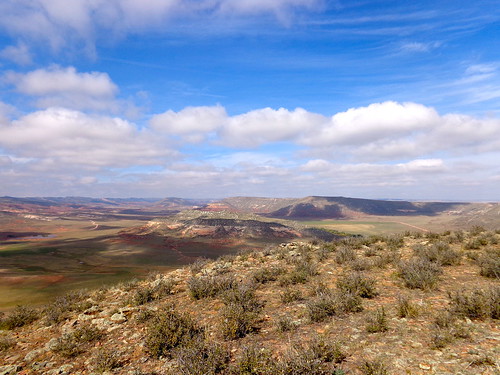 |
| The mesa-like foothills of northern Colorado. All pics: Hinterberg. |
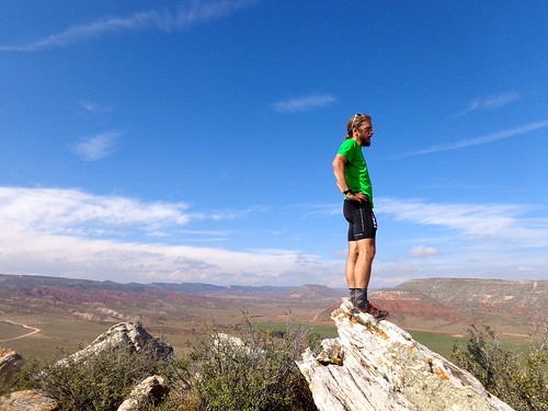 |
| Surveying from top Bobcat Mtn. |
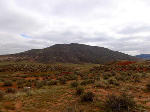 |
| Campbell Mtn from the car. |
Hopped back in the car and then drove around Park Creek Reservoir to the south, north on CR 19, left on CR21. Parked up directly to the east of 6,380' (which we dubbed the 'Triple Nipple' due to three very prominent cairn stacks) on CR 21, ran quickly across an open meadow (dropping to the ground as a couple of trucks went by), crossed a creek then humped up the southeast ridge following an old use road to near the top. Commanding views of the reservoir and surrounding peaks from the top. Definitely a worthy peak. Back the way we came. Up and down in 35 mins.
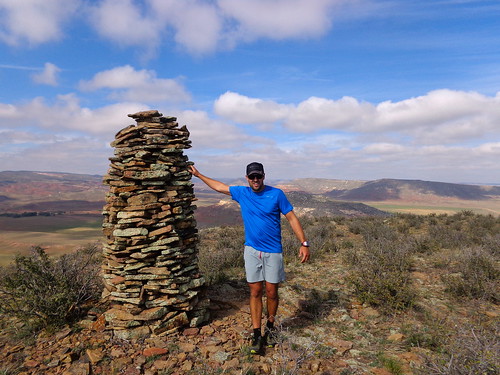 |
Josh manhandling the summit nip. |
 |
| Crossing the creek on the way back from the 'Triple Nipple' (6,380' - background) |
Sunday - 2 miles setting up the Rolland Moore 4k T&H course.
Total: 34 miles (6,300')
--------------------------------
Week Ending October 20
Mon - Off
Tues - 5 miles (1,500') easy. Horsetooth north summit
Weds - 5 miles (1,500') easy. Horsetooth north summit.
Thurs - 5 miles (1,500') easy. Horsetooth north summit. Too early for the sunrise today, but always good to be on a summit early with friends: Lee, Mike, Celeste, Mary B, Marie, Ziggy.
PM: 7 miles (1,700') hill tempo. Mustered just enough energy and motivation for an evening run up Towers. Started at an easy effort and then ratcheted a bit on the second half. Worked harder than I would have liked for a 33.5 min summit, but that's just the state of play right now with my fitness.
Fri - Off
Sat - 2 miles (500') hiking/baggery. Dana was out of town for the weekend, so the kids got to go hiking with their Old Man. Had three peaks lined up for this morning, but a bridge was out by the Poudre water filtration plant for the intended route up 6,823', so we moved onto the next. Bonner Peak is a prominent bump in the northern foothills and has commanding views of Grey Rock among other nearby peaks from the top. Bonner Springs Rd is signed as private, but it gives access to public lands. Not quite sure what the status of Bonner Peak itself is, but we didn't have to jump any fences or pretend not to see any posted signs. From our little pull-off, there was a trail essentially all the way to the rocky summit. Super easy to get and a great little peak. Back in the car down Bonner Springs Rd to Grey Rock Rd. Took that left until we were just northeast of 6,622'. Parked up and then scampered across a meadow to a barbed fence. Alistair point blank refused to go over the fence ... and our day was done. One out of three ain't bad with a 2.75 year old and 7 year old in tow.
Sun - 2 miles (600') hiking/baggery. I had heard that Stove Prairie Rd had re-opened, so we headed out that way to try and get 7,515', which lies just north of the impressive and dominating Ethel Mountain and Stove Prairie Landing. I was wrong on Stove Prairie Rd, which has a huge washout that hasn't yet been repaired just south of the Buckhorn Narrows. Turned around and drove the long drive out to Rist Canyon to try our luck there. Rist Canyon Rd is in decent shape and passable all the way up to Stove Prairie Landing. Headed north from there to the benchmark before the drop into the Poudre (road is closed soon thereafter, BTW). Hoofed through High Park burn terrain and got the summit with relative ease, just as big flakes started coming down. Alistair wanted nothing to do with 7,697', so we called it good after admiring Ethel Mountain for a while. Mike and I got Ethel two winters ago by traveling through fairly dense forest. Unfortunately that was all consumed in the High Park Fire, but somehow the rocky pinnacle looks even more impressive now that it is fully exposed. Lots of mitigation work has been done up here with acres of mulch laid down.
Total: 26 miles (7,300')
Just trundling along here. Really not at all ready to get back into anything remotely structured at this point. I feel like I still need down time to recover from the summer (and indeed the past four years), so that'll be the agenda for at least the next few weeks.


.png)


Thanks for sharing your post. Hiking and Mountain Climbing is very adventurous. You will see your capability and stamina. Many Travellers love this kind of activity but there are risk and sometimes it is dangerous so a full time mountain climber have their own best travel insurance for unexpected scenario.
ReplyDeleteMany thanks! This post seems to have done the trick!
ReplyDelete