 |
| 5,740' between Masonville Road and Eden Valley. |
 |
| View from first 5,740' of Eden Reservoir, Horsetooth, Milner and first line of hogbacks in front of second 5,740'. |
 |
| Class three weakness in first cliff band. |
 |
| Hogback to north of 5,740'. Cairn is obscuring the flagstone quarry works. |
PM: 3 mile hike (600') with the family. Falls loop.
Tuesday - AM: 10 miles intervals. With Jane's group at City Park. Had Chris and Mike to work with again for this one. Felt like we might have taken our foot off the gas a bit in places, but still a good workout on what was a good morning for running. Workout went: mile, 4 x 300 hard (cross country) w/200 medium, fartlek mile (3 x hard, 2 x medium), 1,200 hard, fartlek 1,000 (2 x hard, 1 x medium). Splits: 5:29 (1.04 mile), didn't time the cross country 300's, 5:19 (.98), 3:49 (5:07 pace), 3:15 (5:13)
PM: 7.5 miles (1,300') easy. Milner loop plus neighborhood add-ons.
Weds - Noon: 6.5 miles (1,100') easy. Milner long with neighborhood add-on. Warm and super breezy out. Nice and casual.
PM: 5 miles (1,000') easy. Falls long. Temps in the high 50s and strong winds left a lot of slush and slop on the trails. Major melt today. Running was pretty crap as a result.
Thurs - AM: 11.5 miles (1,400') sketch. Met Celeste, Slush, Tim and Colin for 10 on the Centennial hills. Less than a mile in and it was apparent that this one would be about survival; all thoughts of the usual tempo effort back from the turnaround were dumped. A wet overnight powdering had left a nasty sheet of ice on the road. Skid tracks and busted up fender parts suggested that more than a couple of cars had plowed into the crash barriers on some of the tighter turns and hills. Tim gave up less than a mile in, which was probably a pretty sound decision, but the rest of us persevered. The road doesn't see a whole lot of traffic in the early morning, but for every car that went by I was stopped and either on the other side of the crash barriers or way off the road. Traction was terrible in places, but I was thankful to be running versus trying to maintain control of 5,000 pounds of steel. Back in just under 40 mins for a personal worst, but thankful to be done and in one piece.
PM: 9 miles (1,900') Towers. A mix of drifts, ice and generally crappy footing made this trip up Towers one of my less enjoyable ones, but by no means the worst. Up in 39 and change. Two mile warm up on Shoreline.
Fri - Noon: 9.5 miles (1,500') easy. Milner loop, plus Redstone one mile O@B and neighborhood add-ons.
PM: 5 miles (1,000') easy. Falls long.
Sat - AM: 22 miles easy (1,400'). Twin Mountain Trudge was postponed as the start area was inaccessible due to heavily drifted snow. This left me with two options: run solo around home or go join friends at sunrise for a Double Bacon Strip (Slush, Sarah, Al_Wesir, Kyle and Alex). Neither sounded that appealing to be honest, as I was ready to go trudge, but I opted for company even if the location left a little to be desired. The Bacon Strip is a ten-mile route east of I-25 (the plains for those not from the Front Range) on rolling dirt county roads. The Double Bacon is a Fort Collins staple among marathon runners, but not something I have ever partaken of before. I've done the Single Bacon a couple of times under race conditions; however, the double as a training run has always sounded miserable. Fortunately good company kept the clock ticking in real time and it turned out to be a fun morning under bluebird conditions. Aside from great mountain views, we were also treated to sightings of a bald eagle and a red tail hawk. Jogged the first lap and a half and then picked it up and ran mid sixes to high fives for the last five miles with Scott. Jogged a couple more at the end for good measure.
Sun - AM: ~ 9 miles sloggin' and peakbaggin' (3,000'). This one was intended as a 22 mile, 5-bag outing but the reality on the ground turned it into a 9-mile, 4-bag frozen slog-fest.
Mike and I started at the crack of dawn heading east up Rist Canyon Road from Stove Prairie Landing to the saddle between Buckhorn Mountain and unnamed peak 8,415'. For the summit, we took CO 41, followed by a short bushwhack to the top. As would be the case for the rest of the morning, the PBWF (Postholing Bushwhack Factor) was high, meaning very, very slow going. After hitting a wrong outcropping to the north of the true summit, it was a quick bop down to the small saddle and back up to the true Buckhorn Mountain summit, which was satisfyingly craggy with nice views to the west out towards the Old Flowers Road area of Roosevelt NF.
 |
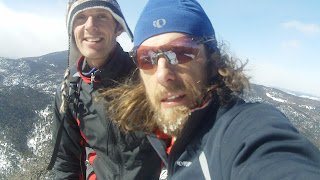
| Mike on Buckhorn summit. |
 |
| Unnamed Peak 9,166' (we guessed) to the west from top Buckhorn. That one was on the original agenda for the morning, but quickly dispatched after the slogging started in earnest. |
 |
Gaining 8,415'. |
 |
| Mike, Nick & a big stick. |
 | ||
Mount Ethel (8,471') left, sub summit (8,430') right from top 8,415' (Leila).
|
 |
| Almost out of the woods and into the valley between 8,415' (in background) and Ethel. Mike sloggin'. |
 |
| Mike finally gaining the true Mount Ethel summit. |
 |
| Ready to get off the mountain. |
 |
| Lower Poudre Canyon from top Ethel. |
Total: 101.5 miles (15,600')
Didn't get a second long run in on Sunday, but I was sufficiently worked after the 4.5 hour slog-fest that it certainly felt like I got a good B2B weekend done. Thinking I'll try and push out another strong mileage week before taking the foot off the gas a bit in the week before the Salida Marathon, which I'll be running for the fourth time this year. Salida is always a great pre-season read on fitness, in addition to a fun all-around weekend. I think Brownie is getting a 45 minute handicap this year.
In the weekly Quad Rock update, we are now sold out, but if you get your name on the wait list there is still a strong chance you'll get in. In other news, Pete and I are super stoked to be bringing on board local craft brewers Pateros Creek as sponsors. Our hosts, Lory State Park, allow only 3.2 beer, so Pateros is complying by brewing us up something a little lighter than their normal fare. It was either that or Nattie Lite, so I think we're coming out ahead on this one.


.png)


I thought you gave me 60 minutes this year?
ReplyDeleteWhy you running the course four times in two weeks? Don't be stingy with details on course conditions! Hopefully you can finally get a W down there this year.