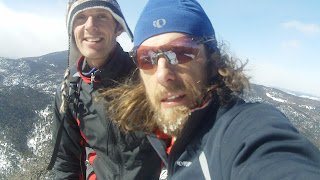
Sunday, February 26, 2012

Week Ending February 26

Mon - AM: 3. 5 miles (1,400') peakbaggery. Went back and did the ranked peak 5,740' by Eden Reservoir that I messed up the day before, after also knocking off one down the road north of Hwy 34 that also tops out at 5,740'. Drove between the two as I was short on time.

5,740' between Masonville Road and Eden Valley.
For the first one, I parked on the north side of Hwy 34 just west of the bikers' tourist store a mile or two before the Big Thompson Narrows in a small pull-off. Cut a line due north straight up the hillside, before cutting northwest around a cliff band and then due east to the summit on a nice ledgy section of the capstone. A quick tag, a look at the views and then hot-footed it down. Up and down in about 20 minutes. Jumped in the car and drove around to County Road 29, parked up near the bridge by the water filtration plant then ran the half mile to the south side of the reservoir. Decided to cut straight up the steep first hillside as I thought I saw a weakness in the cliff band that looked like it would be reasonably easy to negotiate, which it was.

View from first 5,740' of Eden Reservoir, Horsetooth, Milner and first line of hogbacks in front of second 5,740'.
Class three weakness in first cliff band.
Went up the hogback to the north of my target by mistake (went up the one to the south the day before), but quickly turned around when I breached the summit ridge and saw the quarry was in full swing. Ooops. I quickly rectified my error, headed for the small saddle, then stomped up through the snow to finally get 5,740' off my back (third time's a charm).

Hogback to north of 5,740'. Cairn is obscuring the flagstone quarry works.
Came down the west side, back down through the weakness in the cliff band above Eden Valley and back to the car. Just four ranked Larimer County 5'ers left to pick off and three of those are around Horsetooth Reservoir with the other one in Laporte, so I should have them in short order.  
PM: 3 mile hike (600') with the family. Falls loop.

Tuesday - AM: 10 miles intervals. With Jane's group at City Park. Had Chris and Mike to work with again for this one. Felt like we might have taken our foot off the gas a bit in places, but still a good workout on what was a good morning for running. Workout went: mile, 4 x 300 hard (cross country) w/200 medium, fartlek mile (3 x hard, 2 x medium), 1,200 hard, fartlek 1,000 (2 x hard, 1 x medium). Splits: 5:29 (1.04 mile), didn't time the cross country 300's, 5:19 (.98), 3:49 (5:07 pace), 3:15 (5:13)
PM: 7.5 miles (1,300') easy. Milner loop plus neighborhood add-ons.

Weds - Noon: 6.5 miles (1,100') easy. Milner long with neighborhood add-on. Warm and super breezy out. Nice and casual. 
PM: 5 miles (1,000') easy. Falls long. Temps in the high 50s and strong winds left a lot of slush and slop on the trails. Major melt today. Running was pretty crap as a result.

Thurs - AM: 11.5 miles (1,400') sketch. Met Celeste, Slush, Tim and Colin for 10 on the Centennial hills. Less than a mile in and it was apparent that this one would be about survival; all thoughts of the usual tempo effort back from the turnaround were dumped. A wet overnight powdering had left a nasty sheet of ice on the road. Skid tracks and busted up fender parts suggested that more than a couple of cars had plowed into the crash barriers on some of the tighter turns and hills. Tim gave up less than a mile in, which was probably a pretty sound decision, but the rest of us persevered. The road doesn't see a whole lot of traffic in the early morning, but for every car that went by I was stopped and either on the other side of the crash barriers or way off the road. Traction was terrible in places, but I was thankful to be running versus trying to maintain control of 5,000 pounds of steel. Back in just under 40 mins for a personal worst, but thankful to be done and in one piece.
PM: 9 miles (1,900') Towers. A mix of drifts, ice and generally crappy footing made this trip up Towers one of my less enjoyable ones, but by no means the worst. Up in 39 and change. Two mile warm up on Shoreline.

Fri - Noon: 9.5 miles (1,500') easy. Milner loop, plus Redstone one mile O@B and neighborhood add-ons.
PM: 5 miles (1,000') easy. Falls long.

Sat - AM: 22 miles easy (1,400'). Twin Mountain Trudge was postponed as the start area was inaccessible due to heavily drifted snow. This left me with two options: run solo around home or go join friends at sunrise for a Double Bacon Strip (Slush, Sarah, Al_Wesir, Kyle and Alex). Neither sounded that appealing to be honest, as I was ready to go trudge, but I opted for company even if the location left a little to be desired. The Bacon Strip is a ten-mile route east of I-25 (the plains for those not from the Front Range) on rolling dirt county roads. The Double Bacon is a Fort Collins staple among marathon runners, but not something I have ever partaken of before. I've done the Single Bacon a couple of times under race conditions; however, the double as a training run has always sounded miserable. Fortunately good company kept the clock ticking in real time and it turned out to be a fun morning under bluebird conditions. Aside from great mountain views, we were also treated to sightings of a bald eagle and a red tail hawk. Jogged the first lap and a half and then picked it up and ran mid sixes to high fives for the last five miles with Scott. Jogged a couple more at the end for good measure.

Sun - AM: ~ 9 miles sloggin' and peakbaggin' (3,000'). This one was intended as a 22 mile, 5-bag outing but the reality on the ground turned it into a 9-mile, 4-bag frozen slog-fest.

Mike and I started at the crack of dawn heading east up Rist Canyon Road from Stove Prairie Landing to the saddle between Buckhorn Mountain and unnamed peak 8,415'. For the summit, we took CO 41, followed by a short bushwhack to the top. As would be the case for the rest of the morning, the PBWF (Postholing Bushwhack Factor) was high, meaning very, very slow going. After hitting a wrong outcropping to the north of the true summit, it was a quick bop down to the small saddle and back up to the true Buckhorn Mountain summit, which was satisfyingly craggy with nice views to the west out towards the Old Flowers Road area of Roosevelt NF.

Mike on Buckhorn summit.
Unnamed Peak 9,166' (we guessed) to the west from top Buckhorn. That one was on the original agenda for the morning, but quickly dispatched after the slogging started in earnest.
We were quickly back down to Rist and then popped over the road to follow the fire road north for a half mile or so past a few cabins, before cutting northeast over a gully and then up towards the best peak of the morning (8,415'), which Mike is naming Leila (sister of Ethel, his grandmother (?)). The south-facing aspect of the slope left decent sections of rock for us to move over, and we were up in reasonably short order. Big views north and east out to the Poudre Canyon area (nice shot of Greyrock) and also to the west from the rocky summit, which sported a big stick of a marker.
 
Gaining 8,415'.
Mike, Nick & a big stick.
Mount Ethel (8,471') left, sub summit (8,430') right from top 8,415' (Leila).
8,415' descent.
Fom here things became slogworthy in the extreme. We chose the direct northerly route down a class-4 rockfall to get off the summit, while being whipped by the wind and generally freezing all extremities. I could see the sun on the Ethel side of the valley and desperately wanted to be over there, but first there was a long and super-cold session of postholing over rocks, deadfall and other unseen nastiness once we were off the boulders and moving through the trees. I don't think we went much deeper than crotch level all morning, but we were consistently up to our knees in snow.

Almost out of the woods and into the valley between 8,415' (in background) and Ethel. Mike sloggin'.
We finally got into the sun on the southern slope of Mount Ethel and then proceeded to head up the Ethel sub-summit to the right by mistake. From the top in the howling wind, Ethel's true summit looked frustratingly far away across the saddle and I was almost ready to throw in the towel, but we forged on - swimming through snow in places - before finally gaining the wind-blown summit.

Mike finally gaining the true Mount Ethel summit.
Ready to get off the mountain.
Lower Poudre Canyon from top Ethel.
We chose a poor descent route down the big drainage on the western slope of Ethel, which was covered in deadfall under the snow. The 1,400 foot descent was not a quick one, but to our surprise eventually popped us out on Stove Prairie Road, leaving a short mile and a bit back to the car, a good four and half hours after we started; a crankin' 30 minute per mile average.         


Total: 101.5 miles (15,600')

Didn't get a second long run in on Sunday, but I was sufficiently worked after the 4.5 hour slog-fest that it certainly felt like I got a good B2B weekend done. Thinking I'll try and push out another strong mileage week before taking the foot off the gas a bit in the week before the Salida Marathon, which I'll be running for the fourth time this year. Salida is always a great pre-season read on fitness, in addition to a fun all-around weekend. I think Brownie is getting a 45 minute handicap this year.

In the weekly Quad Rock update, we are now sold out, but if you get your name on the wait list there is still a strong chance you'll get in. In other news, Pete and I are super stoked to be bringing on board local craft brewers Pateros Creek as sponsors. Our hosts, Lory State Park, allow only 3.2 beer, so Pateros is complying by brewing us up something a little lighter than their normal fare. It was either that or Nattie Lite, so I think we're coming out ahead on this one.

Sunday, February 19, 2012

Week Ending February 19

Mon - 7 miles (1,900') easy. Horsetooth summit, home long. Got up at the end of the day and the trench wasn't the best, being a bit soft and punchy near the bottom after a warmer day. Upper half was still solid. Took things easy.

Tues - AM: 10.5 miles intervals. Met Jane's group on the first decent Tuesday morning we've had in a while. Temps were in the high 20s and the City Park roads were largely clear of ice. 3.5 mile w-u. 1.5 mile c-d. On tap: mile, 1.5 lamp post fartlek, broken 2 mile (800 medium, 800 hard, repeat), mile. Mike H turned up this morning and pulled me and Chris around the first mile harder than we probably would have otherwise. Splits: 5:16, 8:16, 12:20 (with hard 800s at 2:40 & 2:32, and medium 800s at cop-out pace), 5:15.
PM: 11.5 miles (1,400') easy. Milner loop, plus out & back to 2 mile on Redstone, bench loop at Horsetooth and home long. Took this one nice and easy.

Weds - 11.5 miles (2,600') easy. Milner loop with summit of Horsetooth on the way back. Conditions in the trench are still pretty good for spiked traction, but look like they're about ready to break up with a couple of warmer days in the forecast.

Thurs - AM: 12 miles (1,400') hill tempo. Met up with Celeste, Ziggy, Tim H, and Mike at Maxwell at the appointed HTH5MO&B hour (0 dark & cold 30) and then got sucked into a conversation (and pace) with Tim heading up Spring Creek dam, which meant a slightly faster outbound leg than the usual jog fest (38:24). At the turnaround, I figured I'd notch the effort a bit but generally keep things sane; however, there's no accounting for male ego and Mike sitting on my shoulder the whole way back. Maintained a controlled effort up the north dam hill despite firey, tired quads, before settling into a tempo effort that inevitably started getting out of hand as the run progressed, and ended with a 4:45  last mile shootout with Mike (downhill). Not a return-leg PR (30:31 vs 30:20), but I think an overall PR (68:55) given the faster-than-usual outbound leg. Coming back: 7:24, 6:23, 6:13, 5:43, 4:45 (30:31). Mile w-u/c-d. 
PM: 7 miles easy on the Spring Creek trail with a small group from FCTR.

Fri - Noon: 6.5 miles (1,000') easy. Milner long.
PM: 5 miles (1,000') easy. Falls long.

Sat - AM: 21 miles (4,000) peakbaggery. Scott and I picked off Larimer County's two lowest ranked peaks as a warm up for lower Rist Canyon's peak 7,260' (aka 'Ziggy Point'), Larimer County's 217th highest ranked peak.

Reservoir Ridge is a very familiar rocky outcropping for anyone in Fort Collins who spends any kind of time out by the northern end of the reservoir. Scott and I run to the base of it most Thursday mornings as the turnaround point of our hill tempo efforts, but oddly enough neither of us had ever taken down the summit. That was remedied 11 minutes after we set off on our merry way from the Reservoir Ridge trailhead at the crack of dawn. So yeah, not a tough peak.

After backtracking, we headed north to Bellevue to take down Goat Hill, which despite being the lowest ranked peak in Larimer County is in fact a most impressive mound. It's a classic Northern Colorado hogback with a very impressive red rock cliff band along its upper west side. We approached from the east, off County Road 23E, and were able to summit without having to hop any fences or gates, or indeed pretend not to see signage. I'm not sure who owns the land, but was glad  to be able to summit hassle free. The way up was scrubby and rocky, but mostly runnable.
'Reservoir Ridge' (5,735') post-run.
Goat Hill (5,603') in October 2009. Larimer County's lowest ranked peak. Image: Dean McCollum (Lists of John)
A quick descent and then it was five miles up Rist Canyon to Pine something Road, which we ascended at a very sharp grade for the first three-quarters of a mile before it mellowed out a bit. Despite being a private road, we had an arrow of an excuse in our quiver if stopped. And about a mile in, Scott pulled out the arrow and fired after we were confronted by a burly-looking mountain man asking us what we were up to and who we were on our way to see.

"Why, Dave Thurlow at the end of the road," Scott said in a matter-of-fact manner.

Scott had apparently been up this road a decade ago to visit his friend's cabin, which at the time was just being framed. He hadn't seen him in years, but used him as our alibi anyway. It was good enough for the now less-zealous mountain man and we were soon on our way, but not before being warned to watch out for a pack of dogs a mile up the road.

The dogs chased us for about a quarter mile, but soon tired of the hunt after we started trudging through deep and crusty pow. We got a view from an outcropping at 7,000 feet and it was clear that our peak was a good ways up the ridge and around a deep gully. We quickly took stock and decided to push on and get it done, despite the apparent mile and a half of trudging and bushwhacking that would be required. On the way, we discussed possible names for our unnamed peak and quickly settled on 'Ziggy Point' after Ziggy the Wunderdog who was at home suffering from what Scott and Celeste believe is autoimmune disease. Hopefully that won't keep him from ascending his namesake mountain some time here in the near future, though.

Ziggy Peak (7,260') is the second forested peak from the right in bottom photo & second one from left in top pic.
The summit slog was ... well ... a slog: steep and slippery but thankfully short-lived at about 600 feet. The top was a fine one with views of upper Rist Canyon, Signal Peak, Stormy Peaks Pass and a Mummy or two to the west, and the other side of Rist Canyon to the south. We descended the 900 feet to the canyon floor in super short order thanks to the stellar snow conditions and then it was eight miles back down the canyon to the cars at Reservoir Ridge. A fine morning and a 100% success rate on the morning's peakbaggery goals. Awesome! 

Sun - AM: 19.5 miles (1,900') easy. Ran down to tag ranked summit 5,740', just east of the south end of Eden Reservoir, but got on the hogback to the south (5,620) by mistake. Doh. Kind of figured I was on the wrong one when I looked north to the correct hogback, but wasn't in the mood and didn't have the time to remedy the error by hoofing it over. What was pleasant however was the run down Eden Valley on County Road 29, which was a first. Ended up heading cross country in a southeasterly direction from the south end of the dam, climbed over a short cliff band on the rim of the first line of hogbacks (due east of the water filtration plant) and then continued southeast (should have been northeast) to the next hogback. Nice views west to Alexander Mountain and east to Devil's Backbone, but looking north it was quite apparent that I was on an inferior peak. Ah well, easily remedied another time. Continued down to the east, skirted someone's driveway and then picked up Masonville Road before cutting east to Glade Road and then north back up to 38e and home.   
Looking east from Alexander Mtn (7,105') to Eden Valley Reservoir with hogbacks directly behind to the east.
Total: 111.5 miles (15,300') 

Week three safely in the books. All systems seem to be firing quite well at the moment and my body appears to be adjusting well to the increased load. Pounded a fair bit of pavement this week, but that's okay. Obviously my preference is trail, but I think I'd rather run road in scenic surroundings than be slogging through slop, ice and drifts on the trails right now. My current weekend M.O. of running roads to fun and new peaks seems to be working well for the time being.

A quick shout out to training partner Sarah Hansen who picked up an impressive third place finish in the Red Hot 55k out in Moab this weekend in what was her first ultra. Looking forward to hearing the play by play on that one, along with all the other stories from the annual Fort Collins pilgrimage to Moab.

Three spots left in the Quad Rock 50 and then we're all sold out. Twin Mountain Trudge next weekend in the wilds of the Laramie High Plains. Brrr.

Monday, February 13, 2012

Week Ending February 12

Mon: 12.5 miles (1,600') steady. Milner Mountain loop + 2 mile out and back on Redstone, mile out and back on Soderberg to Rock trail intersection, home long. Headed out with six miles in mind, but came home with 12.5. Felt great and found myself cruising at an effortless up-tempo effort. Great footing on the trench up Soderberg.

Tues - AM: 10 miles intervals with Jane's group at City Park. Cold and slick out, so no expectations for this workout. On tap: mile, fartlek mile, 1,200, fartlek kilo, 1,200, fartlek kilo, mile. Results: 5:49 (1.05), 5:31, 4:00, 3:30 (with a fall), 4:01, 3:26, 5:42 (1.05). Slid out on the first kilo on the exact same corner (Nick's Corner) where I put a hole and four stitches in my shin last year. Thankfully less damage, but a nice knee shred on my tights that I'll have to patch up. Pretty much had to stop on each corner and restart to avoid going down. 2 mile w-u/c-d.
PM: 6 miles (1,000') easy. Quick Milner loop before picking up Alistair and heading out sledding.

Weds - AM: 7.5 miles (1,300') easy. Milner loop with Soderberg/bench loop add on. Super chilly out in the pre-dawn.
PM: 8.5 miles (1,400') easy. Milner loop with Soderberg/H'tooth loop add on, plus end of Overhill add. A little cranky and tired on this one.

Thurs - AM: 12.5 miles (1,400') hill tempo. Back on the HTH5MO&B horse: out easy to the 5 mile point of the heavily rolling Horsetooth Half course, then back at a tempo effort. Tacked on 1.5 at the front end and a mile at the back end. Out easy with Pete, Slush, Mike, Celeste and Ziggy the Wunderdog, then eased into the return tempo effort with Pete and Slush up the north dam hill, not really rolling until the third mile, and picking up Mike right around the three-mile mark. Felt super sluggish and a bit sore in the legs and lower back, but aerobically felt killer. Out in 41:30, back in 31:54 (7:46, 6:32, 6:12, 6:04, 5:18).
PM: 6 miles (1,700') easy. Straight up and down Horsetooth. Conditions were close to perfect for spiked traction, especially on the descent which I stomped. Still a bit of punch to the cowpath in places, but mainly it's solidly packed and ready for action.

Fri - Noon: 7 miles (1,900') steady. Horsetooth summit, home long. Killer conditions again. Steady up and then blitzed the descent.

Sat - PM: 21.5 miles (2,200') steady. 2:35. The window was short today, so chose to run roads at a steady clip to max out mileage. Ran Redstone Canyon to the end, with an extended Milner loop, and out and back to the end of Overhill. Pushed the Redstone return section, cruised the rest. Legs were tired there towards the end with some groin stuff mixed in, but I think they're just adjusting to the new workload.

Sun - AM: 21 miles (3,500') easy. Ranked peak 7,725'. Launched an assault on 7,725' from my house by way of a road that I didn't know existed until last night. The original plan was to run up to Green Ridge Peak and tag that, but I was pretty sure the Storm Mountain Forest Road off Stove Prairie would be heavily snowed in, so I opted for Otter Road, which leads most of the way to what I am going to call 'Otter Peak'. Otter Road runs the southern section of the ridge that divides Redstone Canyon and Buckhorn Canyon. Otter Peak, while ranked, is a sub-summit of Christ Mountain which is a mile or two further north and a few hundred feet higher.

Anyway, Otter Road begins about 50 feet west of the Masonville Rd/38e junction, and gives access to a neighborhood of mountain homes about 4 miles and 2,000 feet up the ridge. This is a private road, and is clearly posted as such, but I figured I'd run it until told not to. As it turned out, I only passed one car the whole 12 mile out and back and they waved and smiled, so no harm done. The last tracks up the road petered out after about five miles, leaving about a mile and 600 feet of trudging in calf- to thigh-deep pow-pow. Nice top with good views to the west and lines of sight down into Redstone Canyon. Coming back down, the backside views of Horsetooth from on high were phenomenal. Overall, a really good outing on a beautiful morning, and to top it all off my legs felt better finishing up than they did on Saturday. Awesome way to start the day and finish the running week. 

Total: 112.5 miles (14,100')

So this was a good week on the whole. All my running windows essentially stayed open, allowing me to load on the miles a bit. Two weeks in and I am generally feeling good with the extra load. However, there are also the niggling signs that I remember from last year that remind me that carrying this kind of mileage will require some good luck, patience and common sense. Some early morning shuffling has already settled in, my groin is barking a bit on longer runs, the achilles is just starting to make some noise and that dull soreness/tiredness has begun to find its home in the quads. All these things will come and go, wax and wane as the mileage piles on, but hopefully I'll find a way to muck through as I have the last two years in building up for Western States.

Speaking of Western States, I was fortunate enough to be invited down to Boulder last week to check out the movie from the 2010 race. Mr Benna really did a great job piecing it all together and tying in a compelling race narrative. Sitting there watching it, especially as the action was passing through Foresthill before the endless descent to the Middle Fork of the American River, I shuddered a bit and asked myself if I really wanted to put myself through all that trauma again? My immediate thought was, no. Far too painful. But upon reflection, I know that I enjoy the journey too much to let the fitness and durability go to waste.

I will need to keep things interesting this training cycle to maintain high levels of motivation. After my Sunday run, I am happy to report that the training stoke meter is currently at an all time high. I have a ring of ranked peaks within 30 miles (round trip) of my house many of which I am yet to summit, so the short-term plan for upcoming weekends it is to embark on a bunch of long-distance peak-bagging missions, which should keep things reasonably new and fresh. The weekly meat will be a grind at times, but thankfully I have a good circle of running friends with whom to while away the miles. The wheels are in motion, let's hope they lead somewhere good.

Changing tack, there are less than 20 spots left in the Quad Rock 50 which means we'll probably be sold out by the end of the week. Sponsors continue to climb on board, and race prizes now include a mix of cash, Pearl Izumi shoes, Smith Sunglasses, weekend getaways in Estes Park at Active at Altitude, $50 Runners Roost vouchers, and free race entries. There will also be a major schwag fest during the awards raffle, so chances are you'll be going home with something additional to all the other great stuff we're including in the race entry. Oh, and we're going to be holding a kids trail race too, so bring the little guys along and let's get them sweating a bit.

Sunday, February 5, 2012

Week Ending Feb 5

Mon - 7 miles (1,900') easy. Soderberg - Rock - Wathan - Spring Creek - Falls - home long.

Tues - AM: 9 miles intervals. 1.5 mile w-u/c-d, then 6 miles of work: 2 x (mile, 800, 1.5 mile) w/2-3 mins between reps. Legs were super heavy from Sunday's 5k, 10k double, plus I wasn't getting full oxygen due to a chesty cold, so did what I could. Ran with Chris M, which helped keep things honest: (5:29, 2:40, 8:19 (w/mile @ 5:28)) (5:24, 2:43, 8:22 (w/mile @ 5:25)).
PM: 7 miles (1,900') easy. Soderberg - Rock - Wathan - Spring Creek - Falls - home long.

Weds - Noon: 5 miles (1,100') easy. Falls loop long.
PM: 5 miles (1,100') easy. Falls loop long.

---------------------------------------------------------------------------
January: 330 miles (45,200')
---------------------------------------------------------------------------
Summits: 
Horsetooth 2
Palisade 1
Milner 1
Alexander 1
Blue Mountain (Sth) 1
Green Mountain (7,335)
7,098' (Poll Mtn range)
----------------------------------------------------------------------------

Thurs - AM: 14 miles tempo. 2 x 4 mile on Spring Creek bike path with Sarah and Mike, with 2 mile w-u/c-d and 2 mile jog between 4 milers. We started from the east side this week, so headed west and up (~200') for the first four miles and back down for the second four. Target was 5:50s both ways. First mile was a bust on the timing as the Mason tunnel was closed, meaning detour and no stopped watch. Will consider that one a 6:00, then 5:55, 5:52, 5:52. Coming back: 5:51, 5:50, 5:47, ~5:50. Had to work a bit going out, but felt good coming back.
PM: 6.5 miles easy with FCTR at Pineridge just as the big snow dump was getting underway. Dead light made things tough, but survived.

Fri: 4 miles (700') snowshoe. I guess winter finally arrived. We got a pelting overnight and through the day. Once I finally got out of the house onto my driveway at noon I was knee deep in fluff. Total sink fest in the snowshoes but headed out to the park anyway. Trudged up to the Horsetooth/Soderberg intersection and then called it a day. The snow up Soderberg was consistently knee deep - easy 20 inches with drifts way higher. First tracks up, but they'll be blown in soon enough. Home long. Gonna be roads for a while, me thinks.

Sat: 20.5 miles (2,100') easy. With Mike and Sarah from my house to end of Redstone Canyon, back on Milner Mountain Ranch, then some extra jogging in the neighborhood to breach the magic 20.

Sun: AM (1): 7 miles easy setting up the Edora Park 8k Tortoise & Hare course.  
AM (2): 5 miles tempo. Ran to the 2 mile point of the T&H course with Slush, who was last off, at 6 min pace. Back at the same pace, then one mile cool down after everyone was in and results tabulated.
PM: 11 miles (2,500') easy. Milner Mountain loop with Horsetooth summit, home long. Unbelievably nice afternoon and perfect scheduling hole meant that I was out the door in search of miles in the flash of a pan. Paced off a few quick ones on Milner then hit the Horsetooth trench for the summit push. For the most part it was packed down beautifully, but the afternoon sun had softened things up enough that it was annoyingly punchy in places. Wore the XTRs, but probably would have been better off with snowshoes given the punch. Trench walls were midriff deep in places. Awesome. Came down on Southridge, which has had less traffic and was pretty choppy, but great winter outing nonetheless.

Total: 101 miles (11,300') 

First 100 mile week of the year. Here we go...