Mon - Noon: 7 miles (1,800') easy. Horsetooth south summit. Slow.
PM: 2 miles easy on the bike paths pushing the stroller while Alistair was at x-country practice.
Tues - Noon: 5 miles (1,000') easy. Falls loop.
PM: 11.5 miles track. Workout was 800, 400, 400, mile, 800, 400, 400 w/lap jog after 800s, 200 jog after 4s and mile. Started with a mile open to warm up (5:41), then: 2:37, 76, 74, 5:25, 2:42, 76, 74. Died a death on the back half of the mile with the short rest, and the 800 wasn't much better but rallied a bit for the final 400s with the extra rest after the 800. Really looking forward to cutting mileage and working on some speed this fall/winter. I feel pretty slow right now. 4 mile up, 2.5 mile down.
Weds - Noon: 7 miles (1,600') easy. Horsetooth north summit in a heavy fog. Finally a break in the weather. Excited for the cooler weather ahead.
PM: 6.5 miles pushing the stroller on the bike paths while Alistair was at x-country practice. Easy, easy.
Thurs - AM: 10 miles (1,500') tempo. Finally managed to get out and run some asphalt this morning with a return to Centennial Road and the HTH5MO@B (Horsetooth Half 5 Mile Out & Back), a winter staple. Basically the route goes from the Maxwell parking area up onto the rolling dam roads on the east side of the reservoir. We go out five miles at a social pace, then drill the return five at varying intensities depending on desire and motivation. Anything sub 31 minutes is a good workout for me coming back. First mile includes a 300 foot climb up the north dam in the first half mile with a slight downgrade over the last quarter, then the next two miles are a rolling, net uphill, grind that require frequent reminders to double down on the effort, and then the last two miles have a couple of ripping descents, a quarter mile of flat and two short speed bumps. Definitely one of the best test pieces in town, and I only wish I'd gotten out for a few more sessions in the last month before UROC. Oh well. Scott, Celeste and Ziggy ran out three with me on a perfectly foggy morning, and on the remaining two miles to the turnaround, I decided that given the lack of company and a somewhat sore lower right calf, I would take things easy for the first session back. The out was a slower than usual 44:50, and the return a pretty mediocre 33:36 (7:52, 13:31 (mile 2 & 3), 6:17, 5:56), more than four minutes off my PR at what felt like a harder effort than it should have been.
PM: 9.5 miles (1,900') steady on Towers. 31:45. Tired legs and a still gimpy right calf, but after a 2.5 mile warm up and an easy first mile, I picked things up a touch and felt good at a tempo-type effort. Perfect evening for running.
Fri - Noon: 6.5 miles (1,600') easy. Horsetooth north summit from north gap. Felt good, but kept the effort easy to give my calf/achilles a break.
Sat - AM: 10 miles (1,100') steady. Bluesky trail to Devils Backbone. Dana and the kids picked me up on the south end and then we took off to Brighton for Alistair's first cross country meet (fun times). Climbed up the Keyhole rock, but pretty sure a rib to the north is the highest point. Some private property issues there, but will get it another time, as I can always use an excuse to run Bluesky, which I tend to neglect. Getting on the Keyhole was straightforward from the back (north to northwest side). The actual Devils Backbone high point is ranked a 5.1 climb, and this wasn't that. Ran hard this morning to make up for being lazy and not getting up early enough to jam in 20 miles.
PM: 6.5 miles (2,100') hike/run. Estes Cone (11,006'). After heading west to Lyons for lunch (Oskar Blues) from Alistair's cross country meet, we headed north up to Estes, detouring off for a stop at the East Longs trailhead and a go at Estes Cone with the kids. I guess Alistair wasn't really into it, so we stopped halfway at the old mine site on the way to Storm Pass and played for a bit. Dana was happy to hang out with the kids, who all of a sudden were having a great time, so I finished things up by running up to Storm Pass and Estes Cone. Tagged the top after a good steep climb, took in the killer (like, uber killer) views of the Divide (from the Mummies all the way to Longs), and then hoot-footed it back. The kids were still cool and the gang, so it was quick work on the return leg back to the trailhead. Dana and Alistair played tag pretty much the whole way, while I brought up the rear with Stella on my back. Ice cream in Estes, then home. Fun day.
Sun - AM: 21 miles (2,200') long run. 2:45. Ran a loop of the reservoir counterclockwise via 38e, South Dam, Centennial, Lodgepole to Lory, Valley trails to Bluesky, 38e. I wasn't too excited for this run, so procrastinated for an hour two before getting going. This meant I had to suffer through the heat of the morning on a totally exposed route, which is never much fun. I was feeling tired, so just plugged into a comfortable 8:00 average and got around. Chased one road biker up Monster Hill on Centennial after giving away about 100 meters on Spring Canyon dam and almost caught her by the top, but other than that this was a total one-gear run.
Total: 102.5 miles (14,800')
Good week on balance. Wanted to run 20 on Saturday, but just couldn't get going and so gave up an hour of running time, but other than that, I got done what I think I wanted to get done this week, including a good number of road/flatter miles. I really don't think I can or should cram any more volume before UROC, as I've been feeling a bit tired and flat this week. The wise thing from here will be to cut the volume aggressively, and just do the workouts to see if I can inject a bit of zip into my stride.
The field at UROC looks to be road-background heavy, so I'm expecting a different kind of race than I'm used to. I'm 100% prepared to let a lead pack develop ahead of me if I feel the pace is unreasonable for me and the distance. My strengths versus the faster road guys should manifest themselves in the second half of the race, and if Steamboat is any example then hopefully there should be some significant gains to be made as people start to get tired. Despite the impending and guaranteed suffering, I'm looking forward to participating on a good mix of terrain against some talented runners that I've either never run against or who I haven't raced over a longer distance.
In other news, Pete and I are finalizing permitting details for the Quad Rock 25/50 mile trail races for May 11 next year, so get that one on the calendar. As race directors, we were extremely fortunate that the High Park blaze (which torched approximately 200,000 acres north and west of town earlier this summer) did not impact the race course at all. In fact, the Timber trail in Lory State park acted as a fire line on the southeast perimeter of the fire. So, same great course, same great volunteers and same great giveaways and prizes. We're both super excited to build on the successes and lessons from 2012 with an eye towards three things: impeccable course marking, great value, and a post-race experience to match the running and racing itself. I've already ordered up a sunny forecast for 2013. Registration will be going live in December.
Also, if you're looking for a little autumn racing, then think about signing up for the Bluesky Marathon here in town. The race takes place October 7, and I believe there are still spots available. This is a great race with trail mileage in Horsetooth and on the fast Bluesky Trail. Proceeds benefit the Larimer County trail network, Larimer County Search and Rescue, and local youth running programs.
Oh, and one other thing. I just saw Karl's post-bunny-race interview over at iRunFar, and it sounds like he's going to take a shot at the Grand Slam record next year. I've been mulling that one for a couple of years now, and was kinda thinking that 2013 might be a good year to give it a go. Now that Karl's taking a run at it, I almost feel obliged to do it; nothing like a bit of competition to add some extra motivation, but that ain't set in stone just yet. I also think Pedatella should get on board for the GS now that he has a WS spot. He knows how to stack 'em up back to back. And while we're at, Neal, you should come on out and defend! Anyone else?
Regardless of who takes a stab at it next year, I think there's still a good three to five hours of play in Neal's (stout) record, but it would take a stellar and injury-free summer of racing to get it done.
Monday, September 17, 2012


Tuesday, September 11, 2012
Week Ending September 9
Mon - 1 mile (500') hiking. Tooled around in the lower Big Thompson above the narrows after aborting an approach on Larimer ranked peak 6,674' due to private property lines that were posted in an extremely aggressive fashion. This one might have to be a night summit.
Tues - Noon: 5 miles (1,000') easy. Falls loop.
PM - 8.5 miles track. 800 open, then 600-800-1000-800-600 with 200 jog after 600 & kilo, 400 jog after 800s. Motivation was low tonight, so kept things comfortable: 2:51, 1:56, 2:38, 3:23, 2:40, 1:58. 2.5 mile up, 3 mile down.
Weds - Noon: 8 miles (2,300') easy. Horsetooth north summit via north gap. Actually thought I was in the south-center gap, climbing the center tooth, so was somewhat surprised to clamber up and be on the north summit. There is a doable line from this gap up to the center tooth, but I deemed it too sketchy to attempt without protection when looping back around for a second look after the north summit. Southridge/Audra up, Wathan, Spring Creek back.
Thurs - AM: 14.5 miles (6,100') mountains. Mount Ida (12,880'), Chief Cheley (12,804'), Point 12,820' (Chorier Point), Cracktop (12,766'), Julian (12,928'), Terra Tomah (12,718').
Steph, Mike and I got an early start for this one from the Milner Pass/Poudre Lake trailhead off Trail Ridge Road. The circle of peaks that we were heading for are probably among the most photographed in the whole park, given their striking prominence above Forest Canyon and their visibility from Trail Ridge Road. Given the relatively scant internet beta on the route, however, they are apparently far less visited, which is somewhat surprising as access is actually very good from Milner Pass. Indeed, the trail from the TH to maybe 500 feet below Ida's summit is one of the best that I've ever had the pleasure of running. The views of the cirque peaks heading out are substantial and the cruise back to the trailhead is about as cushy as it comes, and made all the better by the consistently stunning views of the as-remote-as-it-gets-in-RMNP Never Summer Range. For whatever reason the trail is not marked on any maps, which helps - I am sure - to keep this route a hidden treasure.
Anyway, as stated, the four miles or so of trail leads you to just below the Ida summit, after which it is a very straightforward mix of talus and tundra to the top. Ida offers views of the whole line all the way around to Terra Tomah, with the intermediate peaks and connecting ridges of Chief Cheley, Cracktop and Julian along the way. As a bonus, the ridgeline (12,820') between Chief Cheley and Cracktop is one of three Larmier County ranked high points on the route (along with Ida and Julian). The descent off Ida is steep but straightforward, as is the 400-500 foot climb up Cheley. From there the high point on the 12,820' ridge is also easy, with the ascent of the two Cracktop summits a little more involved, but still no more than class three maneuvering.

The ridge between Cracktop and Julian slows progress a bit, with some
route finding to be done, but again things can quite easily be kept
class three, with a class four move thrown in here and there for the
impatient. Once off the ridge the climb up Julian is stout but
uneventful and then it's no more than a pleasant rocky tundra traverse
over to Terra Tomah to round off the circle peak action.
In order to completely encircle the beautiful lake-filled basin we decided to roll the dice by dropping down a steep and loose gulley on the not-insignificant northwest face of Terra Tomah. With no beta and an uncertain cliffy-looking edge 500 feet down the gulley, we were prepared to reascend if necessary. As it happened, a series of tufty ledges and class-four rock slabs opened up and kept the route alive all the way down to the Doughnut Lake drainage. With that said, this was by no means a trivial descent.
From there, it was an easy ascent on firm rock to the bench above Lake Arrowhead, then a grunt back up to Ida's northeast ridge and a tundra traverse to the Continental Divide and the Mount Ida trail. As previously described, the rolling alpine descent along the Divide was an absolute classic and left me with an unquenchable desire to hit the full Never Summit traverse from Mount Baker on the southern end all the way north to the stunning summits of the venerable Baron von Richtofen and the Nokhu Crags.
This one gets a Rocky Mountain two thumbs up.
Fri - PM: 6.5 miles (1,500') easy. Horsetooth south summit via crack towards the north end of the east face.
Sat - 35 miles (8,500') hills. Ran up and down Towers 4.5 times during the second annual 24 Hours of Towers. Added an ascent of Horsetooth to the first Towers summit (40 mins from campsite), with a line up Slush's Slit - an easy chimney on the north side of the south tooth. Mike took an unfortunate fall while we were scoping other lines up the north summit from the middle gap, so we had to cut further exploration short to get him back to his vehicle so he could get a gash on his thigh attended to. Needless to say, we hit the shortest line possible from Horsetooth back to Soderberg via Wathan and Herrington. A text an hour or two later confirmed that Mike was fine after a total of 18 stitches (wowzer). A lesson or two learned there.
The rest of the morning was spent trying to catch up with Cat who was by now a lap and a half ahead of me. After two more Towers summits (38, 41), I took a 3.5 hour break to play with the kids down by the lake before pounding out another quicky before the 'family lap' (37 up, 22 down). As it turns out, pushing a jogging stroller with flat tires up Towers on tired legs with an ornery six year old in tow isn't that much fun. We cut it short at Herrington after two miles and let Mom get on with her lap while we headed back for food and fun at the campsite. I had no further interest in running up Towers, even with 12 hours left on the clock. Rob would go on to knock out a further 4 summits through the night (after taking the day completely off) to take the 2012 crown with 7 summits, 50 miles and 12,000 feet of vertical.
Sun - 4 miles (2,200') peak baggery. The original plan was to run a 20 mile road run as a bookend to the vertical from the day before, but on waking up I had zero motivation, so took the easy option with the time that I had to go bag a couple of Larimer County peaks. I decided on a couple of neighbors up the North Fork of the Big Thompson.
From the Upper North Fork picnic area on Devils Gulch Road, I found a steep scratch trail that led to the Triangle Mountain ridgeline, which I then followed to the summit. A very faint trail leads the whole way to the summit, but it is very easily lost in the scrub, grass and rocky outcroppings that define the terrain up on the ridge. Nonetheless, the summit was very straightforward given the lack of tree cover and offered killer views of the Continental Divide, Mummies, Crosier, and east down the Big T to Round and Palisade Mountains. A most worthy - and highly recommended - peak.
By contrast, point 7,470, some two miles down the North Fork, was a total 'schwak fest through thickets of nasty prickly stuff by the river and heavy tree cover above. Having no beta on this particular summit, I wasn't really sure where to start, so I chose a random (large) pull-off on the south side of the road by an aggressively posted private log bridge over the river. The private property (aside from the bridge) appeared to mainly be off to the right once I was on the south bank, so I cut a line straight up the steep hillside veering slightly to the left. After 400 or so feet of very steep bushwhacking, I gained a connecting ridge for the 7,470' summit, which I had to traverse for a quarter mile before pushing out the last 300 feet for the true summit. As expected there was no register, although there was a small cairn just below the summit. The top was lightly treed, which allowed me to confirm from topographic landmarks that I was in fact on the correct summit, so I built a more substantial summit cairn for future LoJ peak baggers before heading down. I took a slightly different route off the summit heading in a northeasterly direction through more open terrain for the first 200 feet of the descent before cutting due north for the river through heavy tree cover on a very steep line. It took me a little while to find a suitable spot to cross the river (eventually finding a downed tree trunk over the river) and then it was a short quarter mile jog back up Devils Gulch to the car.
Total: 82.5 miles (22,100')
I failed again to put in any kind of course-specific training for UROC this week, but with 11 summits on the week (8 new, 9 unique), I can't complain. I guess I'll have what I have for the Blue Ridge Parkway in three weeks.
Tues - Noon: 5 miles (1,000') easy. Falls loop.
PM - 8.5 miles track. 800 open, then 600-800-1000-800-600 with 200 jog after 600 & kilo, 400 jog after 800s. Motivation was low tonight, so kept things comfortable: 2:51, 1:56, 2:38, 3:23, 2:40, 1:58. 2.5 mile up, 3 mile down.
Weds - Noon: 8 miles (2,300') easy. Horsetooth north summit via north gap. Actually thought I was in the south-center gap, climbing the center tooth, so was somewhat surprised to clamber up and be on the north summit. There is a doable line from this gap up to the center tooth, but I deemed it too sketchy to attempt without protection when looping back around for a second look after the north summit. Southridge/Audra up, Wathan, Spring Creek back.
Thurs - AM: 14.5 miles (6,100') mountains. Mount Ida (12,880'), Chief Cheley (12,804'), Point 12,820' (Chorier Point), Cracktop (12,766'), Julian (12,928'), Terra Tomah (12,718').
 |
| L-R: Terra Tomah, Julian, Cracktop, Chorier Point (12,820'), Chief Cheley, Ida |
 |
| Gorge Lakes loop. |
 |
| Mount Ida from Chief Cheley |
 |
| Top Cracktop |
 | ||||
| Cracktop Descent Ridge |

 |
| Mike, Steph on Cracktop |
In order to completely encircle the beautiful lake-filled basin we decided to roll the dice by dropping down a steep and loose gulley on the not-insignificant northwest face of Terra Tomah. With no beta and an uncertain cliffy-looking edge 500 feet down the gulley, we were prepared to reascend if necessary. As it happened, a series of tufty ledges and class-four rock slabs opened up and kept the route alive all the way down to the Doughnut Lake drainage. With that said, this was by no means a trivial descent.
 |
| Scoping the Terra Tomah descent. Rest of pics: Steph Lynn. |
 |
| Terra Tomah descent line with slight variations. Red: Nick; Blue: Mike, Steph. |
This one gets a Rocky Mountain two thumbs up.
 |
| Arrowhead Lake, Terra Tomah, Julian. |
 |
| Azure Lake |
 |
| Highest Lake, Chief Cheley, Cracktop |
 |
| Arrowhead, Julian, Cracktop |
 |
| Never Summers |
 |
| Steph, Nick above the shores of Lake Arrowhead with Ida, Cheley, 12,820' and Cracktop behind |
Sat - 35 miles (8,500') hills. Ran up and down Towers 4.5 times during the second annual 24 Hours of Towers. Added an ascent of Horsetooth to the first Towers summit (40 mins from campsite), with a line up Slush's Slit - an easy chimney on the north side of the south tooth. Mike took an unfortunate fall while we were scoping other lines up the north summit from the middle gap, so we had to cut further exploration short to get him back to his vehicle so he could get a gash on his thigh attended to. Needless to say, we hit the shortest line possible from Horsetooth back to Soderberg via Wathan and Herrington. A text an hour or two later confirmed that Mike was fine after a total of 18 stitches (wowzer). A lesson or two learned there.
The rest of the morning was spent trying to catch up with Cat who was by now a lap and a half ahead of me. After two more Towers summits (38, 41), I took a 3.5 hour break to play with the kids down by the lake before pounding out another quicky before the 'family lap' (37 up, 22 down). As it turns out, pushing a jogging stroller with flat tires up Towers on tired legs with an ornery six year old in tow isn't that much fun. We cut it short at Herrington after two miles and let Mom get on with her lap while we headed back for food and fun at the campsite. I had no further interest in running up Towers, even with 12 hours left on the clock. Rob would go on to knock out a further 4 summits through the night (after taking the day completely off) to take the 2012 crown with 7 summits, 50 miles and 12,000 feet of vertical.
Sun - 4 miles (2,200') peak baggery. The original plan was to run a 20 mile road run as a bookend to the vertical from the day before, but on waking up I had zero motivation, so took the easy option with the time that I had to go bag a couple of Larimer County peaks. I decided on a couple of neighbors up the North Fork of the Big Thompson.
From the Upper North Fork picnic area on Devils Gulch Road, I found a steep scratch trail that led to the Triangle Mountain ridgeline, which I then followed to the summit. A very faint trail leads the whole way to the summit, but it is very easily lost in the scrub, grass and rocky outcroppings that define the terrain up on the ridge. Nonetheless, the summit was very straightforward given the lack of tree cover and offered killer views of the Continental Divide, Mummies, Crosier, and east down the Big T to Round and Palisade Mountains. A most worthy - and highly recommended - peak.
By contrast, point 7,470, some two miles down the North Fork, was a total 'schwak fest through thickets of nasty prickly stuff by the river and heavy tree cover above. Having no beta on this particular summit, I wasn't really sure where to start, so I chose a random (large) pull-off on the south side of the road by an aggressively posted private log bridge over the river. The private property (aside from the bridge) appeared to mainly be off to the right once I was on the south bank, so I cut a line straight up the steep hillside veering slightly to the left. After 400 or so feet of very steep bushwhacking, I gained a connecting ridge for the 7,470' summit, which I had to traverse for a quarter mile before pushing out the last 300 feet for the true summit. As expected there was no register, although there was a small cairn just below the summit. The top was lightly treed, which allowed me to confirm from topographic landmarks that I was in fact on the correct summit, so I built a more substantial summit cairn for future LoJ peak baggers before heading down. I took a slightly different route off the summit heading in a northeasterly direction through more open terrain for the first 200 feet of the descent before cutting due north for the river through heavy tree cover on a very steep line. It took me a little while to find a suitable spot to cross the river (eventually finding a downed tree trunk over the river) and then it was a short quarter mile jog back up Devils Gulch to the car.
Total: 82.5 miles (22,100')
I failed again to put in any kind of course-specific training for UROC this week, but with 11 summits on the week (8 new, 9 unique), I can't complain. I guess I'll have what I have for the Blue Ridge Parkway in three weeks.
Monday, September 3, 2012
Week Ending September 2
Mon - 7 miles (1,800') easy. Horsetooth south summit. Southridge/Audra both ways.
Tues - Noon: 5 miles (1,000') easy. Waterfall loop. Couple of miles with Aaron.
PM: 7 miles track. 1.5 mile warm up with the last couple of laps a little quicker to test the waters post Leadville. Things felt okay so I decided to give the workout a decent effort. On tap was 800 open, followed by 4(800/100 float/300/400 jog). Warmed up with the 800 open (3:01) then 2:39, :57, 2:36, :57, 2:37, :57, 2:40, :55.
Weds - PM: 6.5 miles (1,600') easy. Jogged up for a north Horsetooth summit. Rock trail up, Audra/Southridge down. Totally flat.
Thurs - AM: 12 miles (5,000') mountains. Mike and I parked up at the RMNP Alpine Visitor Center then jogged down the Old Fall River Road to tag Marmot Point (11,909'), a ranked (and named) bump of no more than 400 feet of prominence from its nearest saddle. From there we picked up game trails to Chapin Creek and then hopped on the climbing trail that contours under Mount Chapin. When that petered out at Chapin Pass, we were forced into a couple of miles of talus/tundra sidehilling on a 12,000' - 12,500' contour under Chiquita and Ypsilon to the connecting ridge between Desolation Peaks and Ypsilon. We followed that ridge up to the west summit of Desolation Peaks (12,918'), picking up point 12,768' along the way.
As we were enjoying the views from the west summit, I started to get a tingling feeling of electricity in the air. As I relayed this information to Mike, he mentioned that a few of my hair strands were standing on end too. However, the skies did not look particularly malicious, so we foolishly ignored the warning we'd been handed and started the process of connecting the west and east summits of Desolation via the scrambly east/west ridge. Then, BOOM, out of seemingly nowhere a lightening strike as close as I've ever heard one. I didn't see the strike, but it sounded like it was right over our heads. Panicked, Mike and I scrambled off the ridge and found a talus-rock cave to hide in. It started hailing and the thunder/lightening kept coming, so we crouched for a good 40 minutes before we decided things were safe again.
The skies looked a little grey in places to the north and east once we emerged from our cave, but we
deemed things safe enough to quickly pick off the true summit, East
Desolation (12,949'), by scampering across the ridge. Wet rocks made what
would otherwise have been a straightforward class III ridge traverse a
little more spicy. We quickly backtracked after gaining the class IV summit and
then headed west off the mountain in the direction of the Chapin
Creek/Cache La Poudre Valley below. This involved way more bushwhacking
through heavy forest (and deadfall) than anticipated, but it was good to
be off the alpine and away from potential lightening strikes. A couple
of miles (and over an hour) later, we finally popped out into the clearing, some 2,800 feet below Desolation.
Original plans called for a summit of the heavily forested 'nutcracker,' a ranked Larimer peak (10,855'), but my nuts were already cracked from the heavy bushwhacking getting off Desolation, so I made the call to head back up the valley towards the car. We followed Chapin Creek up the valley a ways before picking up a drainage coming off Marmot Point, which we tracked through the woods (with mercifully good game trails) up into the alpine before rounding off with a tag of point 12,005' (a higher put unranked sister to Marmot Point). Mike insisted on a goosey gander around the kitsch-filled visitors center before we took off, and lo and behold it was full of tat.
Fri - 7 miles (1,700') easy. Jogged up to the Horsetooth south summit.
---------------------------------------------------------------------------
January: 330 miles (45,200')
February: 445 miles (58,500')
March: 501.5 (79,600')
April: 430 (66,800')
May: 387.5 (70,700')
June: 297.5 (48,500')
July: 369 (71,100')
August: 330.5 (67,100')
Total: 3,091 miles (507,500')
Avg: 386 miles (63,438')
---------------------------------------------------------------------------
2012 Summits (129):
.......................................
Horsetooth (7,255') (58 - Sep 1)
.......................................
Mount Elbert (14,443')
Longs Peak (2) (14,259')
Mount Belford (2) (14,197')
Mount Oxford (14,153')
Missouri Mountain (14,067')
Pacific Peak (13,950')
Emerald Peak (13,904')
Crystal Peak (13,852')
Atlantic Peak (13,841')
Iowa Peak (13,831')
Hagues Peak (2) (13,571')
Ypsilon Mountain (13,514')
Fairchild Mountain (13,502')
Mummy Mountain (13,425')
McHenrys Peak (13,327')
Pecks Peak (13,277')
Whitney Peak (13,271')
Powell Peak (13,208')
Taylor Peak (13,153')
Mount Chiquita (13,069')
West Mount Sheridan (12,952')
East Desolation Peak (12,949')
West Desolation Peak (12,918')
Hallet Peak (12,713')
Otis Peak (12,486')
Mount Chapin (12,454')
Flattop Mtn (12,324')
Marmot Point W(12,005')
Marmot Point E (11,909')
Twin Sisters (11,420')
Mount Baldy (11,068')
Hidden Peak (10,992') (2)
Lookout Mountain (10,626')
Storm Mountain (9,918')
Lily Mountain (9,786')
Crosier Mountain (9,250') (4)
Pilot Hill (8,829')
Mount Ethel (8,471')
8,415' (Leila Peak)
Buckhorn Mountain (8,341')
8,310'
Round Mountain (8,250') (4)
Palisade Mountain (8,225')
8,194' (Giant Boulder Point)
Alexander Mountain (8,144')
Spruce Mountain (7,781')
Sullivan Stump (7,778')
7,725'
7,567'
Green Ridge (7,402')
Green Mountain (7,335')
7,260' (Ziggy Point)
7,178'
7,098' (Poll Mtn range)
Table Mountain (7,074')
Arthurs Rock (6,780') (5)
Milner Mountain (6,893')
5,773' or 'Aggie Peak'
5,740' (Hwy 34 B4 Narrows) (1)
5,740' (Off Masonville Rd) (2)
Reservoir Ridge (5,735')
Goat Hill (5,604')
Aitxuri (1,551 meters)
Aizkorri (1,528 meters)
Aratz (1,443 meters)
----------------------------------------------------------------------------
Sat - AM: 15.5 miles (6,400') mountains. Flattop (12,324'), Hallet (12,713'), Otis (12,486'), Taylor (13,153'), Powell (13,208'), McHenrys (13,327'). Met Tony early at the Bear Lake trailhead for what was intentioned as a full Glacier Gorge traverse - an uber-classic RMNP loop that runs the rim of Glacier Gorge, picking up 11 peaks along the way, including Longs - the monarch of the northern Front Range. I had a good bit of familiarity with the route through the first four peaks and also with McHenrys and Longs, but not so much with Chiefs Head and Pagoda, the headwall peaks. I hadn't seen the techie crux sections from Powell to McHenrys and from Chiefs Head to Pagoda, so they were weighing on my mind a bit as we got going, especially Pagoda's west ridge which is considered by most to be a very airy 5.6/5.7. Without protection there's no way I'd take that on, but Tony had beta on a low-class-V sneak on the south face of the ridge. I guess I was dubious about the sneak, as there was simply no beta on it anywhere that I could find, but I told myself I'd at least take a look.
The ascent from Bear Lake went as quickly as it always seems to, and before you could say 'my god those aspen are turning early,' we were above the trees and working into a bit of a breeze, albeit a pretty tame one by Flattop standards. Anyone who's been on Flattop knows that it's not really a mountain in the true sense of the word, but for whatever reason it is named and popular - probably more for the route options available from the plateau than for any aesthetic reasons (and also its relative proximity to the Bear Lake TH). Nonetheless, I was sure to tag the summit boulder (ahem!), before getting started with the meat of the route with a quick ascent of Hallet. Tony got a step on me up Hallet, tagging it a minute, maybe two before me, and he was off before I got there. It was clear he was on a mission, so I didn't bother hanging around either, hoping that I could hang on to his coattails. While I consider myself a decent enough talus negotiator, I couldn't match Tony on the descent off Hallet, so I soon resigned myself to a solo morning in the mountains.
I was heartened to see that I was still within a couple of minutes of Tony off the summit of Otis, a close neighbor to Hallet that offers killer views of the Gorge, Chaos Canyon and Loch Vale (if you take the time to stop and look). The run to Taylor is always a grind, and I once again dipped too low by essentially hitting the rim above Andrews Glacier rather than staying a little further west and maybe 80 feet higher. Not a big deal, but maybe two or three minutes, if you care about such things. I also managed to misdirect to the east a bit after Andrews by being drawn in by false summit 12,829', an unnamed rim bump. I soon realized my error and straightened for Taylor, seeing Tony up on the summit ridge a few hundred feet above.
After Taylor comes Powell, which was to be my first virgin summit of the morning, so I took a few minutes to enjoy the new-to-me vista before heading south in search of the scree gulley that I knew would hook me into McHenrys Notch. I found the gulley immediately, but doubted that it was the right one. I hit it anyway and was relieved to find the cliff bands (easily traversed) that circled back to the base of the Notch a couple hundred feet below the summit of Powell. Looking up at the McHenrys side of the Notch, I was relieved to see what looked like a very straightforward climb. And indeed it was. There may have been a class V move in there somewhere, but it was mainly class IV slabs with surprisingly low exposure (given how vertical the Notch looks from afar). I was up above the Notch in no time, and then it was just a question of negotiating a couple of ledges to the right and a couple more hundred feet of scrambling for the summit. The descent off McHenrys to Stoneman Pass went way quicker than the last time I was up there. And then my engine stalled.
Up on the ledges of Stoneman, I kept cliffing out in search of the line onto Chiefs Head. Backtracking after a second unsuccessful search for the route, I bumped into Joel Wolpert (who was there to film Tony but got to the pass too late), and pretty much felt my desire to continue fade. I looked up at Chiefs Head and all of a sudden the 1,000 feet of relief looked like an insurmountable 3,000 feet. Joel decided that he wasn't going to be able to catch Tony and said he was heading back down the Gorge. Content with six peaks on the morning (and still dubious about the Pagoda route), I stepped in behind Joel, tripping and stumbling my way back down to Bear Lake on legs that were all of a sudden leaden and more than ready to be done.
We were back at the trailhead in a little over five and a half hours, and I have to say I was pretty shocked to see Tony roll in not long after in a time of 6:17 - easily a new standard for the route. Turns out the Pagoda sneak did go. I probably won't get another crack at this until next summer at the earliest, but now that I know the line can be done safely without gear I'll be more committed mentally from the get go. Although not fully successful, this was still a great morning in the mountains.
Splits:
Flattop: 0:59
Hallet: 1:09
Otis: 1:27
Taylor: 2:05
Powell: 2:35
McHenrys: 3:05
Sun - Noon: 1 mile (600') hiking. Took the kids up the Big Thompson a ways and had a picnic at a bend in the river known as Sleepy Hollow. Alistair wanted to do some exploring, so we set off up the steep slopes of the canyon for a ridgeline 500 feet above the river (hard work and somewhat nervy with your daughter in a pack on your back.) Stopped for another picnic at the top and then downclimbed on some pretty sketchy rock that cliffed out on us twice.
PM: 6.5 miles (1,600') easy. A nice late afternoon summit of Horsetooth (north) with Alex. Visibility was way better than it's been in months. Saw Pikes 100 miles to the south for the first time since spring.
Total: 67.5 miles (19,700')
I need to start running some road miles to get ready for UROC, but it's so difficult at this time of year in Colorado. Roads are so much easier to deal with in the winter.
Tues - Noon: 5 miles (1,000') easy. Waterfall loop. Couple of miles with Aaron.
PM: 7 miles track. 1.5 mile warm up with the last couple of laps a little quicker to test the waters post Leadville. Things felt okay so I decided to give the workout a decent effort. On tap was 800 open, followed by 4(800/100 float/300/400 jog). Warmed up with the 800 open (3:01) then 2:39, :57, 2:36, :57, 2:37, :57, 2:40, :55.
Weds - PM: 6.5 miles (1,600') easy. Jogged up for a north Horsetooth summit. Rock trail up, Audra/Southridge down. Totally flat.
Thurs - AM: 12 miles (5,000') mountains. Mike and I parked up at the RMNP Alpine Visitor Center then jogged down the Old Fall River Road to tag Marmot Point (11,909'), a ranked (and named) bump of no more than 400 feet of prominence from its nearest saddle. From there we picked up game trails to Chapin Creek and then hopped on the climbing trail that contours under Mount Chapin. When that petered out at Chapin Pass, we were forced into a couple of miles of talus/tundra sidehilling on a 12,000' - 12,500' contour under Chiquita and Ypsilon to the connecting ridge between Desolation Peaks and Ypsilon. We followed that ridge up to the west summit of Desolation Peaks (12,918'), picking up point 12,768' along the way.
As we were enjoying the views from the west summit, I started to get a tingling feeling of electricity in the air. As I relayed this information to Mike, he mentioned that a few of my hair strands were standing on end too. However, the skies did not look particularly malicious, so we foolishly ignored the warning we'd been handed and started the process of connecting the west and east summits of Desolation via the scrambly east/west ridge. Then, BOOM, out of seemingly nowhere a lightening strike as close as I've ever heard one. I didn't see the strike, but it sounded like it was right over our heads. Panicked, Mike and I scrambled off the ridge and found a talus-rock cave to hide in. It started hailing and the thunder/lightening kept coming, so we crouched for a good 40 minutes before we decided things were safe again.
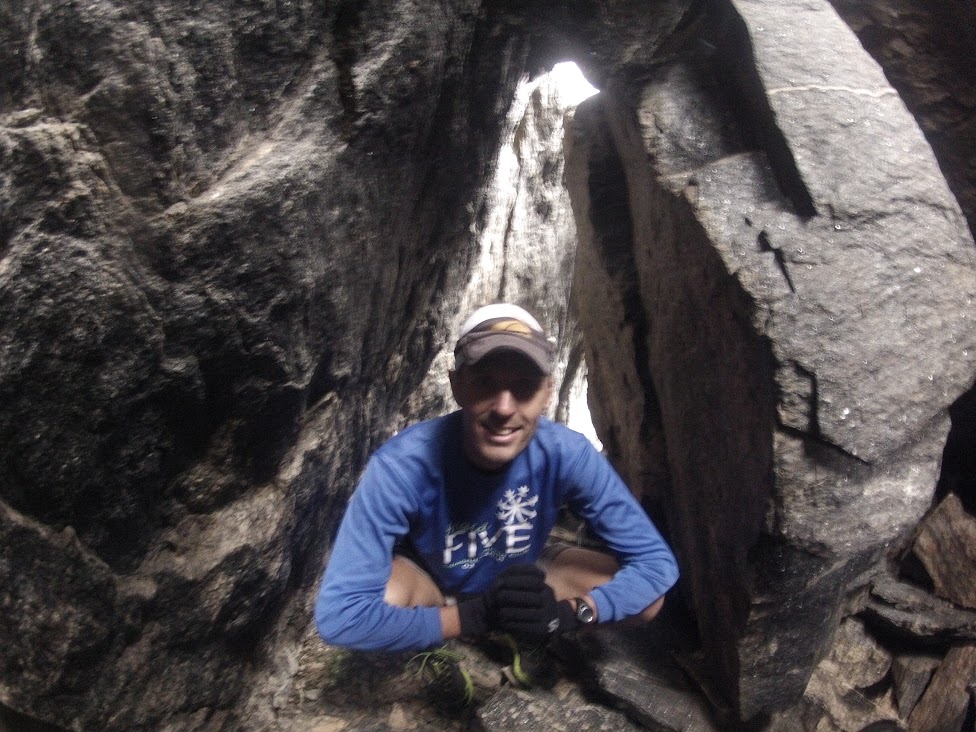 | |||
| Cave dweller. |
Original plans called for a summit of the heavily forested 'nutcracker,' a ranked Larimer peak (10,855'), but my nuts were already cracked from the heavy bushwhacking getting off Desolation, so I made the call to head back up the valley towards the car. We followed Chapin Creek up the valley a ways before picking up a drainage coming off Marmot Point, which we tracked through the woods (with mercifully good game trails) up into the alpine before rounding off with a tag of point 12,005' (a higher put unranked sister to Marmot Point). Mike insisted on a goosey gander around the kitsch-filled visitors center before we took off, and lo and behold it was full of tat.
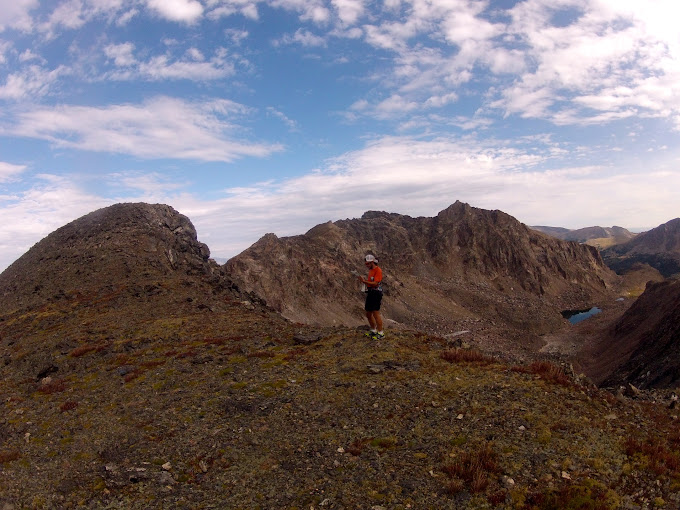 |
| West and East Desolation Peaks above and to the right of me. All pics: Hinterberg. |
 |
| Rowe Mountain back right, with Fairchild and the connecting ridge to Ypsilon in the right foreground. Desolation Peaks obscured by my head. |
 |
| Summit shot. |
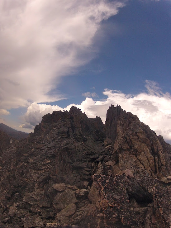 |
| East Desolation from East/West connecting ridge. |
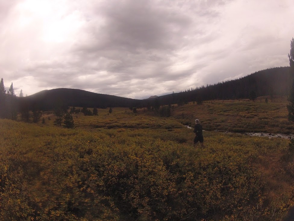 |
| Chapin Creek/Poudre Valley |
 |
| Backside of Chapin, Chiquita, Ypsilon and Desolation from slopes of Marmot Point. |
Fri - 7 miles (1,700') easy. Jogged up to the Horsetooth south summit.
---------------------------------------------------------------------------
January: 330 miles (45,200')
February: 445 miles (58,500')
March: 501.5 (79,600')
April: 430 (66,800')
May: 387.5 (70,700')
June: 297.5 (48,500')
July: 369 (71,100')
August: 330.5 (67,100')
Total: 3,091 miles (507,500')
Avg: 386 miles (63,438')
---------------------------------------------------------------------------
2012 Summits (129):
.......................................
Horsetooth (7,255') (58 - Sep 1)
.......................................
Mount Elbert (14,443')
Longs Peak (2) (14,259')
Mount Belford (2) (14,197')
Mount Oxford (14,153')
Missouri Mountain (14,067')
Pacific Peak (13,950')
Emerald Peak (13,904')
Crystal Peak (13,852')
Atlantic Peak (13,841')
Iowa Peak (13,831')
Hagues Peak (2) (13,571')
Ypsilon Mountain (13,514')
Fairchild Mountain (13,502')
Mummy Mountain (13,425')
McHenrys Peak (13,327')
Pecks Peak (13,277')
Whitney Peak (13,271')
Powell Peak (13,208')
Taylor Peak (13,153')
Mount Chiquita (13,069')
West Mount Sheridan (12,952')
East Desolation Peak (12,949')
West Desolation Peak (12,918')
Hallet Peak (12,713')
Otis Peak (12,486')
Mount Chapin (12,454')
Flattop Mtn (12,324')
Marmot Point W(12,005')
Marmot Point E (11,909')
Twin Sisters (11,420')
Mount Baldy (11,068')
Hidden Peak (10,992') (2)
Lookout Mountain (10,626')
Storm Mountain (9,918')
Lily Mountain (9,786')
Crosier Mountain (9,250') (4)
Pilot Hill (8,829')
Mount Ethel (8,471')
8,415' (Leila Peak)
Buckhorn Mountain (8,341')
8,310'
Round Mountain (8,250') (4)
Palisade Mountain (8,225')
8,194' (Giant Boulder Point)
Alexander Mountain (8,144')
Spruce Mountain (7,781')
Sullivan Stump (7,778')
7,725'
7,567'
Green Ridge (7,402')
Green Mountain (7,335')
7,260' (Ziggy Point)
7,178'
7,098' (Poll Mtn range)
Table Mountain (7,074')
Arthurs Rock (6,780') (5)
Milner Mountain (6,893')
5,773' or 'Aggie Peak'
5,740' (Hwy 34 B4 Narrows) (1)
5,740' (Off Masonville Rd) (2)
Reservoir Ridge (5,735')
Goat Hill (5,604')
Aitxuri (1,551 meters)
Aizkorri (1,528 meters)
Aratz (1,443 meters)
----------------------------------------------------------------------------
Sat - AM: 15.5 miles (6,400') mountains. Flattop (12,324'), Hallet (12,713'), Otis (12,486'), Taylor (13,153'), Powell (13,208'), McHenrys (13,327'). Met Tony early at the Bear Lake trailhead for what was intentioned as a full Glacier Gorge traverse - an uber-classic RMNP loop that runs the rim of Glacier Gorge, picking up 11 peaks along the way, including Longs - the monarch of the northern Front Range. I had a good bit of familiarity with the route through the first four peaks and also with McHenrys and Longs, but not so much with Chiefs Head and Pagoda, the headwall peaks. I hadn't seen the techie crux sections from Powell to McHenrys and from Chiefs Head to Pagoda, so they were weighing on my mind a bit as we got going, especially Pagoda's west ridge which is considered by most to be a very airy 5.6/5.7. Without protection there's no way I'd take that on, but Tony had beta on a low-class-V sneak on the south face of the ridge. I guess I was dubious about the sneak, as there was simply no beta on it anywhere that I could find, but I told myself I'd at least take a look.
The ascent from Bear Lake went as quickly as it always seems to, and before you could say 'my god those aspen are turning early,' we were above the trees and working into a bit of a breeze, albeit a pretty tame one by Flattop standards. Anyone who's been on Flattop knows that it's not really a mountain in the true sense of the word, but for whatever reason it is named and popular - probably more for the route options available from the plateau than for any aesthetic reasons (and also its relative proximity to the Bear Lake TH). Nonetheless, I was sure to tag the summit boulder (ahem!), before getting started with the meat of the route with a quick ascent of Hallet. Tony got a step on me up Hallet, tagging it a minute, maybe two before me, and he was off before I got there. It was clear he was on a mission, so I didn't bother hanging around either, hoping that I could hang on to his coattails. While I consider myself a decent enough talus negotiator, I couldn't match Tony on the descent off Hallet, so I soon resigned myself to a solo morning in the mountains.
I was heartened to see that I was still within a couple of minutes of Tony off the summit of Otis, a close neighbor to Hallet that offers killer views of the Gorge, Chaos Canyon and Loch Vale (if you take the time to stop and look). The run to Taylor is always a grind, and I once again dipped too low by essentially hitting the rim above Andrews Glacier rather than staying a little further west and maybe 80 feet higher. Not a big deal, but maybe two or three minutes, if you care about such things. I also managed to misdirect to the east a bit after Andrews by being drawn in by false summit 12,829', an unnamed rim bump. I soon realized my error and straightened for Taylor, seeing Tony up on the summit ridge a few hundred feet above.
After Taylor comes Powell, which was to be my first virgin summit of the morning, so I took a few minutes to enjoy the new-to-me vista before heading south in search of the scree gulley that I knew would hook me into McHenrys Notch. I found the gulley immediately, but doubted that it was the right one. I hit it anyway and was relieved to find the cliff bands (easily traversed) that circled back to the base of the Notch a couple hundred feet below the summit of Powell. Looking up at the McHenrys side of the Notch, I was relieved to see what looked like a very straightforward climb. And indeed it was. There may have been a class V move in there somewhere, but it was mainly class IV slabs with surprisingly low exposure (given how vertical the Notch looks from afar). I was up above the Notch in no time, and then it was just a question of negotiating a couple of ledges to the right and a couple more hundred feet of scrambling for the summit. The descent off McHenrys to Stoneman Pass went way quicker than the last time I was up there. And then my engine stalled.
Up on the ledges of Stoneman, I kept cliffing out in search of the line onto Chiefs Head. Backtracking after a second unsuccessful search for the route, I bumped into Joel Wolpert (who was there to film Tony but got to the pass too late), and pretty much felt my desire to continue fade. I looked up at Chiefs Head and all of a sudden the 1,000 feet of relief looked like an insurmountable 3,000 feet. Joel decided that he wasn't going to be able to catch Tony and said he was heading back down the Gorge. Content with six peaks on the morning (and still dubious about the Pagoda route), I stepped in behind Joel, tripping and stumbling my way back down to Bear Lake on legs that were all of a sudden leaden and more than ready to be done.
We were back at the trailhead in a little over five and a half hours, and I have to say I was pretty shocked to see Tony roll in not long after in a time of 6:17 - easily a new standard for the route. Turns out the Pagoda sneak did go. I probably won't get another crack at this until next summer at the earliest, but now that I know the line can be done safely without gear I'll be more committed mentally from the get go. Although not fully successful, this was still a great morning in the mountains.
Splits:
Flattop: 0:59
Hallet: 1:09
Otis: 1:27
Taylor: 2:05
Powell: 2:35
McHenrys: 3:05
Sun - Noon: 1 mile (600') hiking. Took the kids up the Big Thompson a ways and had a picnic at a bend in the river known as Sleepy Hollow. Alistair wanted to do some exploring, so we set off up the steep slopes of the canyon for a ridgeline 500 feet above the river (hard work and somewhat nervy with your daughter in a pack on your back.) Stopped for another picnic at the top and then downclimbed on some pretty sketchy rock that cliffed out on us twice.
PM: 6.5 miles (1,600') easy. A nice late afternoon summit of Horsetooth (north) with Alex. Visibility was way better than it's been in months. Saw Pikes 100 miles to the south for the first time since spring.
Total: 67.5 miles (19,700')
I need to start running some road miles to get ready for UROC, but it's so difficult at this time of year in Colorado. Roads are so much easier to deal with in the winter.
Monday, August 27, 2012
Week Ending August 26
Mon - Off
Tues - Off
Weds - Off
Thurs - 8 miles (1,800') easy. Ran the Towers TT at a very moderate effort to the halfway, then picked up the pace just a notch as I started to warm up. 35 and change, I think. Descent was a little sore on my right hip, and legs in general, but nonetheless things are looking good for a speedy Leadville recovery.
Fri - 9.5 miles (3,000') easy. Round Mountain. Met Steph and Mary at the Round TH for a late afternoon run to the summit. Half a mile in, Steph and I stopped in our tracks 15 meters behind a big 200 pound bear who was sauntering down the trail. Bear heard Steph pull up, looked back and then casually headed up the hillside. By the time Mary caught up, the bear was a good 50 feet above us and we carried on our way. Second bear sighting in the last two outings on Round. Always a bonus. Bears aside, the moderate-effort ascent (57:05) felt descent, while the descent was just okay, but noticeably better than yesterday on Towers.
Sat - 3.5 miles (800') hike. Ranked Peak 8,194' - aka 'Giant Boulder Point.' Had plans to scout the tricky 5.7 west ridge of Pagoda with Brian, but he bailed the night before with a sore knee, so I enjoyed a fun little hike with the family instead. It's been a while since I checked in with the Larimer County high points project, so I decided to bag a nice easy one as part of our hike. The start point for this hike is off the Devil's Gulch Road past Glen Haven and just before the first of the two big S-bends that take you to the plateau above Estes. As described by Joe Grim on the Lists of John site, you essentially head under the three powerline transformers on the north side of the road (parking at a pull-off on the south side), following an old dirt road for 20-30 meters before picking up a faint trail to the left. We followed the trail for probably a mile or so, before cutting cross country up a drainage. Dana and Stella hung out in a nice spot on the ridge, while Alistair and I ran west along the ridge tagging two bumps along the way until we hit the actual summit block. Gaining the top of the summit rock requires some class III climbing, which was a lot of fun for Alistair, but really quite straightforward. The views from the top were exceptional for such a lowly peak. Longs was framed beautifully by a hole in the ridgeline to the south, while the Mummy's and more were impressively clear to the north and west. After a couple of summit shots, and signing in on the Lists of John member-studded log book, Alistair and I boogied back to the girls, packed up their picnic and made quick work of the exit, stopping for delicious cinnamon buns at the 100-year-old Glen Haven general store on our way down the canyon. Fun morning.

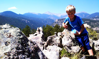

Sun - 6 miles (2,800') peak baggin'. 8,310' & 7,567'. Enthused by yesterday's outing, I decided to pick up a few more of Larimer County's 255 ranked peaks, focusing again on the Big Thompson area. I had meant to knock off 8,092' with the other two this morning, but as is often the case with these bushwhacking routes, things frequently move much slower than planned. Anyway, with these two picked off, I only have two of 10 peaks left to bag in the Drake quadrangle: 8,092' and Pole Hill.
To get on 8,310', I drove about two miles up the tight Waltonia Road south off Hwy 34 to approximately 6,900' where the road dead ends at a private gate. I parked there and then ducked under the gate before heading in a southeasterly direction straight up the hillside, crossing one drainage and then following another to the ridge. There was some fun class three/four rock moves to be made approaching the ridge. Once on the ridge, the grade mellowed out and it was an easy, grassy jog to the rock pile at the summit. To my surprise, there was a pill box summit register at the top, which described the summit as 8,240'. This had me confused, especially as I could find nothing on the map suggesting an 8,240' peak in the vicinity. I'm 99% certain that I was on 8,310' as intended. After figuring the lay of the land on the south side of Round Mountain, I proceeded in a southeasterly direction for unranked point 7,812' along the ridge that forms the south side of a valley with the Round Mountain ridge to the north. From 7,812' I dropped down to Saddle Notch, following an old undeveloped homesite road to the road that services a couple of impressive houses down in the Round Mtn Saddle Notch Valley. Then it was just a question of crossing the road and hoofing the 400 or 500 feet up to 7,567'. No summit register that I could find, but there was a definitive summit rock pile. I essentially backtracked the way I had come, deciding to leave 8,092' for another day due to time constraints, which was a bummer, but my fault for being lazy and not getting up earlier. Just 210 more ranked Larimer summits to tag!
Total: 27 miles (8,400')
Nice easy week finding my legs after Leadville. It was good to be back ticking off peaks in the Larmier County project. I look forward to really getting back into that once I'm done with UROC. I'm also looking forward to taking a stab at the Glacier Gorge Traverse next weekend, but am a little nervous about the Pagoda west ridge section from Chiefs Head. That section will have to be a game-time decision for me as I've never seen it before, but all indications suggest that there's no avoiding a couple of very airy 5.6/.7 crux sections, without dropping all the way down and re-climbing.
Tues - Off
Weds - Off
Thurs - 8 miles (1,800') easy. Ran the Towers TT at a very moderate effort to the halfway, then picked up the pace just a notch as I started to warm up. 35 and change, I think. Descent was a little sore on my right hip, and legs in general, but nonetheless things are looking good for a speedy Leadville recovery.
Fri - 9.5 miles (3,000') easy. Round Mountain. Met Steph and Mary at the Round TH for a late afternoon run to the summit. Half a mile in, Steph and I stopped in our tracks 15 meters behind a big 200 pound bear who was sauntering down the trail. Bear heard Steph pull up, looked back and then casually headed up the hillside. By the time Mary caught up, the bear was a good 50 feet above us and we carried on our way. Second bear sighting in the last two outings on Round. Always a bonus. Bears aside, the moderate-effort ascent (57:05) felt descent, while the descent was just okay, but noticeably better than yesterday on Towers.
Sat - 3.5 miles (800') hike. Ranked Peak 8,194' - aka 'Giant Boulder Point.' Had plans to scout the tricky 5.7 west ridge of Pagoda with Brian, but he bailed the night before with a sore knee, so I enjoyed a fun little hike with the family instead. It's been a while since I checked in with the Larimer County high points project, so I decided to bag a nice easy one as part of our hike. The start point for this hike is off the Devil's Gulch Road past Glen Haven and just before the first of the two big S-bends that take you to the plateau above Estes. As described by Joe Grim on the Lists of John site, you essentially head under the three powerline transformers on the north side of the road (parking at a pull-off on the south side), following an old dirt road for 20-30 meters before picking up a faint trail to the left. We followed the trail for probably a mile or so, before cutting cross country up a drainage. Dana and Stella hung out in a nice spot on the ridge, while Alistair and I ran west along the ridge tagging two bumps along the way until we hit the actual summit block. Gaining the top of the summit rock requires some class III climbing, which was a lot of fun for Alistair, but really quite straightforward. The views from the top were exceptional for such a lowly peak. Longs was framed beautifully by a hole in the ridgeline to the south, while the Mummy's and more were impressively clear to the north and west. After a couple of summit shots, and signing in on the Lists of John member-studded log book, Alistair and I boogied back to the girls, packed up their picnic and made quick work of the exit, stopping for delicious cinnamon buns at the 100-year-old Glen Haven general store on our way down the canyon. Fun morning.
 | |||||
| Ranked Peak 8,194'. Photo: Brandon Reich (from Lists of John). |
Sun - 6 miles (2,800') peak baggin'. 8,310' & 7,567'. Enthused by yesterday's outing, I decided to pick up a few more of Larimer County's 255 ranked peaks, focusing again on the Big Thompson area. I had meant to knock off 8,092' with the other two this morning, but as is often the case with these bushwhacking routes, things frequently move much slower than planned. Anyway, with these two picked off, I only have two of 10 peaks left to bag in the Drake quadrangle: 8,092' and Pole Hill.
To get on 8,310', I drove about two miles up the tight Waltonia Road south off Hwy 34 to approximately 6,900' where the road dead ends at a private gate. I parked there and then ducked under the gate before heading in a southeasterly direction straight up the hillside, crossing one drainage and then following another to the ridge. There was some fun class three/four rock moves to be made approaching the ridge. Once on the ridge, the grade mellowed out and it was an easy, grassy jog to the rock pile at the summit. To my surprise, there was a pill box summit register at the top, which described the summit as 8,240'. This had me confused, especially as I could find nothing on the map suggesting an 8,240' peak in the vicinity. I'm 99% certain that I was on 8,310' as intended. After figuring the lay of the land on the south side of Round Mountain, I proceeded in a southeasterly direction for unranked point 7,812' along the ridge that forms the south side of a valley with the Round Mountain ridge to the north. From 7,812' I dropped down to Saddle Notch, following an old undeveloped homesite road to the road that services a couple of impressive houses down in the Round Mtn Saddle Notch Valley. Then it was just a question of crossing the road and hoofing the 400 or 500 feet up to 7,567'. No summit register that I could find, but there was a definitive summit rock pile. I essentially backtracked the way I had come, deciding to leave 8,092' for another day due to time constraints, which was a bummer, but my fault for being lazy and not getting up earlier. Just 210 more ranked Larimer summits to tag!
Total: 27 miles (8,400')
Nice easy week finding my legs after Leadville. It was good to be back ticking off peaks in the Larmier County project. I look forward to really getting back into that once I'm done with UROC. I'm also looking forward to taking a stab at the Glacier Gorge Traverse next weekend, but am a little nervous about the Pagoda west ridge section from Chiefs Head. That section will have to be a game-time decision for me as I've never seen it before, but all indications suggest that there's no avoiding a couple of very airy 5.6/.7 crux sections, without dropping all the way down and re-climbing.
Saturday, August 25, 2012
Fortnight Ending August 19
Week Ending August 12
Mon - Off
Tues - 5.5 track. 8 x 200 @ 31-33. Yup, that's how to get ready for a 100 miler.
Weds - 5 miles easy in town on the bike paths
Thurs - 10 miles (2,000') steady. Towers in 31:01. Started out at a moderate effort, than picked it up from the halfway. Good tempo effort.
Friday - 7 miles (1,800') easy. Horsetooth middle summit. First time I've been up the middle tooth, as it happens. There's a nice big crack in the east face, which made things a little easier than I was expecting. A couple of low fifth class moves required, but really pretty straightforward.
Saturday - 7 miles (1,800') easy. Horsetooth north summit.
Sunday - 8.5 miles (1,800') easy. Horsetooth south summit. Nice little Horsetooth trifecta over the last three days to build some mountain karma for Leadville.
Total: 43 miles (7,400')
Week Ending August 19
Mon - 4 miles easy to two-mile fence and back on Bluesky.
Tues - 4 miles (800') easy with Torrence on roads up from Leadville house.
Weds - 4.5 miles easy around lake by Leadville house.
Thurs - 3.5 miles (1,300') hiking. West Mount Sheridan (12,952'). Alistair and I drove up to 11,600' on some old mining roads and then hiked up to the summit of West Sheridan Mountain. This was a super-fun outing and Alistair's highest climbed peak to date (he's taken the cog & also driven up to the top of Pikes but that doesn't count for anything). The log book on top was from 1980 (!), with very few entries. Alistair and I got our names in there and enjoyed the killer views of Gemini, Sherman and Sheridan right in the heart of the Mosquitoes. Sometimes it's fun to get on the less-traveled peaks, especially when you find a log book with a 32-year vintage. On the way down, we had tons of fun rummaging through a couple of old mining sites. Proud of the young man, and hoping we can tag a 13'er and then a 14'er together before the summer season is over.
Fri - 2.5 miles easy around the lake with Ian, Tinder and Emily.
Sat - 102.5 miles (17,400') racin'. Leadville 100.
Sun - Off.
Total: 121 miles (19,500')
Nice easy two week lead up to Leadville with just 60 miles of pretty leisurely running. Recovery post the race has been about the best of I have ever had after a 100 miler, and I already find myself champing at the bit to get out and make the most of the remainder of the summer, before maybe burning some longer road runs in preparation for the UROC 100k in five weeks. Pretty sure that will do it for me in terms of ultra races in 2012.
Mon - Off
Tues - 5.5 track. 8 x 200 @ 31-33. Yup, that's how to get ready for a 100 miler.
Weds - 5 miles easy in town on the bike paths
Thurs - 10 miles (2,000') steady. Towers in 31:01. Started out at a moderate effort, than picked it up from the halfway. Good tempo effort.
Friday - 7 miles (1,800') easy. Horsetooth middle summit. First time I've been up the middle tooth, as it happens. There's a nice big crack in the east face, which made things a little easier than I was expecting. A couple of low fifth class moves required, but really pretty straightforward.
Saturday - 7 miles (1,800') easy. Horsetooth north summit.
Sunday - 8.5 miles (1,800') easy. Horsetooth south summit. Nice little Horsetooth trifecta over the last three days to build some mountain karma for Leadville.
Total: 43 miles (7,400')
Week Ending August 19
Mon - 4 miles easy to two-mile fence and back on Bluesky.
Tues - 4 miles (800') easy with Torrence on roads up from Leadville house.
Weds - 4.5 miles easy around lake by Leadville house.
Thurs - 3.5 miles (1,300') hiking. West Mount Sheridan (12,952'). Alistair and I drove up to 11,600' on some old mining roads and then hiked up to the summit of West Sheridan Mountain. This was a super-fun outing and Alistair's highest climbed peak to date (he's taken the cog & also driven up to the top of Pikes but that doesn't count for anything). The log book on top was from 1980 (!), with very few entries. Alistair and I got our names in there and enjoyed the killer views of Gemini, Sherman and Sheridan right in the heart of the Mosquitoes. Sometimes it's fun to get on the less-traveled peaks, especially when you find a log book with a 32-year vintage. On the way down, we had tons of fun rummaging through a couple of old mining sites. Proud of the young man, and hoping we can tag a 13'er and then a 14'er together before the summer season is over.
 |
| Oldest log I've ever found on a summit. |
 |
| Alistair running to West Sheridan summit. Sherman in the backdrop. |
 |
| Putting back the log. |
Sat - 102.5 miles (17,400') racin'. Leadville 100.
Sun - Off.
Total: 121 miles (19,500')
Nice easy two week lead up to Leadville with just 60 miles of pretty leisurely running. Recovery post the race has been about the best of I have ever had after a 100 miler, and I already find myself champing at the bit to get out and make the most of the remainder of the summer, before maybe burning some longer road runs in preparation for the UROC 100k in five weeks. Pretty sure that will do it for me in terms of ultra races in 2012.
Wednesday, August 22, 2012
Leadville 100
 |
| The Leadville 2012 start. Photo: Rob Timko |
In the moment, each and every one of these ridiculous events seem to suck just as much - if not more - that the last one, but yet we never come to that realization until it's too late, until we are committed to the pointless road to the finish. It makes no sense. The pain is so tangible, the desire to quit so real, and yet we find a way to gloss over it all and repaint with bright colors and sweet smelling tales of absurdity. Maybe it's the human condition to commit ourselves to tasks of complete and utter pointlessness - I certainly wouldn't be the first to suggest such a thing - and there is compelling evidence in the sport of ultrarunning that this is the case. And so you process these thoughts and continue moving forward. You find ways to finish what you've started, just so you can sit down at the end of the day feeling wrecked and abused. That's how I felt Saturday afternoon as I was ever so slowly making my way up towards Hope Pass for the second time in less than two hours.
Then it dawned on me that the Slushmeister - my pacer and good friend - was having a merry old time on the mountain. He seemed to think, or at least pretend, that there was some kind of reason to all of this. We were involved in a race and I needed to do everything in my power to win it - or at least not fall apart too tragically. And so I played along, using the energy-conservation card as an excuse for hiking every single step to the top of the pass. Scott bought it, and even encouraged it. I'd like to say that I at least hiked with some kind of authority, but in all honesty it was a pretty miserable effort. But I digress. One should always start from the beginning - not the middle - and then conclude with the end. That's how stories go.
I had been dreading the start of the Leadville 100 for days, weeks, even months. After you've done enough of these torturous events, you know that the fairy tales you tell yourself on comfortable 20 mile training runs are nothing more than endorphinated pipe dreams. There is no way in hell you're going to come down Sixth Street with the sun blazing, angels singing, and the clock just ticking over to a thoroughly impressive 15:30 course record. The reality of it is that you're going to turn onto Sixth with a mile to the finish and it will seem like you still have a marathon to go. Your stomach will be a mess, your legs will be screaming, and you'll have given up caring - many hours ago - about the vacuous goals you'd set in a previous (positive) life. It just won't matter anymore.
 |
| The top three, as it turned out. |
 |
| Sharing some laughs and pretending that this one wouldn't hurt. |
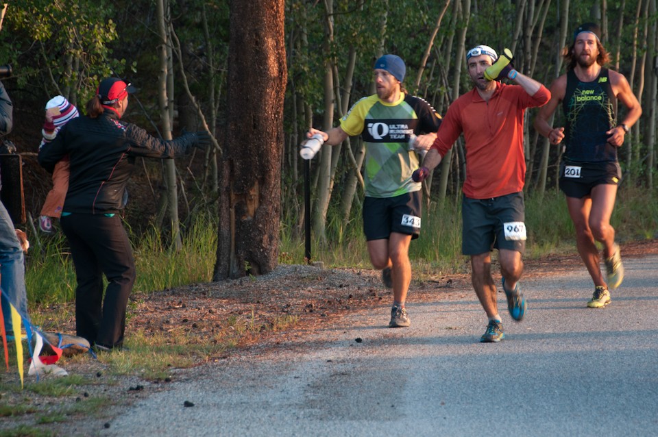
Negotiating the singletrack in the dark, the only way to tell who was on board was by the banter. Jay was worried about the Olympian peeing on his Armani button-down shirt, Thomas was rugby tackling Zeke, Tony was banging on about arm panties, the Fruitarian about trail tourism and me about dead headlights. By the time we popped out onto the Haggerman Road for the trip up to Haggerman Pass, the sun was just beginning to illuminate matters. The pack was down to five. Who exactly was pushing the pace was uncertain, but with a 3:05 split to the Fish Hatchery, things on paper seemed fast.
 |
| The 3:05 Express, running ahead of schedule. |
 |
| Photos: Timko |


 |
| Get me off this road! |
I found some good energy on the first third of the mountain, running essentially everything, but then proceeded to get lazy after convincing myself that running a third of the mountain was plenty adequate for this stage of the race, with any more possibly spelling disaster for later in the run. Ah, the games we play. But this was the first hike break in 40+ miles of running, so perhaps it was warranted.
Given that my hiking was largely decent and somewhat convincing, I felt like I might be clawing back some time on Thomas and Mike, if not Tony. I was eager to get a view of things as I broke above timberline. From the Hopeless aid station I could see Thomas making his way up to the pass and, to my surprise, Mike was behind him. He looked like he might be heading for the casualty list - the first one of our lead pack of five to submit. In that short distance from the aid station to the pass, I made up ground very quickly on Mike and by the first switchback of the descent I was going past him. His day from a competitive standpoint looked to be over. I offered some shallow advice (what else can you do?) and forged on with what felt like a pretty good descent to the new contour trail.
Ah, yes, the new contour trail. Much moaning about the added mileage and vertical, but it came and it went. I timed the Winfield turnaround cheers for the lead two at 15 minutes and 13 minutes respectively. Both Tony and Thomas looked strong as I passed them coming back the other way, and given that I was now beginning to feel pretty gassed, I was mainly concerned with just getting the job done and finishing this ridiculous thing. But I hadn't considered the Slush factor. He had his stoke on and he wanted to get after it.
Given Scott's energy levels, I couldn't start him out with a hike back up the Winfield road, and so we ran. I did, however, forewarn him that we were hiking every step up Hope once we got off the contour trail and to the base of the climb. As noted previously, he was on board with the plan. We passed Zeke on our return at what looked to be about an 8-10 minute gap, and then it was a long way back to fifth.
The climb back up Hope on the far steeper south side felt pathetically slow. It was no surprise to me whatsoever that Zeke was just a few minutes back on us once we crested the hump, but seeing my good friend Alex May moving well over the pass and seemingly in good spirits was uplifting enough for me to want to get back after it, even if I could feel my stomach beginning its typical back-half revolution.
I knew I was pretty much on fluids from here on in. I gulped Coke at the Hopeless aid station and then let Scott clear a path as we bombed our way down the hill. Scott was clearly having fun with the descent and was undoubtedly the right man for the task at hand. LOOKING GOOD, RUNNER COMING THROUGH. The shout-outs coming down were insane. To see so many familiar faces was a joy - to those of you that I missed, I apologize, but I'm sure Scott had some fine words for you.
And then we hit the flat, exposed meadows before Twin Lakes. Deflation. Nonetheless, this meant that I was 60 miles in with just two climbs left. Dana was there at Twin Lakes with the kids and some aid station goodies. I slipped on the new Pearl Izumi E-Motion M2s and instantly my feet thanked me. These will certainly be my shoe of choice when they go into full production in spring 2013.

 |
| Photos: Eric Lee |
 |
| Photo: Timko |
The guys at the Mount Elbert fluid station told us that we were no more than 10 minutes behind Thomas. I dismissed that as total bunk, as we hadn't been moving nearly well enough to have closed that much. Nonetheless, I downed a can of cold Coke and we proceeded to get after it. The section from there to Half Pipe was easily my best of the day. I was breaking down and barely getting enough calories in, but was somehow managing to stay loose enough to run pretty much everything with a good degree of authority. I was worried about energy levels down the road though. Nothing sounded good to my stomach.
And then we met the trail angels taking a break on the Colorado Trail. They had cherries. Never, in my whole life had anything sounded so good. They could sense my stoke and they gave me the whole bag. I ate about half of them as quickly as possible over the next quarter mile. And then the magic wore off and the cherries were placed on the banned substance list along with everything else.
'Four minutes.' That was the reported gap at Half Pipe. It seemed like Thomas was cracking. But then it was 15 minutes (Tony) and 12 minutes (Thomas) two miles later at Treeline. Regardless, we were definitely closing. And then we hit the road and all life was immediately sucked out of the rally. Wind, sun and long-ass road vistas did a number on me. We slowed considerably by the time we got to Fish Hatchery, but the math still seemed to be in our favor, and it was now pretty clear that Tony was in trouble, just 10 minutes ahead of me and two minutes behind Thomas - now the leader.
 |
| Getting ready to run the last 23 with the Epic Stoke Machine. Photo: Slusher. |
There I was, once again, stuck in this odd third-place time warp. I could sense that Zeke was moving better than me, that we'd catch Tony soon enough, and that Thomas was probably juiced enough about leading to be able to hang on. Dylan was trying every trick in the book to get calories in me, but I just couldn't do it. My stomach was riding the line. Any solids and it would have been chunks, but liquids I could just about consume. Dylan (to his immense credit) had three options for me: Coke, EFS sports drink and water. I stuck to mainly EFS and Coke and so we shuffled on.
'A little jogging?' Dylan would prompt as Zeke got ever closer up the Powerline climb. We jogged a bit, I got some spasms in my calf, we hiked. But we made it to the top of the climb before Zeke. And immediately we saw Tony. I laughed inwardly at the situation. I was about to take second only to hand it back in the next mile or two to a charging Zeke. The downs were still working okay for me though, so I was able to hold off Zeke until just before the turn onto the Colorado Trail. I was even able to keep him in sight for a good third of it. And then he was gone and I came to terms with my predicament.
I couldn't get enough calories in to mount a charge, so I had to play defense and maintain what I had, which was a podium finish and possibly a sub-17 clocking. Dana looked concerned when I arrived at May Queen - you know you're in trouble when your wife looks at you like that. I took some time at the aid station, unconcerned about Zeke and his three-minute lead. I ate a couple of salted potatoes and washed them down with a couple of shots of Coke. Dylan wanted to get after it - I was just plain tired and desperately wanting to be done. But there were 13 long miles still left to cover.
All things considered, the torturous trip around Turquoise Lake went surprisingly well, with just a few short hike breaks on a couple of the steeper rollers to recharge the fading batteries. By Tabor, Zeke was no more than seven minutes up we were told, which meant that we'd been largely holding our own. I was still getting some EFS down, but I had no competitive drive left in me. The course had ground it all out of me long ago. There were cheers behind that were worrying, but made no sense, as we progressed through the campgrounds. Surely Tony wasn't mounting a charge. The cheers were enough to keep me running though.
 |
| Six or seven miles to go. Turquoise essentially done. Photo: Slush |
We hit the Matchless parking lot and saw the family and crew. Scott said third was in the bag and that Tony was 15 minutes back at May Queen. I was still paranoid about those cheers though. Two miles later and four miles from the finish, just before the Boulevard turn, a car stopped and the guy inside informed us that he'd waited 17 minutes at Tabor and nobody had come through. Boom, just like that I made the executive decision that we'd be hiking the whole of the Boulevard. There was nothing left to play for and nothing left to defend. Yes, I could have run for the sub-17 (and in hindsight I wish I had), but I was just so done with running at this point that a nice three-mile stroll on a beautiful Leadville evening was where I wanted to be.
Dylan and I chatted a good bit and then I started getting nauseous again. The roller coaster was apparently not quite over. With a mile and half to go, I was once again fighting off the chunder monkey. We hiked absolutely everything, with the exception of one very short downhill stretch, until we were overlooking the finish on Sixth. Slusher and Stefanovic were there and jogged down the road with me. Some girls joined the parade, there was Justin and Dana, Stella and Alistair. The glow of the finish line clock turned into distinct numbers, and then, finally, I was done. Third again.
I was so done, about as done as I've ever been at the end of one of these ridiculous races.
 |
| The two man 'get me to the finish' 100 mile stare. |
 |
| So good. |
 |
| Thank the sweet baby Jesus. Where's the chair? |
 | |||||||||||||||||||||||||||||||||||||||||
| Just a few of the Fort Collins Trail Runners in town for the weekend. |
Thanks, of course, to everyone who had a hand in my day, and congratulations to everyone who found a way to reach their own personal finish lines on Saturday and Sunday. One hundred miles in one push hurts; it takes conviction and dedication to get it done, and those, I believe, are traits worth celebrating.
Subscribe to:
Posts (Atom)


.png)