Showing posts with label Palisade. Show all posts

Saturday, January 21, 2012

Alexander Mountain

Alexander Mountain (right), the gateway to the Big Thompson Narrows.

Despite it's somewhat diminutive stature, Alexander Mountain (7,105') is a good challenge, with rewarding and unique views of some very familiar terrain from its summit.

If you've ever driven up Hwy 34 through the Narrows of the Big Thompson, then you've undoubtedly seen Alexander, but maybe never known it as such. Alexander Mountain is the first named mountain in the Big Thompson Canyon, but plays little brother to it's better-known neighbors. Both Round Mountain and Palisade Mountain can be seen from the top of Alexander, but neither of them offer the unique views of the Narrows and hogback foothills that their humble sibling does.

As you approach the mouth of the canyon, Alexander Mountain is easily recognizable from its sheer south face. The Big Thompson itself begins its journey from the peaks of Rocky Mountain National Park - viewable to the west from Alexander's summit.


Left to right: Stone, Meeker, Longs, Round.

There are a number of ways to get on top of the mountain, the most direct of which is to ascend a steep, brush-infested gully directly from the canyon floor, soon after Hwy 34 crosses the Big Thompson for the first time. From the summit, Ryan and I spied a longer, but more interesting route that would take you up from the jaws of the canyon on Alexander's long southeastern ridge.


The entry to the gully, right off the Big Thompson.
The southeast ridge of Alexander.

Soon after entering the gully, there is a large boulder plugging up the boxed-in route, which requires some class III maneuvering to get around. Once past the chockstone, it's time to fight with the rough brush that inhabits the dry creek bed.

Tiring of that game, Ryan and I cut a line to the western ridge of the gully and enjoyed some fun class III/IV climbing all the way to the top of a small point from where the best views on Alexander are available. The actual summit is a short hike north on the summit ridge in a forested area of little note.


Chockstone.

Brush, brush and more brush early on.

Out of the weeds...
...and on to some solid rock.
Anticlimactic summit.

After making the requisite summit tag, Ryan and I returned to the slightly lower point that we had gained from the ridge and enjoyed the awesome views for a while. 100 miles to the south, Pikes Peak was visible, with close-ups of Carter Lake, Longs Peak, Mount Meeker, and Round and Stone Mountains in the foreground. Off to the east, there were great views of the foothill hogbacks, including Devil's Backbone, the Bluesky Valley, Eden Valley Reservoir, Horsetooth and Milner Mountain. To the west were good views of the nicely painted Mummies and other RMNP peaks. But perhaps most impressive of all was the view down into the Big Thompson Narrows - a quite unique vantage point to be sure.

Eden Valley Reservoir
Horsetooth (left) & Milner Mountain (right)

Big Thompson Narrows, with hogbacks beyond.

Coming down, we forewent the rocky down-climbing, deciding instead to wage war against the mountain mahogany and other nasty creek brush.

With 20-30 minutes on top, we were up and down in about 2.5 hours. Total climb is in the 1,600 foot range and distance is probably no more than 3 miles. This one comes highly recommended.

Sunday, January 15, 2012

Fortnight Ending Jan 15

Mon - 3.5 miles easy. Two university loops.

Tues - 3.5 miles easy. Two university loops.

Weds - 0 miles. London to Denver by way of manic JFK.

Thurs - Noon: 4.5 miles (900') easy. Falls loop. Insanely warm out.
PM - 6 miles easy on the bike paths with the FCTR crowd. Despite the Jan 6 date and dark of night, we had sports bras and bare midriffs aplenty tonight. Two weeks in the UK and I return home to mid-summer in January.

Fri - PM: 2.5 miles (500') easy with Dylan and Yassine on the Bandera course.

Sat - 62 miles (4,500'). Bandera 100k.

Sun - 0 miles

Total: 82 miles (5,900')

Mon - 0 miles

Tues - 0 miles

Weds - 0 miles

Thurs - AM: 10.5 miles (1,500'). HTH5MO&B with Pete, Celeste, Ziggy (who has big doggy goals for 2012), Slush, Mike, and a very late Sarah. Windy and cold. Out in a sore 45 mins, back in an even sorer ~34.5 mins. Downhills were quite painful on the quads. Took things very easy.
PM: 7 miles (1,700'). First Towers session of the year. Good turnout on what was a pretty nice evening for mid January. Track was dangerously icy in places. Up in an easy 38 mins.

Fri - 5 miles (1,100') easy. Falls long.

Sat - 22 miles (1,800') easy.
Horsetooth circumnavigation with Sarah, Alex and Pete. Beautiful morning. Still quite sore in the quads, but just glad to be out.

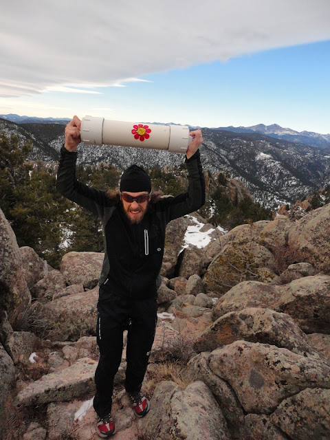
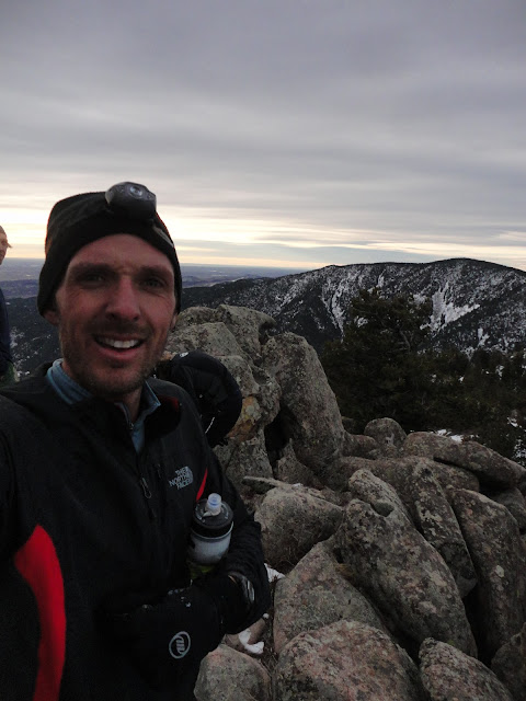
Sun - AM: 3.5 miles (2,500'). Palisade Mtn (8,264') with Mike and Elijah. Been wanting to get on Palisade Mtn, a prominent and jagged Front Range peak, for quite some time. Palisade is essentially on the opposite side of the Big Thompson from Round Mountain and is visible from many vantage points in Fort Collins and Loveland. From the canyon floor, there are multiple drainages and ridges to choose from in getting up. We ascended a few drainage ribs too far to the east, making our morning a little longer than it would otherwise have been, but we were still up and down in a reasonable 2.5 hours. All bushwhacking, probably a little more class III than necessary, and a ton of cactus. Back home for breakfast and then up Horsetooth with friends and family.


Possibly the largest summit-register canister in the Rockies. All pics: Mike H

Mike with Round Mtn. behind
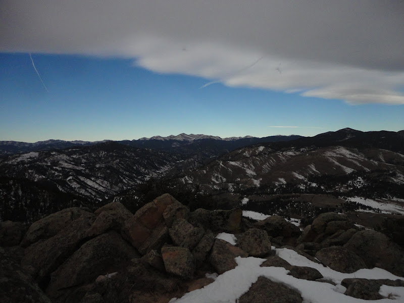
West up the Big Thompson toward RMNP

PM: 4.5 miles (1,500'). Horsetooth summit with Dana, Alistair, Stella C, Brian, Sandis, Stella W, Rob and Madison.

On H'tooth summit with Great Plains to the east behind.

Looking southwest. Pikes is faintly visible 100 miles south.

Halfway up with my zonked-out baby.

Total: 52.5 miles (10,100')

Bit of this, bit of that and a few days off after Bandera. January will be a very relaxed, run-when-I-want kind of month. There is so little snow around right now, I think I'll take the opportunity to explore locally a bit and get up a few of the lesser visited NoCo Front Range peaks. Palisade was a good start today. Also on the list are Alexander, Storm, Christ, Milner, Goat, Spruce, Buckhorn, and Ethel. Other suggestions welcome.

Registrations for the Quad Rock 50 (aka FoCo 50) are going strong. We're about half full right now, with just 40 spots left in the 25 miler. Pete and I are working hard to make sure that we put on a top-notch event, and we couldn't be happier to be teaming up with some really great local companies, including Pearl Izumi which has just signed on as the shoe and apparel sponsor. This means top-quality, gender-cut race T-shirts for all participants, shoes for age group winners and tons of other great giveaways.

In addition to Pearl, we're working with First Endurance as the fuel sponsor. All participants will receive a 5oz EFS gel flask with their entry and we'll be doing jug refills at the aid stations. If you haven't tried EFS before and want to test it out before the race, we've set up a 20% discount for runners. Visit the race website, nose around a bit and you'll find the coupon code. We're also working with Smith Optics (which means more awesome prizes and giveaways) and Colorado Physical Therapy Specialists (which means free massages and PT after your run). Other relationships are in the works, all of which means more cool stuff for you.

Rick just hosted his first annual VerticALE Beer Mile in North Carolina. I hear there might be one occurring on the Incline soon too. It's sweeping the nation, folks.