Monday, August 6, 2012

Week Ending August 5


Mon - Off. Rental business and work all day.

Tues - 5 miles track. mile, 8x 400: 5:36, 2:42, 2:36, 2:41, 2:39. No warm-up whatsoever for this workout, so eased into the mile and then cruised the 800s. Tired from a very busy extended weekend of turning rental properties around.

---------------------------------------------------------------------------
January: 330 miles (45,200')
February: 445 miles (58,500')
March: 501.5 (79,600')
April: 430 (66,800')
May: 387.5 (70,700')
June: 297.5 (48,500') 
July: 369 (71,100')

Total: 2,760.5 miles (440,400')
Avg: 394.5 miles (62,914')

---------------------------------------------------------------------------
2012 Summits (110): 
Horsetooth (7,255') (51 - Aug 5)
Mount Elbert (14,443')
Longs Peak (2) (14,259')
Mount Belford (2) (14,197')
Mount Oxford (14,153')
Missouri Mountain (14,067')
Pacific Peak (13,950')
Emerald Peak (13,904')
Crystal Peak (13,852')
Atlantic Peak (13,841')
Iowa Peak (13,831')
Hagues Peak (2) (13,571')
Ypsilon Mountain (13,514')
Fairchild Mountain (13,502')
Mummy Mountain (13,425')
Pecks Peak (13,277')
Whitney Peak (13,271')
Mount Chiquita (13,069')
Mount Chapin (12,454') 
Twin Sisters (11,420')
Mount Baldy (11,068')
Hidden Peak (10,992') (2)
Lookout Mountain (10,626')
Storm Mountain (9,918')
Lily Mountain (9,786')
Crosier Mountain (9,250') (4)
Pilot Hill (8,829')
Mount Ethel (8,471')
8,415' (Leila Peak)
Buckhorn Mountain (8,341')
Round Mountain (8,250') (2)
Spruce Mountain (7,781')
Sullivan Stump (7,778')
7,725'
Green Ridge (7,402')
Green Mountain (7,335')
7,260' (Ziggy Point)
7,178'
7,098' (Poll Mtn range)
Table Mountain (7,074')
Arthurs Rock (6,780') (5)
Palisade Mountain (8,225')
Milner Mountain (6,893')
Alexander Mountain (8,144')
5,773' or 'Aggie Peak'
5,740' (Hwy 34 B4 Narrows) (1)
5,740' (Off Masonville Rd) (2)
Reservoir Ridge (5,735')
Goat Hill (5,604')
Aitxuri (1,551 meters) 
Aizkorri (1,528 meters)
Aratz (1,443 meters)
----------------------------------------------------------------------------    

Weds - Noon: 7.5 miles (1,800') easy. Horsetooth summit. Southridge/Audra.
PM: 5 miles (1,000') easy. Falls loop.

Thurs - AM: 13 miles (900') easy
. Redstone out and back with Alex and Danny.
Noon: 3 miles (600') easy. Bench loop.
PM: 7.5 miles easy with FCTR crew.

Fri - Noon: 3 miles (600') easy
. Bench loop.
PM: 10 miles (700') easy. From Brandon's house in Leadville. Late run with Mike and Nick P down to Turquoise Lake campgrounds and then back up into town before returning to Brandon's. Up-tempo pace felt good.

Sat - AM: 16.5 miles (8,300')
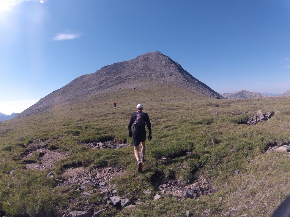
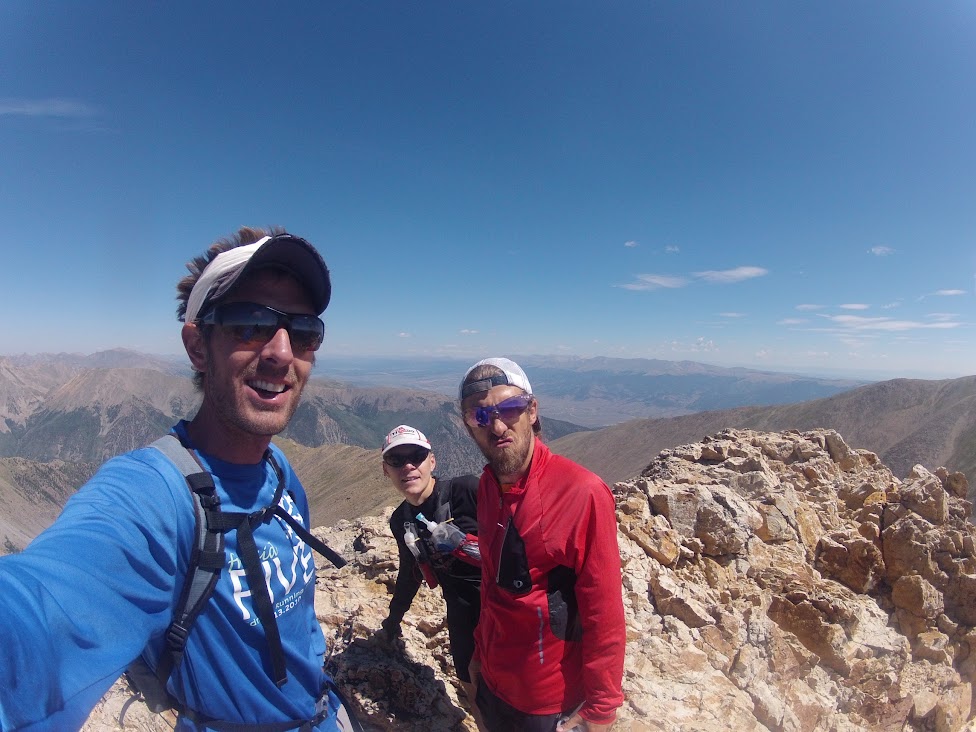
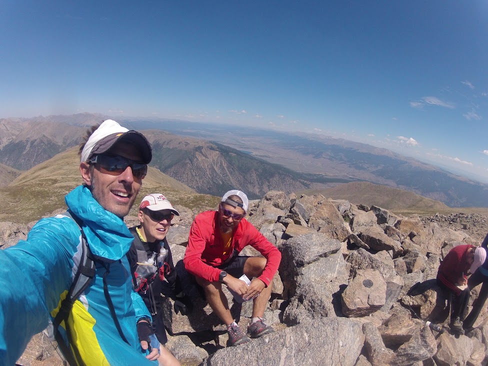
mountains. Missouri (14,067'), Iowa (13,831'), Emerald (13,904'), Belford (14,197'), Oxford (14,153'), Belford (14,197'), Pecks Peak (13,277').

For those into Colorado 14'ers - or Colorado mountains in general - the triumvirate of Missouri, Oxford and Belford are something of a classic given their tight proximity to one another and ease of route negotiation. Mike suggested we get them done in combination with some surrounding 13'ers, and while that would make our day a long one (with 21 miles of running planned for the evening session), I wasn't about to give up a rare weekend of bachelorhood by sitting around twiddling my thumbs.

With Pedatella on board as well, the three of us set out from the Missouri Gulch trailhead a little before 7:00am, taking the standard route to the summit of Missouri with a mix of running and hiking. Half way up Missouri, it was apparent that Mike and Nick were up for a slightly mellower pace on the morning than I was, meaning my outing was punctuated with some good breaks on the peaks and passes. Missouri came and went quickly, and it was just a quick bop from there to Iowa Peak - not much more than a bump on the ridge running south from Missouri. The extension on to Emerald Peak - a more prominent and 'sexy' summit than Iowa - was a little more consequential to reach in terms of effort output, but still not much more than a steep talus-slope walk up. From Iowa, we assessed our options and decided on a straight-line route across Pine Creek Basin towards Elkhead Pass. As it turned out the scree/talus sidehilling was pretty miserable, and a far superior option would have been to lose some extra elevation and traverse on the grassy flats of the basin. Next time.

From Elkhead Pass, we were back on trail and it was quick going up to Belford. In well under an hour of foot time we were back on Belford - after an Oxford out and back - debating the worthiness of tagging Pecks Peak, which we could essentially descend to by following Belford's northern ridge for a mile or so. We finally managed to convince Pedatella of the glory the extra peak would add to the day and set off to round out the six peak, seven summit morning. Once the grassy bump was negotiated, it was a steep descent back down to the Missouri Gulch trail and then no more than a couple of miles and 2,000 feet down to the trailhead. Total outing time was a casual seven and a quarter hours; moving time was significantly less. A little creek action for the legs and a generous serving of Ultragen recovery nectar and the legs were ready for the evening session.
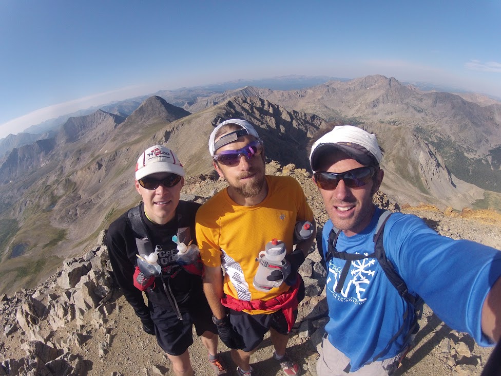
Top Missouri, Iowa (above my head) and Emerald (above Nick P's head) in background. All photos: Mike H.
Top Iowa.


Emerald approach.

Iowa, Missouri, Pine Creek Basin, Elkhead Pass, Belford.
Top Belford.
Top Oxford.


Oxford, Belford saddle from Pecks Peak.
PM: 21 miles (2,500') easy. Night run from Fish Hatchery to Brandon's house (near the Leadville finish) on the last 20 miles (or so) of the LT100 course. I had little to no desire to run these miles, but with the big-group dynamics it was pretty much a gimme run. Predictably enough, the last few miles around Turquoise Lake were interminably tedious, but far less so than I'm sure will be the case in two weeks. Thanks to Brandon for opening his house and making this happen - and indeed for putting us up the whole weekend.

Sun: 8.5 miles (4,300') mountains.
Crystal Peak (13,852'), Pacific Peak (13,950'), Atlantic Peak (13,841').

After a late start and much hemming and haa'ing, Mike, Andy Gisler and I finally decided on a little Coast to Coast action in the Mosquito Range. From the Mayflower Gulch trailhead off Hwy 91, this route was a worthy way to wait out Sunday's eastbound I-70 traffic. Given the previous day's exertions, my legs were predictably unenthused at the prospect of additional mileage and vertical, but once off the tedious talus approach to Crystal Peak and with a summit in sight, things starting clicking and I was able to move reasonably efficiently. The views of the ten-mile range from Crystal were most excellent, and worthy alone of the effort. Mike decided he was done for the weekend with the Crystal summit, leaving Andy and me to forge on and knock out Pacific and Atlantic. With my legs on board and engaged, we made short work of the not-insubstantial climb up the Pacific ridge from the Crystal saddle and then it was a pretty straightforward traverse and climb to Atlantic Peak. The standard way off Atlantic to Mayflower Gulch is to descend the west ridge into the Crystal Creek drainage, but a steeper and more direct 1,000'+ scree descent down off the ridge into Mayflower Gulch looked negotiable, so we hit that and were soon on the jeep road on our way back down to the trailhead. Mike was there with beers at the ready to celebrate a fine weekend in the high alpine and the beginning of the Leadville 100 taper.
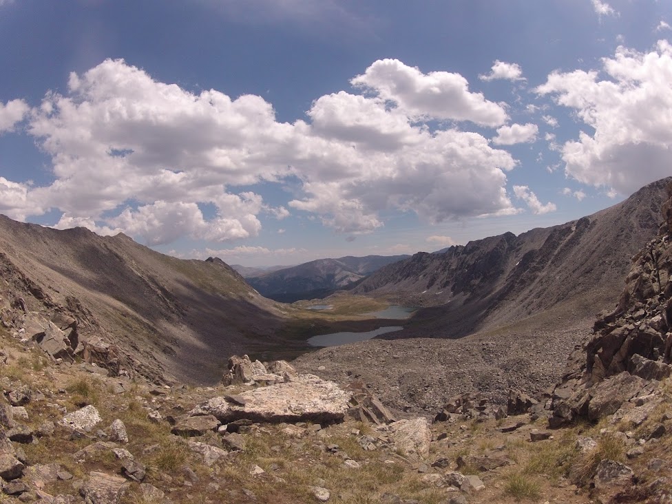
East from Crystal, Pacific saddle. Helen and Father Dyer on ridge to left.
Top Atlantic with ten-mile behind.
Pacific, with Quandry back left.
Total: 101 miles (20,700') 

Well this turned out to be a much bigger week than I would normally look to push out two weeks from a goal race, but given that I had a free weekend away from parental and spousal duties I wasn't about to give it up. And, wow, all systems appear to be go. All 10 of the weekend's 13,000'+ summits came pretty easy, and while Saturday night's long run was a bit of a slog, it could certainly have been worse given the seven hours of vert and mileage in the morning session.

This was a huge confidence builder of a weekend. Rest and relaxation from here until the Leadville start line.

Thursday, August 2, 2012

Week Ending July 29

Mon - Noon: 8.5 miles (800') easy. Milner Mountain Loop with O&B to one mile marker in Redstone Canyon. A bit of gunk in the legs from the weekend. Heat!
PM: 3 miles (600') easy. Quick bench loop before dinner to try and work out some of the soreness.


Tues - Noon: 5 miles (1,000') steady. Falls loop. Legs much better today. Floating in extreme heat (for this Englishman).
PM - 7.5 miles track. Tuesday Night Track workout was 1,200 open, then 12 x 300. Warmed up with a mile and half, but still didn't have much appetite for the opening 1,200, the first half of which I essentially jogged. The 300s were okay; the pain is short-lived and recovery is quick. 100 meter jog between 300s: 4:11, 57, 56, 57, 56, 56, 56, 56, 56, 55, 52, 56, 55.

Weds - Noon: 10.5 miles (2,600) easy. With Mike H to Horsetooth summit (Southridge/Audra) with a stop at top of Audra to wait out heavy rainfall, lightning and thunder. Then Westridge - Towers - Spring Creek - Falls - Falls Trail.
PM: 3 miles (600') easy. Bench loop.

Thurs - Noon: 3 miles (600') easy. Bench loop.
PM: 9.5 miles (2,000') Towers steady. 32:53. Eased into this effort and kept things at a pretty moderate effort all the way up. Corrie brought out a high school contingent from Thompson Valley, which was a fun diversion from their usual training I'm sure. The girls failed to time themselves, but I'm guessing a couple of them ran it pretty quick. Fastest guy was Caleb in just under 32 mins, which I think is a high school best on the hill. Legs felt moderate to good, so hoping I'll have something to work with at Speedgoat.

Friday - Off. Driving or working most of the day.

Saturday - 32.5 miles (11,200') race. Speedgoat 50k. Race report to come.

Sunday - 4 miles (700') easy. Just a bit of jogging around Snowbird before the drive home. Felt fine for the most part, but wasn't really into it, so cut things short. 

Total: 86.5 miles (20,100') 

This ended up being a lower mileage week than planned, so I'll look to cut the taper for Leadville to two weeks and hopefully put in 90-100 miles this week. With that in mind, I shut things down at about the halfway point at Speedgoat after it was evident that I wasn't going to be in contention for a top-five finish - which was a goal going in. Jogging the last two descents there means that my legs have been feeling great this week. I'm looking forward to some big mileage up in Leadville this weekend, capped hopefully with a fun day of peak-bagging on Sunday. I'll shut things down pretty aggressively from there for the last two weeks before Leadville, with mainly flat running and a couple of good tempo workouts.  

Sunday, July 22, 2012

Week Ending July 22

Mon - 9.5 miles (1,600') easy. Horsetooth summit via the Rock trail, then down to Bluesky TH on 38e for 3.5 more with Dana to Towers and back. Bombed the descent from H'tooth to Bluesky as I was running late.

Tues - noon: 5 miles (1,000') easy. Falls loop. Took a big digger 100 yards up the trail, landing rather painfully (and bloodily) on my chin. Came home and could barely chew, my jaw was so jacked from the fall. Ouch. 
PM: 5.5 miles track. Warmed up a mile with Alistair, then workout was 2k open followed by 8 x 400 on 70-73 secs rest. Still missing a step it would seem: 77, 75, 76, 75, 74, 74, 74, 74.

Weds - 7.5 miles (1,500') hard. Short on time, I went hard up Horsetooth and came down hard on Wathan/Soderberg.

Thurs - Noon: 11.5 miles (2,500') easy. To Soderberg TH on 38e/Shoreline, then Towers - Secret Trail - Westridge - Rock - Horsetooth Summit - Audra - Southridge.
PM: 6.5 miles easy with folks from FCTR. 

Fri - Noon: 8.5 miles (2,000') easy. Horsetooth summit (Southrdige/Audra) - Wathan, Soderberg.

Sat - 25 miles (6,000') hills. From my campsite near the South Mount Elbert TH, ran down to meet Mike Aish, now-retired pro track runner, marathoner and Olympian who's decided to take a stab at the Leadville 100 - a bucket-list race for him. We went from the Twin Lakes aid area to Winfield and back. Although the run in and of itself was pretty crap - dead legs from the get go - the chance to run with Mike was thoroughly entertaining. We had a couple of stops on top of Hope and at Winfield, and essentially hiked the return climb, but it was good to work through some fatigue. Running time from Twin Lakes and back was around 3:55; a good bit under Ryan's time from last year. But that doesn't say a whole lot, given relative conditions. Nonetheless, it was good to get a feel for where race pace will be.  

Sun - 16.5 miles (1,200') easy. With Mike from the campsite above TL to the Colorado Trail where we joined the course at the true South Elbert TH. Cruised conversationally all the way to the Fish Hatchery in about 2:05. This run felt tons better than yesterday, but it was mostly cruiser stuff on some very friendly surfaces. Leadville is definitely a running race with all the forest road and buff trail, so it's key to be training that right now if I'm going to do well there. Thinking I'll try and stay off the vertical a bit next week and get some miles done in Redstone Canyon. Good stuff again with Mike.

Total: 95.5 miles (15,800')


I went pretty easy through the early part of the week, mainly due to time constraints. I then struggled a fair bit on Saturday, but these are the weeks you have to grind out with the race getting close. I've now seen the full Leadville course with the Twin Lakes to Fish Hatchery section filled in, and wow, it's a whole lot of high altitude running, with two big climbs and three smaller ones. This one will be interesting.

It was fun running with Mike this weekend. He's a super-talented runner, who has a 2:13 marathon to his credit and Olympic-standard 10k speed, so it'll be good TV to see how it unfolds for him at Leadville. He's definitely there to compete, so we'll see. The roads will definitely be good for him.

Off to Salt Lake City next weekend for some fun and games at the Speedgoat 50. Hope I bring my climbing legs.

Monday, July 16, 2012

Week Ending July 15

Mon - 7.5 miles (1,800'). Horsetooth summit: Audra/Southridge. Legs felt good for the first time since WS100. Pushed both ways. Fun outing.

Tues - AM: 7 miles (1,800') easy. Horsetooth summit with Brian Stef. Up Rock/Vintage/Bushwhack to South Summit, down Audra/Southridge. Super hazy again to the north and west. Smoke from Wyoming, I assume.
PM: 7.5 miles track. Workout was 800 open, then 3 x mile with 2:40 stationary rest. I felt tonight like I was starting to get my running legs back a bit, but I still couldn't hang on for the full workout. Another couple of rounds and I hope to be back running sub-5:20 mile repeats with a reasonable degree of comfort. Splits: 2:36, 5:23, 5:26, 5:30.

Weds - AM: 5 miles (1,000') easy. Quick Falls loop.
PM: 7.5 miles (1,800') easy. Horsetooth summit late in the day. Perfect evening. Southridge/Audra.

Thurs - AM: 11.5 miles (5,200') Longs Peak (14,250'). Met Brian and Adam super early (3:20) for a pre-work trip above 14,000 feet. Left the East Longs TH at 4:20 and took the standard trail to the Chasm turn-off with a few shortcuts below Goblins. Pace was casual and I was happy to slot into Brian's hike/run rhythm. Chasm turnoff at 49 mins, then full Loft route to the summit, which we hit at 6:35 (2:15). Awesome sunrise on the way up, clear morning and very little wind. Took Keyhole/Jim's Grove down (1:26) for a 3:41 RT or 3:51 with summit time. At my desk working by 9:30.
PM: 9 miles (1,900') easy. Took an easy-effort ride up Towers with the FCTR group. Legs were unhappy to be going again after the Longs effort, but started cooperating with a mile or two of warming up. Starting to feel good about reloading the effort. Got to keep moving.

Fri - Noon: 7.5 miles (1,800') easy. Horsetooth summit. Southridge/Audra.
PM - 3.5 miles easy with Dana. Bluesky TH to Towers and back. 

Sat - AM: 17 miles (6,100') mountains. Mummy Mania. My third crack at this classic traverse, which takes in six peaks of the Mummy Range. The standard route goes from the Chapin Pass trailhead, some seven miles up the Old Fall River Road and then follows the range of peaks from Chapin to Mummy in a horseshoe line before dropping all the way down the southeast slopes of Mummy to the Lawn Lake trail. I just about have this route dialed now, but still managed to make a couple of egregious line choices that cost me somewhere in the order of 30 minutes. Nonetheless, I was still able to chop 53 minutes off my time from last year and set a new standard at 5:37.

Chapin, Chiquita, Ypsilon, Fairchild. Four of the six Mummy Mania summits.


South and southeast face of Mummy Mountain.
Some notes for future reference:

I again cut south too early for the Chapin summit (12,454'), hitting the false summit to the west and requiring additional rock hopping to the east. A better line here is probably worth four to five minutes. Chiquita (13,069') as always was very straight forward, but the cairn'ed route is best avoided as it is somewhat circuitous. Ypsilon  (13,514') is also very straightforward, but again the correct line - avoiding the false summit to the south - is worth a few minutes. Ypsilon to Fairchild is the crux of this route. I chose to explore firmer rock on the north side of the connecting ridge / saddle between the two summits, rather than hop the choss on the south side as I have on my two previous Mummy Mania outings. This was a definite error that left me negotiating some low class five sections, adding probably 10 minutes to the trip. I also chose to take the west ridge up Fairchild (13,502') and ended up having to down-climb to get around some dicey exposed rock, and then skirt east before being able to ascend the boulders for the gentler summit slopes. All told, I probably gave up 15 minutes tooling around between the two summits. Fairchild to Hagues (13,571') I nailed, skirting a little ways east 300 feet below the Hagues summit for a much easier and quicker walk-up ascent. Hagues to Mummy (13,425') was textbook too. However, my descent off Mummy was a disaster. From the summit, I felt like I saw a reasonable scree descent down one of the steep gulleys on the southeast face. I figured that rather than take the standard Black Canyon drainage route, I could save myself significant time by heading directly for the Roaring River and Lawn Lake Trail. I'm not sure I hit the correct gulley - or maybe the view from the summit was deceptive - but as it turned out I ended up committed to down-climbing some very sketchy rock with limited choices, which meant extreme caution and many lost minutes. Once on trail, I ran quite hard for the TH.

This route can go under five hours for sure with the correct route choices.

Splits with 2011 in parentheses:

Chapin: 31 (39)
Chiquita: 55 (1:03)
Ypsilon: 1:16 (1:34)
Fairchild: 2:26 (2:45)
Hagues: 3:19 (3:57)
Mummy: 4:01 (4:49)
Lawn Lake/Black Canyon intersection: 4:56 (5:39)
Lawn Lake TH: 5:37:22 (6:30) 

Sun - AM: 17.5 miles (1,300') easy. Redstone Canyon with some folks from the Fort Collins Running Club.
PM: 4.5 miles (1,500') hiking. Horsetooth summit with Alistair and my dad. Up the Rock Trail, down Audra/Southridge. 

Total: 105.5 miles (24,200')

Managed to grind out a pretty good week, with recovery from Western States feeling like it is pretty much complete. Any week with 13 summits in it has to be considered a success, regardless of other stats. Perhaps the most encouraging part of the week, however, was the rapidity with which I seem to be readjusting to working above timberline. Last week on Hagues, I was feeling a bit out of sorts with the altitude; this week with Hagues as my fifth alpine summit of the morning I really wasn't thinking about the altitude factor with the exception of a low-grade headache. This all bodes well for Leadville - where incidentally we'll be camping and scouting next weekend. Three more big weeks and then a shorter two-week taper (maybe 2.5 weeks) and I think I'll be good and ready for a stab at this Colorado classic.

The Pearl Train coming into Dusty Corners last month. Not sure who took this, but it popped up on Dana's Facebook thingy the other day.

Monday, July 9, 2012

Week Ending July 8

Mon - 6.5 miles (1,600') easy. Horsetooth summit via Southridge/Audra, down on Rock trail. Easy up, sore WS quads still on the way down.

Tues - 6 miles track. Workout was: open 1k, then 6 x 600. No watch for these, just wanted to get the legs turning over. Still plenty of residual in there from Western States.

Weds - AM: 6 miles race. Jumped in on the FireKracker 5k to see what I could churn out on trashed legs. As it turned out, I couldn't churn out much. Miles went: 5:35, 5:50, 5:35. :43 (17:43). Assuming that the last .1 was long and third mile short. Worked reasonably hard here for very limited results. Two years ago I went 17:17 on shorter rest after WS, so figured I'd be in that ballpark again, but my quads this time around are remaining stubbornly sore and not allowing for much fluidity in my running.
PM: 2 miles hiking with Alistair above Lily Lake in Estes Park.

Thurs - AM: 10.5 miles (1,400') easy with Mike on Bluesky.
PM: 6.5 miles easy with FCTR at Pineridge.

Fri - 7 miles (1,600') easy. Horsetooth summit. Audra/Culver.

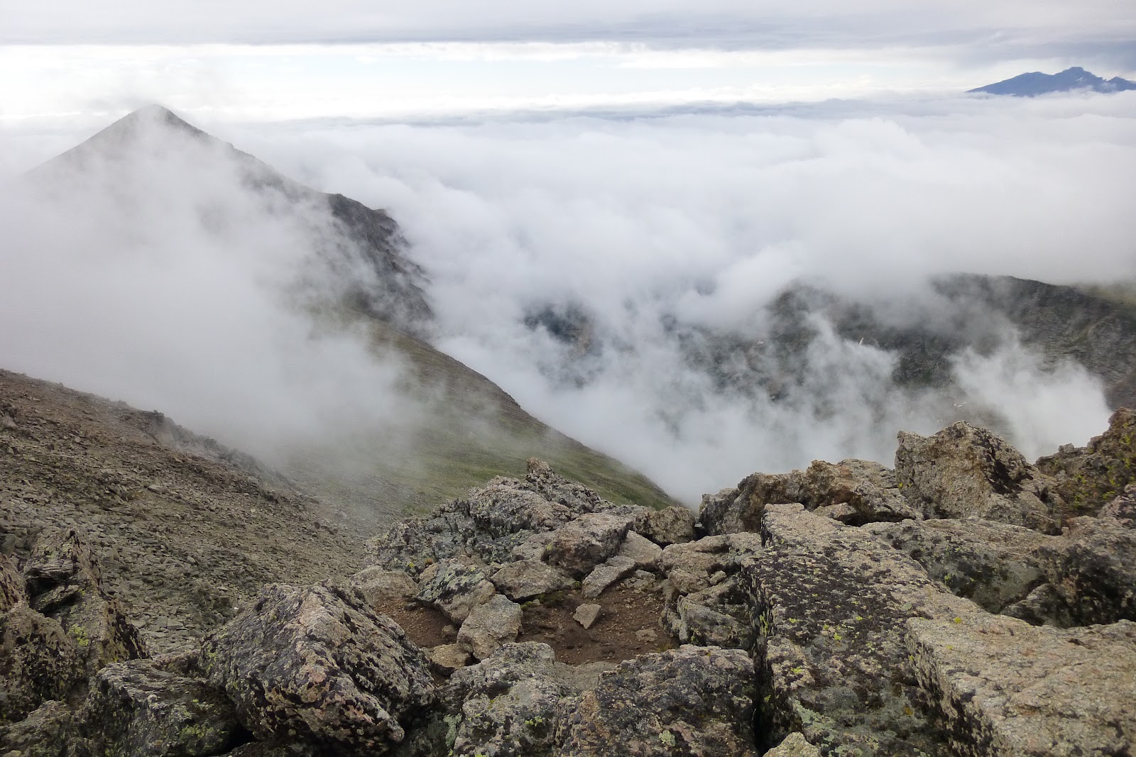
Sat - 16 miles (5,000'). Hagues Peak (13,571') from Lawn Lake TH. Had originally planned to tag Tileston and Bighorn (two ranked Larimer 11ers) on the way back down, but the mountains were socked-in below 11,000 feet so route finding would have been super challenging. Decided instead to take some extra time on top of Hagues enjoying the cloud cover and views of the Glacier Gorge section of the Continental Divide to the south. A full Mummy Traverse next weekend, I think. Still a good bit of soreness in the quads on the last few miles of the descent.   

The scene at Lawn Lake (11,000') later in the morning. Fairchild (13,504'), Hagues, Mummy (13,425').
South face of Mummy Mountain from Slopes of Hagues Peak.
Fog was swirling above the 11,000' cloud base. Mummy almost enveloped on the left. Longs sits above it all to the south.
Fairchild in the fog. Fairchild, Hagues saddle below.
Continental Divide/Longs from Hagues.
Continental Divide behind east ridge of Fairchild and Crystal Lake.

Deer and fawns enjoying the lush timberline summer.


Sun - 2 miles hiking. Headed down to Horsetooth falls with Alistair to enjoy the moisture and explore the creek.


Total: 62.5 miles (9,600')

Had planned to get out Sunday for a longer run, but that never happened due to life and other circumstances. Probably good to give the legs the day off though as there was still some residual Western States soreness in there on the Saturday Hagues descent.

That leaves me three or four weeks to ramp things up to get ready for Leadville. I'm in desperate need of some extended above-timberline action, as I was definitely feeling the lack of oxygen on Hagues this weekend. It's always tough to carve out the time with the extra driving involved, but I'm sure I'll find a way. I'm thinking a Mummy Traverse for Saturday or Sunday which is an uber-classic RMNP route that I always enjoy, and then maybe a couple of family trips to Leadville and other spots in the coming weekends.

I just took a look at the Speedgoat start list - which I haven't done in months - and wow, all of a sudden it's a massively competitive event. I'm not sure I'll be in the best shape to compete, but it certainly looks like it'll be a fun weekend.

Ho hum, time to start getting after it.

Monday, July 2, 2012

Four Weeks Ending July 1

Week Ending June 10

Mon - AM: 5 miles (1,000') easy. Falls loop.

Tues - Noon: 5 miles (1,000') easy. Falls loop.
PM: 7 miles track. Workout was 2k open, then 8 x 400 relay with partner (i.e. 70-75 secs stationary rest between intervals). Steady for the 2k, then started pooping out on the 400s towards the end: 6:46 (3:23, 3:23), 75, 73, 71, 73, 74, 75, 76, 76 w/ an extra 80 tacked on at the end with Sarah for her last rep. 2 mile w-u, 1.5 w-d.

Weds - Noon: 7 miles (1,900') easy. Horsetooth summit via Rock Trail, descent on Audra - Southridge - Rock. 

Thurs - AM: 10.5 miles (1,400') easy with Mike and Sarah on Bluesky. Blah this morning. Super easy.
PM: 7.5 miles easy. Overdressed heat session at Pineridge with the FCTR folks.

Friday - 5 miles (1,000') easy. Falls 

Sat - AM: 18 miles (1,800') race. Pilot Hill 25k.
PM: 5 miles (1,500') hiking. Horsetooth summit with Alistair, Stella, Kenny, Amy and their boys.

Sun: Nada. Cancelled planned 20 miler up and down Storm Mountain due to wildfires. Forced evacuation in afternoon.

Total: 70 miles (9,600')

Week Ending June 17

Mon - 4.5 miles easy. On roads to Jax to pick up food.

Tues - AM: 7.5 miles easy w/Sarah on roads and bike path.
PM: 4 miles track. Ran easy with Sarah and Dennis due to smoke and general lack of desire: mile, 4 x 800.

Weds: Off

Thurs: 10 miles (3,000') hills. Horsetooth Mountain Park was off limits due to the fire, so no Towers. Ran Round Mountain (8,250') with Tina instead. Up in a steady and surprisingly easy 52:10. Stopped about 400 meters from the top to watch a black bear forage under rocks for food. Totally disinterested/unaware of me. Easy down the first two miles with Tina, then took off.

Fri: 7 miles (1,800') easy. Snuck into Horseooth for a quick summit. Bull snake on Soderberg on the way up. Watched the firefighting effort up Redstone for a bit before getting zapped by surplus electricity in the air from an electric storm 10-15 miles off to the west. Scared the bejesus out of me. Zapped three times before I could get off the summit. Scurried down and fine once off the rock. 

Sat - AM: 7.5 miles (2,400') hills. Hiked up Twin Sisters (11,420') for Alistair's first legitimate trek above timberline. Up in a relatively zippy (for a five year old) 1:45, then down much easier as the mileage started to take its toll on the boy. Still, very little complaining just some old fashioned dragging. Above timberline we cut straight for the summit and had fun talus hoping together.

PM: 3 miles (600') easy. Quick bench loop. 

Sun - 8 miles easy (900') in the desert outside of West Wendover, NV. Leppy Hills Trail. HOT. 

Total: 51.5 miles (8,700')

Week Ending June 24

Mon - 4 miles (600') easy. Roads around Alpine Meadows (CA).

Tues - 4.5 miles. Bike paths from Squaw Valley. 

Weds - 5.5 miles (800') easy. Up the Five Lakes Trail. 

Thurs - 4 miles (500') easy with Timmy, Jorge and Connor around Alpine Meadows. 

Fri - 4 miles easy on bike path from Squaw Valley with Jake.

Sat - 100 miles (17,000'). Western States.

Sun - OFF.  Ultra drive back home. 

Total: 122 miles (18,900')

Week Ending July 1

Mon - OFF

Tues - OFF

Weds - OFF

Thurs - OFF

Fri - OFF

Saturday - 7 miles (1,800'). Horsetooth summit with Burch and Stefanovic. Some gimp behind the right knee and in the right hip, but otherwise decent. Moderately sore quads on the descent. Went super easy.

---------------------------------------------------------------------------
January: 330 miles (45,200')
February: 445 miles (58,500')
March: 501.5 (79,600')
April: 430 (66,800')
May: 387.5 (70,700')
June: 297.5 (48,500') 

Total: 2,391.5 miles (369,300')
Avg: 398.5 miles (61,550')

---------------------------------------------------------------------------
2012 Summits (81): 
Horsetooth (7,255') (38)
Mount Elbert (14,443')
Longs Peak (14,259')
Whitney Peak (13,271')
Twin Sisters (11,420')
Lookout Mountain (10,626')

Storm Mountain (9,918')
Lily Mountain (9,786')
Crosier Mountain (9,250') (4)
Pilot Hill (8,829')
Mount Ethel (8,471')
8,415' (Leila Peak)
Buckhorn Mountain (8,341')
Round Mountain (8,250') (2)
Spruce Mountain (7,781')
Sullivan Stump (7,778')
7,725'
Green Ridge (7,402')
Green Mountain (7,335')
7,260' (Ziggy Point)
7,178'
7,098' (Poll Mtn range)
Table Mountain (7,074')
Arthurs (6,780') (5)
Palisade (8,225')
Milner (6,893')
Alexander (8,144')
5,773' or 'Aggie Peak'
5,740' (1)
5,740' (2)
Reservoir Ridge (5,735')
Goat Hill (5,604')
Aitxuri (1,551 meters) 
Aizkorri (1,528 meters)
Aratz (1,443 meters)
----------------------------------------------------------------------------   

Sunday - 14 miles (1,400') easy. Bluesky with Slush, Sarah and Celeste. Legs were okay for the first eight, and then kind of sore and disinterested.

Total: 21 miles (3,200')

Catching up here with the training data for the three weeks before and one week after Western States. As usual, I went with a three-week taper and for the most part think I was well rested going into the race. With the fires, evacuation and other sundry stresses, things weren't quite as relaxed as I would have liked them to be, but with all the distractions I didn't waste a whole lot of mental energy worrying about the race in the lead up. In fact I was very relaxed and somewhat nonchalant about the whole deal, which for me is not the best place to be. I like to be slightly nervous before a big race to help focus the mind, but whatever, it seemed to work out decently in the end.

Had a super easy, but very busy week immediately after the race, but am now back in the regular swing of things. The running these last couple of days has been okay, but I have some good soreness left in the quads it would seem. That should be done with by the end of the week and I'll start getting back after it in preparation for Speedgoat and Leadville.

The fire here in Fort Collins ended up burning on over 87,000 acres, which is a huge swath of land, but thankfully it is now 100% contained. That is to say they have a full perimeter on it, but not that it is fully out. That will require some significant moisture from the heavens, something we have been sorely lacking unfortunately.

On a positive trail running note, the trails of Horsetooth and Lory were very minimally impacted by the fire, which means the Quad Rock course will remain exactly the same for next year. We have set a tentative date of May 11 (permits pending), so get that in your calendars if you're thinking about coming out. The Bluesky trail also has not been impacted by the fires, so the fifth annual Bluesky Marathon (Oct 7) will go ahead as normal this year.

Friday, June 29, 2012

Western States 2012

Snow courses, fire years, 100 degree inferno years, and now - ladies and gentlemen - ‘the cold year.’ I’m not sure there’s a typical Western States with regards to course and conditions, but we got a wild and wonderful one this year.

Rolling up the ski hill towards the Escarpment, it was cool, a little wet and a lot foggy. Up high on the ridges it was raining, sleeting at times, and windy. It was legitimately cold, but with a beanie, gloves and a pair of arm panties I was comfortable enough. Moving at a good clip, there was plenty of warmth to go around, but it was hard for us to wrap our heads around the fact that we were running through the opening miles of the Western States 100 while sitting in a rain cloud.


Maybe it was the unexpected cold or maybe it was some general fatigue, but whatever it was I found myself feeling lazy and tripping over rocks up there in the fog. My eye-foot coordination was off, my legs felt tired and I didn’t much feel like running. But there I was moving along with the Big Boys on the biggest 100 mile stage in the country. The standard sanity check questions were filtering through my mind way earlier than usual, but you just have to push them out and keep moving. It’s either that or quit, and that’s not really an option at mile 10.

A wrong turn, some effing and blinding, four to five minutes lost and four places given up. Dylan, Zeke and Mike got to work immediately and began closing the gap on those that had snuck through. I followed for a bit and then chilled out, reminding myself of the hours ahead. Timmy and Dave were wisely content to sit back and wait. I made my way through the ridges' rocks, tripped on a few, imagined the views and slowly moved past Joe, Neal, Lizzy, Jorge, Ian and then Ryan. By mile 17 Dave, Timmy and I were still in the fog and rain, but back together as a pack near the front of the race, with just Dylan, Mike and Zeke a minute or two up ahead.   

Coming into the Duncan Canyon aid station I was a bit discombobulated. I ran straight through, not seeing Connor, my crew man, as planned. Rather than head back in and fill up my half-empty EFS drink supply, I forged on without stopping. I couldn’t remember how far it was from Duncan to Robinson but I figured I’d be fine with the half bottle I had. It’s not like it was 80 degrees out.
Discombobulated at Duncan. Photo: Glenn Tachiyama
A little more climbing and then we dropped in; the first canyon of the morning. Contrary to the standard mountain run - where one ascends, enjoys the view and then drops back down – canyon crossings descend, cross a river than ascend back out (it all feels so wrong). The Duncan descent is relatively shallow and unlike two years ago we were able to cross at the bottom without getting our feet wet. I was encouraged to see the front of the race – Dylan, Mike and Zeke – just a few switchbacks up ahead. Tim found a better line through the river and jumped ahead of me, catching up to the boys in relatively short order. Zeke was off the pace on the climb and by the time I hit Robinson I was alone and wet in fourth with Dave and the rest of the field an unknown distance behind.

The scene at Robinson looked cold. My poor family was drenched and I unsportingly growled at my wife for mixing up Ultragen instead of EFS drink in the bottle she handed off. I took water and an EFS gel flask instead and left her with my wet and stinky hat, gloves and arm warmers. I immediately regretted everything about the Robinson stop. S-Caps were now unreachable as my exposed and frozen figures couldn’t manipulate the zipper on the back of my shorts, but worse was the lingering memory of my dick’ish snap at Dana. I would have to wait until Foresthill some five hours later to apologize.

And then began the long 14 mile descent to the Swinging Bridge at the bottom of Devils Thumb Canyon. The fog lifted somewhere between Millers Defeat and Dusty Corners, just as I caught up to the lead pack of Timmy, Mike and Dylan. We cruised the wide doubletrack down into Dusty as a group, enjoying a bit of banter and relishing the brief glimpses of blue sky ahead. At Dusty I found Connor, switched out bottles, ate some oranges and asked him to please call Dana to tell her 'sorry' and that I loved her.
The PI train, with Tim obscured, rolls into Dusty. Photo: Glenn Tachiyama
I left at the front of the field feeling a little better about life. Despite the fact that my legs were feeling unreasonably tired just 40 miles in, I was still hanging in there and feeling good about having been able to get a (second-hand) apology off to Dana.

Ryan caught up to us soon thereafter and all of a sudden we were five, with Old Man Mackey just a few strides back in sixth. Timmy led us on the singletrack contour over to the Devil's Thumb descent with the banter now
having been reduced to a minimum. The race, it seemed, was officially on; five boys running through the woods, grunting, peeing and listening to the sounds of the river down in the canyon below.

And then we dropped back in. Dave pulled a Kilian, running the berm of the trail, zipping by the lot of us in search of the river. We all let him go. I needed to pee and I also felt like I needed to slow the pace, so I stopped a couple of switchbacks from the river and let the train go by. I didn’t want to be forced into an uncomfortable pace on the Devil’s Thumb climb, I just wasn’t feeling it.

Every time I do this climb, I think about how much fun it would be to run it on a fresh pair of pins, but it’s never fun in the moment, with 45 miles under your belt. I always just grunt and then curse about the hike that I’m forced to maintain. This year was no different and while it was nowhere near as hot as the last two years, it actually felt like we were dealing with some heat
for the first time, but more uncomfortably some significant humidity. My stomach started knotting up a bit and I got that sinking feeling that things were heading south.

Jogging out from the top, I was feeling unbelievably flat. I needed to regroup and I knew it. Jogging was absolutely the order of the moment on the cruiser section over to the Michigan Bluff drop. If I wanted to race later, I would have to forego the racing now. My descent to the river was unimpressive, while my shuffle back out would probably have been faster at a convincing power hike, but the running cadence was good for confidence. At the Bluff – my mental halfway point – I emptied my shoes, picked up new EFS bottles and then ran on out, polishing off a longer-than-remembered descent into Volcano canyon and a shorter-than-remembered ascent to Bath Road. Coming up into Foresthill I was all of a sudden feeling pretty good.
Heading out from the Bluff. Photo: Marianne Bush
I knew now, on the Foresthill Road, that I was going to at least finish the race, but I’d pretty much given up on competing for the win. I had five guys 10-12 minutes ahead of me, and I knew that at least one - if not all of them - were going to finish out the race stronger than me. The Foresthill stop was a good one. I got a time check from AJW: 9-15 minutes behind the lead five. In addition I got a fresh pair of socks, a cool-down soak, new EFS bottles, and a kiss and a giddyup from the wife and kids. 

AJW gives me the run down. Photo: IRunFar Media Enterprises
I set off with Christian, a young and talented runner from the area, down the Foresthill Road. As usual, my conversational skills were at a minimum, and even a close call with a basking rattlesnake did little for my desire to chat. To his credit, Christian – who I was meeting for the first time – was comfortable with minimal conversation and happy to provide the silent companionship that I was after. The running felt decent if not impressive on the way down to the river, and unlike the last two years it was not punctuated with any positional changes. This year was just about getting down to the river. The split estimations along the way suggested that I was holding my own on the chase pack but losing ground to a charging Timmy and Ryan. As it turned out, I ran my fastest ever 16 for the Cal Street section, but given the significantly cooler conditions it would have been a disappointment if that hadn't been the case.

With Christian on Foresthill. Pic: Ultrarunnerpodcast
At the river, I traded Christian for Connor and learned that we were going to cross the river in boats again. I was marginally bummed not to be fording for the third year in a row, but really was just happy to be getting close. The river is a huge landmark and getting there with functioning legs is something to be celebrated, so I celebrated quietly as we waited the couple of minutes for the boat to come back from the other side. Once we were across, we were almost immediately passing an exhausted Mike Wolfe and moving into fifth place. That one was a surprise.
Cooling off in the river. Photo: Glenn Tachiyama
Connor prompted me to get running as we pulled out from the river up towards Green Gate. As I re-found my stride, I realized that my climbing legs were well and truly on their way out. They had been sub par all day, but now quite frankly they were just pitiful. I had to walk a few of the steeper pitches up to Green Gate, but managed to shuffle the rest. From there on in, I was still able to move well on the flats and downs, but any kind of upgrade was pretty pathetic for the most part. And so we rolled, now in fifth. 
Cruising up to Green Gate. Photo: John Mackey
Photo: Meagan Hicks
Connor was getting excited about hunting down places; I just wanted to finish and sit down. Nonetheless, the news from Auburn Lakes Trail suggested that we were closing the gap on an unnamed runner in fourth. I believe they said six minutes, which meant that we were closing fast. I figured it was Mackey, but as it turned out it was Dylan, and he was clearly a hurting unit when we caught him at Brown's Bar.

With just 10 miles left to run and a reported 15 minutes to Mackey in third, I figured it was just a question of holding on to fourth at this point. If I could run the downs convincingly, shuffle the flats and mellower ups, and hike the climbs with purpose, then I figured I could get it done. It wasn’t going to be especially pretty, but I knew we were at least getting close.

I actually enjoyed the hoof up to Highway 49, as I could hike without shame. Connor had led the whole time we’d been together and I could sense a slight bit of frustration on his part when I dropped to a hike on some of the more pathetic rollers. But there was no shame on the prolonged steep climb to Highway 49, and the hiking felt so good. And then, before I knew it, we were hearing cars and an aid station. 

Dana was there at Highway 49 and so were the kids. I was looking for some sympathy or at least a hug – Dana’s usually good for that kind of stuff – but damn it she was having none of it. She had her game face on and she wanted me to get after it. Mackey was apparently walking and just four minutes removed from the aid station. Just like that a podium was up for grabs. I honestly couldn’t believe it. I just didn’t feel like I was running that well, but then you remind yourself that nobody is moving well at the end of a 100 miler and it’s the guy who slows the least that prevails. A last sorrowful look at Dana for sympathy and another order to get on with it and we were out of there.

And so it was, in the beautifully scenic Cool Meadow that I made the final pass of the back 20, assuming third in the process. We had heard cheers as we were leaving Highway 49, so I knew there was work left to do to fend off a charge from behind, but I figured that if I could run everything up to the Robie Point climb then I would probably be fine. With my downhill legs still alive, Connor and I were able to move really well on the descent to No Hands Bridge, which in my mind pretty much sealed the deal on third. We shuffled the horse grade to Robie and then hoofed the last 800 feet of climbing into town.
Closing in on the finish. Photo: Amy ?
The tarmac felt good, the rubber of the track sublime, and crossing the line again with my boy was a treat that will never get old.


All pics: Glenn Tachiyama

In the final analysis, I have to be happy with another podium finish. I know I didn’t run my best race out there and feel like I maybe missed an opportunity, given the cooler temperatures, to really lay down a time that I can look back on in years to come and be proud of, but it was still a six minute personal best and an effort that required some grit. And the gritty ones are always satisfying.

As usual, I vowed somewhere on the Devil’s Thumb climb that I would never put myself through this torture again, but I know I’ll be back next year. As AJW likes to say, this race gets under your skin and into your blood. With a fourth, two thirds and a set of times that continue to get faster, I just feel like there is more to be squeezed from this race. The Cougar is proving elusive, but maybe if I keep chipping away at it, I’ll get that day where it all comes together and I’ll make that long drive back to Colorado with a little extra weight in the back of the car. Or maybe not. Maybe my son or daughter will win it.

But I’m getting ahead of myself as usual. A big thanks to all the wonderful aid station volunteers, to anyone and everyone who offered encouragement along the way, to Christian, to Conor and his amazingly hospitable parents, and of course to my wonderful family for coming all the way out to California to freeze their tooshies off just to hand me a couple of bottles (and be growled out). You are all owed.     

Friday, June 15, 2012

Pilot Hill 25k

This would be my third year out of four running 'Wyoming's Oldest Foot Race.' I missed it last year but won it consecutively in 2009 and 2010. Sitting two weeks out from Western States and being just 15.5 miles in length (8.5 up, 7 down), this up-and-down hill race was sitting perfectly on the calendar as a last little benchmark sharpener on the way to Squaw, so I couldn't resist.

The goals going in were to register a third win and hopefully run a little faster than 2010, with an emphasis on running the descent at all-out looney pace.

A small crowd was on hand at the start, but with Horsecow Lonac (a mid-15 5k'er when fit) lining up and a few other fit looking dudes milling around, it looked like there would be some guys to help keep the effort solid. From the gun, training partner and perennial first mile over-achiever, Mike Hinterberg, took a flier as we made our way through the opening stretches of rolling sand flats that make up the first few miles of this variably terrained race.

Having forgotten my watch and subsequently borrowed a friend's GPS device, I was to be beeped at every mile for the duration. Annoying, but somewhat unique to have splits along the way. With Mike still ten meters ahead and a young college-age lad (Scott Foley) on my shoulder, the first mile beeped at 5:55. Given the less-than-stellar sandy conditions underfoot and rolling nature of the route thus far, I figured I was probably a touch hot through the first mile.

PH12_011
Scott and me early
Not long after the first beep, Scott and I were passing Mike and starting to tuck into the early sections of uphill that would eventually lead to the communication towers at the top of Pilot Hill (8,829'). And not long after that, I felt like I had to let Scott go; he was clearly a talented runner and any effort to hang on would spell disaster later in the race. Knowing nothing about Scott, I put together a couple of guesswork assumptions: he was a college track or cross country runner that trains for at most 10k races, he would likely smoke me to the top, but I may have a shot at catching him on the deceptively tough descent when post-10 mile fatigue began kicking in.

PH12_030
Pics: High Plains Harriers
And so it went. I watched Scott build a couple of minutes on me, solo in second, as we made our way up to the towers. I had turned in 59:40 in 2010, so was hoping for anything under 60 this year given that the tailwind was significantly lighter. As it turned out, I hit the top on legs that felt 'just okay' in 60:07, with a set of splits that essentially slowed as the terrain turned steeper (5:55, 6:14, 6:45, 6:53, 7:24, 7:52, 8:29, 7:47).

Scott had torched the ascent in a very impressive 57:51, but now the advantage, I believed, turned in my favor. Two+ minutes is a ton of time to make up over seven miles, but I'd come here for the downhill, meaning the rabbit out front was much appreciated. I immediately set to work, running the first flatter mile of the descent into what always seems to be a stiff return headwind, at a much elevated heart rate. I decided to continue pushing the envelope over the more technical rocky terrain in the mid section with hopes that I'd be able to gain some kind of visual on Scott before I blew a gasket. About three miles in (5:56, 44, 47), I got my sighting and it looked like I might have chopped a minute off the lead already.

The effort had caused a good amount of fatigue by the time we were down to the rolling sections around the sand flats, but I figured I had a shot, so I kept pushing. With a couple of miles to go, it was evident that Scott was hurting and I began to feel confident that I would be reeling him in, which I did with a mile left (6:00, 6:01, 6:04, 6:41).

I ended up running a net PR on the course (1:42:24 vs 1:43:45) with a descent almost two minutes faster than last time. Both those facts helped erase some - not all - of the post-Zegama doubts that have been sitting uncomfortably with me for the last few weeks. Yes, this is a small race, but it really wasn't about winning, losing or drawing, it was about gauging fitness. My takeaway is that I'm in at least as good a shape as I was in 2010 (over this course) when I ran my first Western States (4th, 16:04). An additional nugget and confidence booster is that it turns out that Scott has just graduated from Boise State, running a track 10k of 29:52 at the Mt SAC Relays in April and a 68 minute half marathon somewhere else not so long ago.

You take what you can in the mental game before a big race.

I was going to run Storm Mountain up and down the next day as a final effort before Western States, but as it turned out we ended up being evacuated from our home with all hell breaking loose west of Fort Collins in some of my favorite acreage in the whole world. My heart is pretty heavy right now for those who have lost homes and also for the beautiful forestland that is currently burning up, but I'll use that as fuel when things start hurting next weekend. I'm doing this one for The Fort.

Devastating

Friday, June 8, 2012

Week Ending June 3

Mon - 9.5 miles (2,300') easy. Soderberg - Southridge - Audra - Horsetooth summit - Rock - Wathan - Spring Creek - Herrington - Stout - Falls.

Tues - Noon: 5 miles (1,000') easy. Falls loop.
PM: 10 miles track. First Tuesday Night Track session of the season. Big group. Workout was 1,000 open, then 2 x (1,000, 400 rest, 600, 100 rest, 300) with 400 between sets. Had pretty dead legs from the weekend and truth be told, I just don't have the turnover right now to even pretend to be able to keep up with the big boys at the track. That's something I'd like to remedy a bit after Leadville with lots of high intensity shorter reps and less weekly mileage - maybe take another shot at that sub-2:30 marathon. But I'm getting ahead of myself. Today's workout went: 3:23, 3:15, 1:56, 55, 3:21, 1:57, 53. 4 mile w-u, 1.5 mile c-d. Not even close to where I would need to be to go 2:29, but I think I can get there with focus.

Weds - Noon: 7.5 miles (1,800') easy. Straight up and down Horsetooth via Southridge - Audra. Slow and super easy. Felt a bit worked from yesterday's track session.  
PM: 5 miles (1,000') easy. Falls loop. Zipped around pretty good considering the effort it took to get up Horsetooth six hours earlier.

Thurs - AM: 11 miles (1,300') easy. Bluesky, Indian Summer with Slush, Celeste, Sarah, Kyle and Al_Wesir.
PM: 10 miles (2,000') hills. Towers steady. Started out pretty easy, then upped the tempo as I made my way up the hill. Was 18:00 at Herrington (PR + 1:30), then essentially stayed on second half PR pace from there. Felt pretty knackered for most of the up and most of the down. Ho hum.

---------------------------------------------------------------------------
January: 330 miles (45,200')
February: 445 miles (58,500')
March: 501.5 (79,600')
April: 430 (66,800')
May: 387.5 (70,700')
 
Total: 2,094 miles (320,800')
Avg: 419 miles (62,525')

---------------------------------------------------------------------------
2012 Summits (71): 
Horsetooth (7,255') (33)
Arthurs (5)
Palisade
Milner
Alexander
Green Mountain (7,335')
7,725'
7,098' (Poll Mtn range)
Goat Hill
Reservoir Ridge
7,260' (Ziggy Point)
8,415' (Leila Peak)
Mount Ethel
Buckhorn Mountain
5,740' (1)
5,740' (2)
7,178'
Table Mountain (7,074')
5,773' or 'Aggie Peak'
Green Ridge (7,402')
Spruce Mountain (7,781')
Storm Mountain (9,918')
Sullivan Stump (7,778')
Lily Mountain (9,786')
Round Mountain
Crosier Mountain (9,250') (4)
Lookout Mountain (10,626')
Longs Peak (14,259')
Mount Elbert (14,443')
Aizkorri (1,528 meters)
Aratz (1,443 meters)
Aitxuri (1,551 meters) 
----------------------------------------------------------------------------  

Fri - AM: 15.5 miles (1,100') easy. With Lucho, Rob, Amy and Nate in Leadville. Dam Road to May Queen and about a mile further on Colorado Trail, then back. This section of trail will be a suck-fest on the way back to Leadville in August. I need to run Fish Hatchery to Twin Lakes and then I think I'll be familiar with the whole course. I actually think I'm going to run those roads a few times before race day, just to pick up some landmarks to help break up the monotony of the race.

Sat - AM: 10 miles (4,400'). Whitney Peak (13,271'). Mike and I had originally planned on climbing Mount of the Holy Cross, but the seasonal closure on Tigiwon Road was still in effect, so we opted to head down from where we were camping on Homestake Road to climb Whitney Peak - an elegant 13'er with relatively easy road-side access. At approx 9,100 feet on the Homestake Road, there is a trailhead (set back and not immediately obvious) for Whitney Lake. The trail runs a little over 2.5 miles up to Whitney Lake at 11,000 feet through beautiful aspen groves and occasional meadows of wildflowers (not yet in bloom).

From the lake, the views of Whitney Peak were Colorado'fully majestic, and while the true summit could not actually be seen, the spiritual notch summit of the mountain was in plain sight and quite striking. After some debate, we decided to head up through heavy tree cover in the general direction of the southeast ridge. Approximately 800 feet of directionless bushwhacking later and we popped up above timberline with a clear line of sight for the summit. Perfect. The route was largely a class two talus field walkup, with a few spots of easy class three. The views of Mount of the Holy Cross, its lakes, tarns and especially Halo Ridge from the top of Whitney inspired major enthusiasm for future outings in the Holy Cross Wilderness.

No trip with Mike would be complete without at least some directional doubt, and indeed below treeline on the way back down we managed to get completely turned around in search of the lake, wasting a good 45 minutes slopping around in marshes, climbing deadfall and generally wondering where the hell we were before finally finding the lake and zipping back down the trail to the car. According to the summit register, we were just the second party up in 2012, which is one of the best reasons I can think of to enjoy Colorado summit views from vantage points under 14,000 feet.

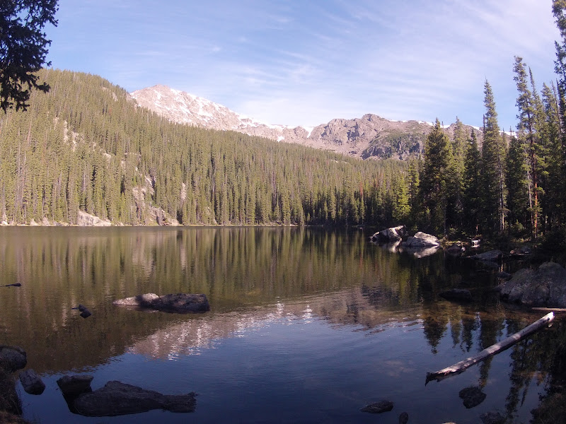
Lake Whitney, Whitney Peak to left. All pics: Mike


Mount of the Holy Cross southern ridgeline with peak far right.
Descending SE ridge, before the drop down to the picture below.
Descending towards treeline.


Whitney Peak and SE ridge to left.

Hanging with the gang on the hillside above camp: Mike, me, Shadow, Alistair, Maddie May, Alex
Sun AM: 21.5 miles (4,000'). Red Cliff to Vail by way of Shrine Pass Rd - DBow's cut-off - Two Elk Trail - Vail back bowl - Highline ski run - Mill Creek.

Dana dropped Mike and me off above the small town of Red Cliff on Hwy 24 from where we planned to run to Vail to meet back up with her, the kids and other friends at the Teva Mountain Games. The road up towards Shrine Pass was an absolute joy to run, so Mike and I set a good honest pace while enjoying the Holy Cross couloir views from on high. About seven miles in at a little under 11,000 feet we cut left on Lime Creek Road before hanging a right onto Bowman's Cut-off Trail in the direction of Two Elk Trail and the Vail Back Bowls. We got snarled up a bit in snow and deadfall on the north-facing slopes on Bowman's Cut-off, but were rewarded with killer views of the Gore Range from the high point of the run at around 11,700 feet. Running late again due to the snow and deadfall, I told Mike I'd meet him back in Vail before setting off with a general idea of what I needed to do to get there. After climbing one of the Vail back bowls to the Vail Mountain ridge, I made one wrong descent attempt into thick trees and snow, reascended and then ended up shooting straight down the Highline ski run at max pace. Just as I popped out, Mike emerged on the service road and we hit the remaining two or so miles together back into Vail. Good little outing.        

Total: 105 miles (18,900')

It feels a little weird to be in taper mode right now given the relatively light mileage in May, but hopefully that will make me one of the more rested guys on the start line in Squaw in a couple of weeks. Ultrarunning is such an obsessive, compulsive sport that it seems to me that guys find it immensely difficult to take their feet off the accelerator when it comes to sharpening for a goal race. Not me, I relish the taper and take it seriously. The one and only goal for me in the last three weeks before a big race is to get to the start line with a fresh pair of pins.

My training hasn't been optimal this year and my racing has been just okay, but I remain confident that I can race hard in California and perform well. I know the course, I know how to get from Squaw to Auburn in one piece, and I know how to ride the highs and lows. I keep reminding myself in moments of self doubt that 100 miles is a long way to run and the shorter-distance form book goes out the proverbial window on race day. Just as it has been the last two years, the cougar is the goal, and I believe I can make that happen regardless of who else is running. My only concern is to run the best race I can, get to Auburn as quickly as humanly possible, and then start tucking into AJW's Sierra Nevadas just as soon as I can.

One more week and then the family road trips out. Fun times ahead. 

Thursday, June 7, 2012

Zegama Marthon and other thoughts

"Zegama is no a very technical track."

Those were the first words of English the Zegama race director put out there as the course preview got underway the evening before the race. And for the most part he was telling the truth; it's just that when the course did get technical - between the second and third summits in particular - it got really technical (as running races go). But let's not get carried away here, we're talking class two rock hoping with a few very short sections of class three hands-on-rock action over a stretch of maybe four miles.

The challenge on the rest of the course was really about dealing with the grade, which for the most part was pretty steep. And then of course there was the weather. Wet rocks, wet grass on looney descents, slick mud, and trails sliding off the side of the mountain (literally). I lost count of the number of times I hit the deck, but generally speaking I was moving faster on my ass than on my feet, so the butt surfing actually worked out pretty well.

The race went out hard, as they always seem to do in Europe. By the time we had completed a circuit of Zegama and begun the first ascent I was probably in 30th place. But that was fine, I was sure half those guys would be coming back to me by the time we topped out on Aratz - the first summit of the day.

Yeah, that never really happened. As it played out, I would pick up some runners on the climbing, generally lose ground on the descents and then salvage a few positions over the last 10 kilometers of downhill to the finish when the endurance factor started coming into play. On the techie crux of the race through the middle section, and the ensuing parachute drop, I probably gave up close to 15 places, while also almost losing my head to a loose rock from above that whistled within a meter of me at break-head speed midway through the steepest drop of the day.

I survived. My ego took a pretty good bruising though.

I love negotiating technical alpine terrain, but I guess I'm just never in that much of a hurry to do so when in the environment. I tend to consider alpine jaunts as time-on-feet training - or just pure pleasure - as opposed to some kind of performance outing, and that was brought into sharp focus at Zegama.

I simply didn't have the technical chops to compete - or even want to try and compete - with the Basque boys around me. Finding myself way back in the pack up there as I did on race morning, I guess I just wasn't motivated enough to put body parts on the line. Maybe if my uphilling had been stronger through the early stages of the race, I would have been compelled to take some risks, but my climbing/pow-hiking wasn't good enough and so I found myself pussyfooting around up high with a mindset more focused on getting through the race in one piece than on rapid movement.  

Maybe I'm getting old. Or maybe, as others have speculated, we U.S.-based trail runners just don't have the occasion or opportunity to rip on the kind of courses that make up the Skyrunning circuit in Europe and across the world. Of the three Skyrunning races I have participated in, I have been humbled by two (Sierre-Zinal and Zegama) and done okay at the third (Pikes Peak).

Sierre-Zinal is not a particularly technical race, but the opening ascent is much steeper than anything I typically run or race on over here. Much like Zegama, therefore, my 'race' at Sierre-Zinal was essentially over once the first 5,000 feet had been negotiated. Pikes Peak, on the other hand, is neither technical nor that steep, rather it is a race about pacing, altitude management and running, and I have performed decently there. Yes you ascend close to 8,000 feet, but at no point during that race should you be hiking (unless of course the altitude gets the better of you). The trail gains 8,000 feet over 13 miles, which works out to an average grade of about 11 percent, or 600 feet per mile. Some would describe that as amateur hour in the mountains (dubbed 'douche grade' by some of the rate-of-ascent purists in the U.S. mountain ultra scene), but the general reality of running in the Mountain West, especially when it comes to racing, is that grades of between 400 and 800 feet per mile are - for sustainability reasons - the angle at which our mountain trails are generally cut.

And I'm fine with that. It just means that I perform at a pretty mediocre level on steeper pow-hiking grades. For as much as I love to ascend steep terrain, I've never felt the need - nor desire - to rip on it. Good job I don't race on uber-steep terrain too often then, I guess. 

Interestingly (all things of course being relative), my fourth shot at a Skyrunning race will come in July on a course that I actually know quite well, and a race that straddles the middle ground between the Euro-style Skyraces and standard U.S. mountain races.

The Speedgoat 50k never gets that technical, but is certainly 'nastier' than Sierre-Zinal or Pikes Peak with regards to terrain. The grades are steep, but with the exception of one hillside, never so steep that the course can't be covered in its entirety at a running cadence, while the altitude tops both Sierre-Zinal and Zegama, but doesn't come close to Pikes' above-timberline action.

The beauty, strength and draw of our sport lies in its variety. I love to race it all, but also recognize where my strengths lie.

People ask me, for example, if Western States or Hardrock is harder (expecting Hardrock to be the answer), and I typically tell them that they're both incredibly hard. For me, Western States is way more punishing physically than Hardrock because it's almost 100% runnable and a race in the true sense of the word, whereas Hardrock is a painfully slow high-altitude grind where you're on your feet for almost twice as long and negotiating sections of legitimate mountain terrain. But you get to hike for hours on end and really don't get too involved in the competition aspect of the event. Patience and perseverance is the name of the game there. Western States is a running race held on grades that play into my wheelhouse, which is the reason, I think, that I have done quite well there and have performed comparatively better than my (somewhat compromised) Hardrock effort. But make no mistake, the last 20-40 miles of both races are - or can be - excruciatingly painful.

I guess the conclusion to this rambling and disjointed post is that the disciplines of mountain, trail and ultra running are hugely diverse, and therein lies the greatest draw of the sport. It is the rare talent that displays mastery of all terrain and distances. From long to short races, from buffed to gnarled, there is a slice of something for everyone. 
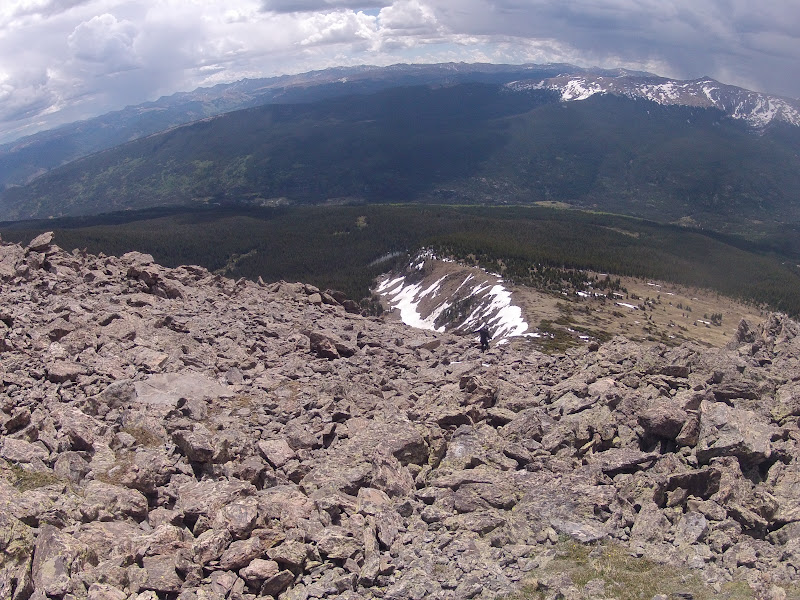
The passion for the mountains that the Basque people displayed in Zegama was a joy for me to experience, and that, at the end of the day, is what our sport is and should always be about.